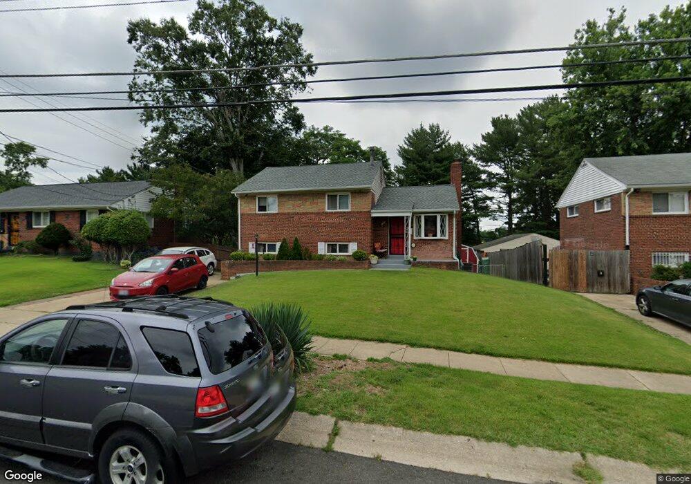
6410 Rolling Ridge Dr Capitol Heights, MD 20743
Estimated Value: $362,089 - $478,000
--
Bed
2
Baths
1,869
Sq Ft
$228/Sq Ft
Est. Value
About This Home
This home is located at 6410 Rolling Ridge Dr, Capitol Heights, MD 20743 and is currently estimated at $426,772, approximately $228 per square foot. 6410 Rolling Ridge Dr is a home located in Prince George's County with nearby schools including Concord Elementary School, Walker Mill Middle School, and Central High School.
Ownership History
Date
Name
Owned For
Owner Type
Purchase Details
Closed on
Mar 22, 2005
Sold by
Mckenzie Huphard C and Mckenzie Alice I
Bought by
Martin Tony
Current Estimated Value
Home Financials for this Owner
Home Financials are based on the most recent Mortgage that was taken out on this home.
Original Mortgage
$130,000
Outstanding Balance
$68,465
Interest Rate
6.2%
Mortgage Type
New Conventional
Estimated Equity
$358,307
Purchase Details
Closed on
Jul 3, 1972
Sold by
Kenney Arthur J J
Bought by
Mckenzie Huphard C and Mckenzie Alice I
Create a Home Valuation Report for This Property
The Home Valuation Report is an in-depth analysis detailing your home's value as well as a comparison with similar homes in the area
Home Values in the Area
Average Home Value in this Area
Purchase History
| Date | Buyer | Sale Price | Title Company |
|---|---|---|---|
| Martin Tony | -- | -- | |
| Mckenzie Huphard C | $27,300 | -- |
Source: Public Records
Mortgage History
| Date | Status | Borrower | Loan Amount |
|---|---|---|---|
| Open | Martin Tony | $130,000 |
Source: Public Records
Tax History Compared to Growth
Tax History
| Year | Tax Paid | Tax Assessment Tax Assessment Total Assessment is a certain percentage of the fair market value that is determined by local assessors to be the total taxable value of land and additions on the property. | Land | Improvement |
|---|---|---|---|---|
| 2025 | $4,026 | $359,700 | -- | -- |
| 2024 | $4,026 | $313,600 | $0 | $0 |
| 2023 | $3,821 | $267,500 | $60,700 | $206,800 |
| 2022 | $3,689 | $261,067 | $0 | $0 |
| 2021 | $3,561 | $254,633 | $0 | $0 |
| 2020 | $3,511 | $248,200 | $45,300 | $202,900 |
| 2019 | $3,414 | $235,933 | $0 | $0 |
| 2018 | $3,300 | $223,667 | $0 | $0 |
| 2017 | $3,204 | $211,400 | $0 | $0 |
| 2016 | -- | $198,500 | $0 | $0 |
| 2015 | $3,186 | $185,600 | $0 | $0 |
| 2014 | $3,186 | $172,700 | $0 | $0 |
Source: Public Records
Map
Nearby Homes
- 6512 Rolling Ridge Dr
- 209 Addison Rd S
- 418 Saint Margarets Dr
- 421 Saint Margarets Dr
- 404 Zelma Ave
- 423 Saint Margarets Dr
- 6610 Central Ave
- 530 Victorianna Dr
- 6915 Adel St
- 6706 Central Ave
- 8 Cindy Ln
- 6103 Westin Ct
- 6903 Fawncrest Dr
- 204 68th Place
- 6610 Arlene Dr
- 208 68th Place
- 5917 Crown St
- 5819 Crown St
- 5817 Coolidge St
- 8 Vale Place
- 6412 Rolling Ridge Dr
- 6408 Rolling Ridge Dr
- 6414 Rolling Ridge Dr
- 6406 Rolling Ridge Dr
- 6411 Rolling Ridge Dr
- 6409 Rolling Ridge Dr
- 6413 Rolling Ridge Dr
- 6500 Rolling Ridge Dr
- 6404 Rolling Ridge Dr
- 6407 Rolling Ridge Dr
- 403 Saint Margarets Dr
- 6402 Rolling Ridge Dr
- 6501 Rolling Ridge Dr
- 6504 Rolling Ridge Dr
- 408 Addison Rd S
- 404 Saint Margarets Dr
- 405 Saint Margarets Dr
- 6400 Rolling Ridge Dr
- 6503 Rolling Ridge Dr
- 313 Milfan Dr