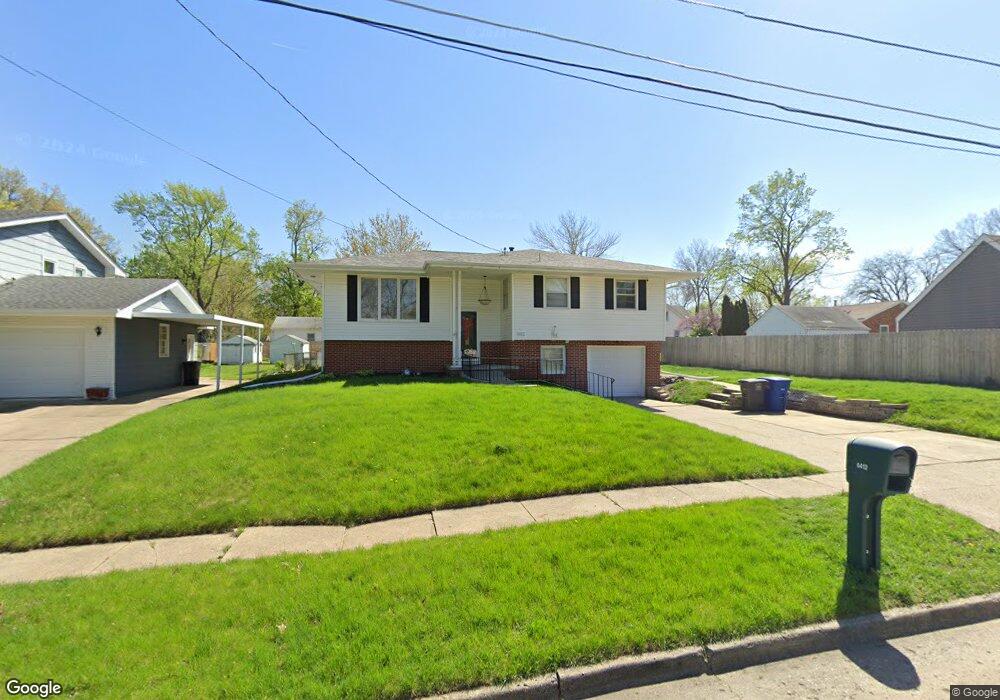
6412 Robin Dr Des Moines, IA 50322
Merle Hay NeighborhoodEstimated Value: $259,902 - $286,000
4
Beds
2
Baths
1,143
Sq Ft
$239/Sq Ft
Est. Value
About This Home
This home is located at 6412 Robin Dr, Des Moines, IA 50322 and is currently estimated at $273,226, approximately $239 per square foot. 6412 Robin Dr is a home located in Polk County with nearby schools including Hillis Elementary School, Meredith Middle School, and Hoover High School.
Ownership History
Date
Name
Owned For
Owner Type
Purchase Details
Closed on
Oct 21, 2020
Sold by
Sparboe Garth D and Deeds Demichole D
Bought by
Fisher Bryan Robert and Fisher Paola Hernandez
Current Estimated Value
Home Financials for this Owner
Home Financials are based on the most recent Mortgage that was taken out on this home.
Original Mortgage
$196,377
Outstanding Balance
$173,948
Interest Rate
2.8%
Mortgage Type
FHA
Estimated Equity
$99,278
Purchase Details
Closed on
Aug 17, 2010
Sold by
Robinson Andrew
Bought by
Sparboe Garth and Deeds Demichole
Purchase Details
Closed on
Mar 3, 2009
Sold by
Bein Virginia L
Bought by
Robinson Andrew
Purchase Details
Closed on
Feb 23, 2006
Sold by
Matalone Dorothy L
Bought by
Ver Huel James Wallace
Purchase Details
Closed on
Sep 15, 2000
Sold by
Bein Virginia L
Bought by
Bein Virginia L
Create a Home Valuation Report for This Property
The Home Valuation Report is an in-depth analysis detailing your home's value as well as a comparison with similar homes in the area
Home Values in the Area
Average Home Value in this Area
Purchase History
| Date | Buyer | Sale Price | Title Company |
|---|---|---|---|
| Fisher Bryan Robert | $200,000 | None Listed On Document | |
| Fisher Bryan Robert | $200,000 | None Listed On Document | |
| Sparboe Garth | $134,500 | Itc | |
| Robinson Andrew | $134,500 | Itc | |
| Ver Huel James Wallace | -- | None Available | |
| Bein Virginia L | -- | -- |
Source: Public Records
Mortgage History
| Date | Status | Borrower | Loan Amount |
|---|---|---|---|
| Open | Fisher Bryan Robert | $196,377 | |
| Closed | Fisher Bryan Robert | $196,377 |
Source: Public Records
Tax History Compared to Growth
Tax History
| Year | Tax Paid | Tax Assessment Tax Assessment Total Assessment is a certain percentage of the fair market value that is determined by local assessors to be the total taxable value of land and additions on the property. | Land | Improvement |
|---|---|---|---|---|
| 2025 | $4,746 | $271,800 | $46,400 | $225,400 |
| 2024 | $4,746 | $249,500 | $41,900 | $207,600 |
| 2023 | $4,780 | $249,500 | $41,900 | $207,600 |
| 2022 | $4,740 | $209,900 | $36,500 | $173,400 |
| 2021 | $4,816 | $209,900 | $36,500 | $173,400 |
| 2020 | $5,171 | $191,300 | $33,300 | $158,000 |
| 2019 | $4,680 | $191,300 | $33,300 | $158,000 |
| 2018 | $4,630 | $172,600 | $29,300 | $143,300 |
| 2017 | $4,240 | $172,600 | $29,300 | $143,300 |
| 2016 | $4,124 | $155,500 | $26,100 | $129,400 |
| 2015 | $4,124 | $155,500 | $26,100 | $129,400 |
| 2014 | $3,884 | $145,300 | $23,900 | $121,400 |
Source: Public Records
Map
Nearby Homes
- 2610 Westover Blvd
- 2729 67th St
- 6700 Sheridan Ave
- 2708 68th St
- 2621 60th St
- 2325 61st St
- 6620 Boston Ave
- 6316 Clearview Cir
- 2615 59th St
- 7005 Sheridan Cir
- 5820 Urbandale Ave
- 3116 61st St
- 3206 68th St
- 7004 Holcomb Ave
- 3233 68th St
- 7051 Oak Brook Dr
- 3320 61st St
- 2250 70th St
- 6717 Roseland Dr
- 5616 New York Ave
- 6406 Robin Dr
- 2707 Westover Blvd
- 6400 Robin Dr
- 2706 64th St
- 2703 Westover Blvd
- 2719 Westover Blvd
- 6403 Robin Dr
- 2700 64th St
- 2728 64th St
- 2625 Westover Blvd
- 2721 Westover Blvd
- 2629 Westover Blvd
- 2620 64th St
- 2732 64th St
- 2715 64th St
- 2707 64th St
- 2719 64th St
- 2617 Westover Blvd
- 2711 64th St
- 2725 Westover Blvd