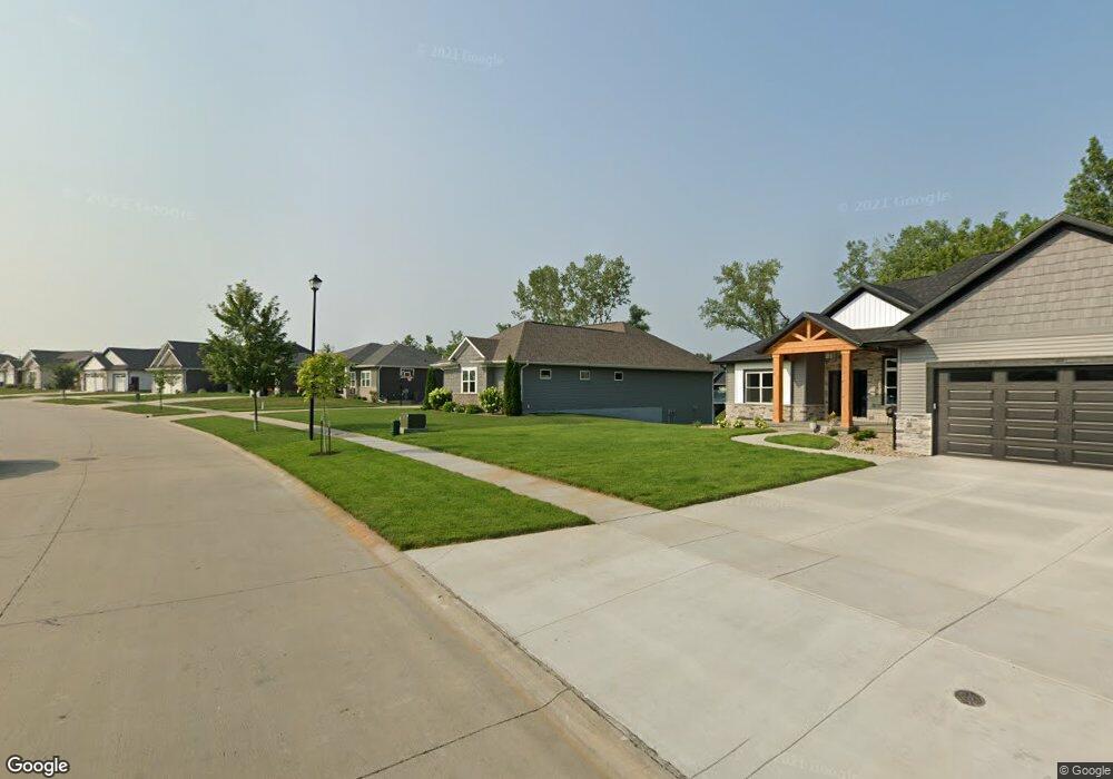
6414 Michael Dr NE Cedar Rapids, IA 52411
Estimated Value: $701,000 - $788,000
4
Beds
4
Baths
2,410
Sq Ft
$304/Sq Ft
Est. Value
About This Home
This home is located at 6414 Michael Dr NE, Cedar Rapids, IA 52411 and is currently estimated at $732,195, approximately $303 per square foot. 6414 Michael Dr NE is a home with nearby schools including Viola Gibson Elementary School, Harding Middle School, and John F. Kennedy High School.
Ownership History
Date
Name
Owned For
Owner Type
Purchase Details
Closed on
Sep 3, 2025
Sold by
Gilkison Charles P and Gilkison Kyra A
Bought by
Nguyen Charles and Nguyen Kathryn
Current Estimated Value
Home Financials for this Owner
Home Financials are based on the most recent Mortgage that was taken out on this home.
Original Mortgage
$626,375
Outstanding Balance
$625,833
Interest Rate
6.72%
Mortgage Type
VA
Estimated Equity
$106,362
Purchase Details
Closed on
Oct 24, 2016
Sold by
B Hancock Construction Inc
Bought by
Gilkison Charles P and Gilkiison Kyra A
Purchase Details
Closed on
May 11, 2016
Sold by
Dx4 Investments Llc
Bought by
Wex Inc
Purchase Details
Closed on
May 5, 2016
Sold by
Wex Inc
Bought by
B Hancock Construction Inc
Create a Home Valuation Report for This Property
The Home Valuation Report is an in-depth analysis detailing your home's value as well as a comparison with similar homes in the area
Purchase History
| Date | Buyer | Sale Price | Title Company |
|---|---|---|---|
| Nguyen Charles | $695,000 | None Listed On Document | |
| Gilkison Charles P | $568,500 | None Available | |
| Wex Inc | -- | None Available | |
| B Hancock Construction Inc | -- | None Available |
Source: Public Records
Mortgage History
| Date | Status | Borrower | Loan Amount |
|---|---|---|---|
| Open | Nguyen Charles | $626,375 |
Source: Public Records
Tax History
| Year | Tax Paid | Tax Assessment Tax Assessment Total Assessment is a certain percentage of the fair market value that is determined by local assessors to be the total taxable value of land and additions on the property. | Land | Improvement |
|---|---|---|---|---|
| 2025 | $10,330 | $661,500 | $123,400 | $538,100 |
| 2024 | $11,998 | $641,400 | $106,200 | $535,200 |
| 2023 | $11,998 | $602,800 | $106,200 | $496,600 |
| 2022 | $11,570 | $581,100 | $86,400 | $494,700 |
| 2021 | $12,206 | $570,900 | $86,400 | $484,500 |
| 2020 | $12,206 | $565,100 | $86,400 | $478,700 |
| 2019 | $11,524 | $546,400 | $72,800 | $473,600 |
Source: Public Records
Map
Nearby Homes
- 6718 Lauder Ln
- 6524 Michael Dr NE
- 6720 Caldwell Ln
- 5871 Shiloh Ln
- 4675 Leprechaun Ln
- 5843 Wells Ln
- 5854 Wells Ln
- 5012 Autumn Dr
- 6505 Blairs Ferry Rd
- 4362 Cloverdale Rd
- 344 Worthington Ct
- 5180 Chestnut Valley Rd
- 4620 Prairie Stone Dr NE
- 4408 Prairie Stone Dr NE
- 4510 Prairie Stone Dr NE
- Lot 1A Buffalo Ridge Dr NE
- 9243 Feather Ridge Pass
- 1845 Lyndhurst Dr
- 4620 N River Blvd NE
- Lot 23 Feather Ridge Pass
- 6408 Michael Dr NE
- 6500 Michael Dr NE
- 6402 Michael Dr NE
- 6402 Michael Dr
- 6506 Michael Dr NE
- 6312 Rapids Ridge Rd NE
- 6411 Michael Dr NE
- 6114 Sanden 297
- 6114 Sanden Rd NE
- 6501 Michael Dr
- 6306 Rapids Ridge Rd NE
- 6318 Michael Dr
- 6405 Michael Dr
- 6318 Michael Dr NE
- 6512 Michael Dr NE
- 6230 Rapids Ridge Rd NE
- 6315 Michael Dr NE
- 6330 Rapids Ridge Rd NE
- 6512 Rapids Ridge Rd NE
- 6518 Rapids Ridge Rd NE
Your Personal Tour Guide
Ask me questions while you tour the home.