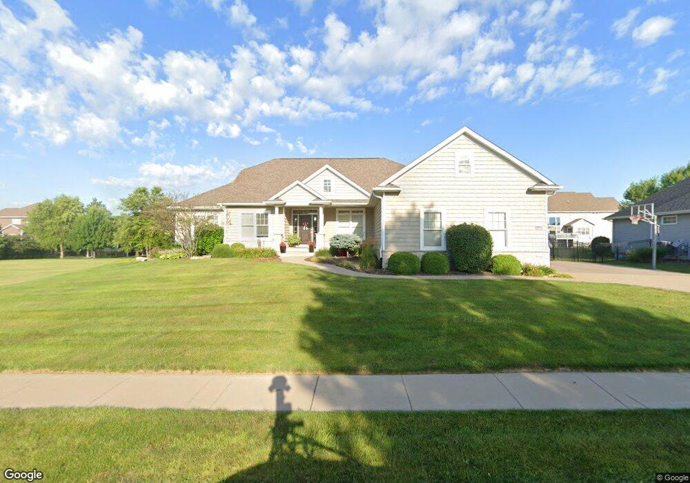
6414 Patrick Pointe Rd Davenport, IA 52807
Estimated Value: $586,628 - $617,000
4
Beds
7
Baths
2,287
Sq Ft
$265/Sq Ft
Est. Value
About This Home
This home is located at 6414 Patrick Pointe Rd, Davenport, IA 52807 and is currently estimated at $607,157, approximately $265 per square foot. 6414 Patrick Pointe Rd is a home with nearby schools including Grant Wood Elementary School, Bettendorf Middle School, and Bettendorf High School.
Ownership History
Date
Name
Owned For
Owner Type
Purchase Details
Closed on
Aug 16, 2013
Sold by
Lundy Corp
Bought by
Mcintosh Stephen M and Mcintosh Trisha E
Current Estimated Value
Home Financials for this Owner
Home Financials are based on the most recent Mortgage that was taken out on this home.
Original Mortgage
$404,730
Interest Rate
4.53%
Mortgage Type
Construction
Create a Home Valuation Report for This Property
The Home Valuation Report is an in-depth analysis detailing your home's value as well as a comparison with similar homes in the area
Home Values in the Area
Average Home Value in this Area
Purchase History
| Date | Buyer | Sale Price | Title Company |
|---|---|---|---|
| Mcintosh Stephen M | $80,000 | None Available |
Source: Public Records
Mortgage History
| Date | Status | Borrower | Loan Amount |
|---|---|---|---|
| Closed | Mcintosh Stephen M | $404,730 |
Source: Public Records
Tax History Compared to Growth
Tax History
| Year | Tax Paid | Tax Assessment Tax Assessment Total Assessment is a certain percentage of the fair market value that is determined by local assessors to be the total taxable value of land and additions on the property. | Land | Improvement |
|---|---|---|---|---|
| 2025 | $9,180 | $583,920 | $88,000 | $495,920 |
| 2024 | $9,709 | $544,770 | $88,000 | $456,770 |
| 2023 | $10,115 | $544,770 | $88,000 | $456,770 |
| 2022 | $9,266 | $491,860 | $82,500 | $409,360 |
| 2021 | $9,266 | $478,930 | $82,500 | $396,430 |
| 2020 | $9,509 | $466,000 | $82,500 | $383,500 |
| 2019 | $9,328 | $448,770 | $82,500 | $366,270 |
| 2018 | $9,300 | $448,770 | $82,500 | $366,270 |
| 2017 | $2,496 | $448,770 | $82,500 | $366,270 |
| 2016 | $9,600 | $435,020 | $0 | $0 |
| 2015 | $8,974 | $309,200 | $0 | $0 |
| 2014 | $6,396 | $55,000 | $0 | $0 |
| 2013 | $1,146 | $0 | $0 | $0 |
| 2012 | -- | $67,140 | $67,140 | $0 |
Source: Public Records
Map
Nearby Homes
- 1711 E 59th Ct
- 1810 E 59th Ct
- 1717 E 59th Ct
- 1807 E 59th Ct
- 1714 E 59th Ct
- 2015 Katie Ct
- 1804 E 59th Ct
- 1708 E 59th Ct
- 1705 E 59th Ct
- 1813 E 59th Ct
- 1814 Katie Ct
- 1908 Katie Ct
- 4705 Forest Grove Ct
- 1912 E 59th Ct
- 1918 E 59th Ct
- 1906 E 59th Ct
- 1713 Katie Ct
- 1709 Katie Ct
- 5800 Elmore Ave
- 0 Elmore Unit MRDQC4238788
- 6422 Patrick Pointe Rd
- 6411 Gabrielle Way
- 6415 Gabrielle Way
- 6407 Gabrielle Way
- 6415 Patrick Pointe Rd
- 6328 Patrick Pointe Rd
- 6423 Gabrielle Way
- 6403 Patrick Pointe Rd
- 4005 Thomas Pointe Rd
- 3935 Thomas Point Rd
- Lot 6 Gabrielle Way
- Lot 13 Gabrielle Way
- Lot 7 Gabrielle Way
- 3935 Thomas Pointe Rd
- 6331 Gabrielle Way
- 6503 Gabrielle Way
- 3920 Kathleen Way
- 6408 Gabrielle Way
- 4009 Thomas Pointe Rd
- 6414 Gabrielle Way