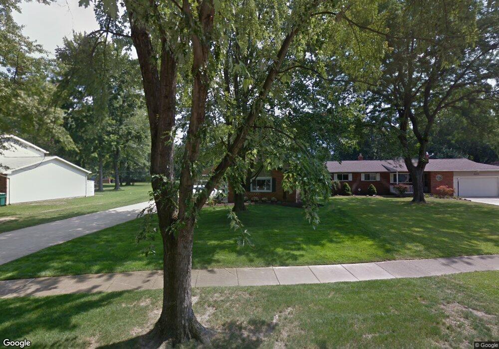
6415 Melshore Dr Mentor, OH 44060
Estimated Value: $280,000 - $309,135
3
Beds
2
Baths
1,718
Sq Ft
$172/Sq Ft
Est. Value
About This Home
This home is located at 6415 Melshore Dr, Mentor, OH 44060 and is currently estimated at $295,784, approximately $172 per square foot. 6415 Melshore Dr is a home located in Lake County with nearby schools including Fairfax Elementary School, Memorial Middle School, and Mentor High School.
Ownership History
Date
Name
Owned For
Owner Type
Purchase Details
Closed on
Oct 14, 2010
Sold by
Thomas Wayne W and Thomas Carnie E
Bought by
Hansen Rick P and Hansen Tiffany M
Current Estimated Value
Home Financials for this Owner
Home Financials are based on the most recent Mortgage that was taken out on this home.
Original Mortgage
$163,596
Outstanding Balance
$108,875
Interest Rate
4.75%
Mortgage Type
FHA
Estimated Equity
$186,909
Purchase Details
Closed on
Dec 15, 1988
Bought by
Thomas Wayne W
Create a Home Valuation Report for This Property
The Home Valuation Report is an in-depth analysis detailing your home's value as well as a comparison with similar homes in the area
Home Values in the Area
Average Home Value in this Area
Purchase History
| Date | Buyer | Sale Price | Title Company |
|---|---|---|---|
| Hansen Rick P | $141,000 | Enterprises Title Agency Inc | |
| Thomas Wayne W | $74,500 | -- |
Source: Public Records
Mortgage History
| Date | Status | Borrower | Loan Amount |
|---|---|---|---|
| Open | Hansen Rick P | $163,596 |
Source: Public Records
Tax History
| Year | Tax Paid | Tax Assessment Tax Assessment Total Assessment is a certain percentage of the fair market value that is determined by local assessors to be the total taxable value of land and additions on the property. | Land | Improvement |
|---|---|---|---|---|
| 2025 | -- | $92,000 | $27,690 | $64,310 |
| 2024 | -- | $92,000 | $27,690 | $64,310 |
| 2023 | $7,638 | $73,510 | $19,590 | $53,920 |
| 2022 | $3,393 | $73,510 | $19,590 | $53,920 |
| 2021 | $3,092 | $66,940 | $19,590 | $47,350 |
| 2020 | $2,988 | $56,720 | $16,600 | $40,120 |
| 2019 | $2,992 | $56,720 | $16,600 | $40,120 |
| 2018 | $2,983 | $48,270 | $20,020 | $28,250 |
| 2017 | $2,668 | $48,270 | $20,020 | $28,250 |
| 2016 | $2,652 | $48,270 | $20,020 | $28,250 |
| 2015 | $2,418 | $48,270 | $20,020 | $28,250 |
| 2014 | $2,324 | $45,720 | $20,020 | $25,700 |
| 2013 | $2,327 | $45,720 | $20,020 | $25,700 |
Source: Public Records
Map
Nearby Homes
- 6484 Elmwood Rd
- 6270 Cumberland Dr
- 6595 Devonshire Ct
- 6676 Oakdale Rd
- 8096 Munson Rd
- 8285 Munson Rd
- 7723 Rutland Dr
- 8067 Independence Dr Unit D
- 8031 Munson Rd
- 6067 Collins Rd
- 8140 Independence Dr Unit B
- 6503 Brooks Blvd
- 6218 Center St Unit 6218
- 0 Collins Rd
- 8352 Quail Point Ln Unit 8352
- 6452 Brooks Blvd
- 8104 Puritan Dr Unit 52-C
- 8078 Puritan Dr Unit 58-D
- 7992 Puritan Dr Unit 76-C
- 8420 Bartley Ln Unit C
- 6407 Melshore Dr
- 6423 Melshore Dr
- 6431 Melshore Dr
- 6399 Melshore Dr
- 6424 Melshore Dr
- 6437 Melshore Dr
- 6391 Melshore Dr
- 6432 Melshore Dr
- 6379 Brewer Ct
- 6410 Melshore Dr
- 6445 Melshore Dr
- 6416 Curtiss Ct
- 6424 Curtiss Ct
- 8089 Meadowdale Dr
- 6404 Melshore Dr
- 6381 Melshore Dr
- 6432 Curtiss Ct
- 6408 Curtiss Ct
- 6400 Cumberland Dr
- 8079 Meadowdale Dr