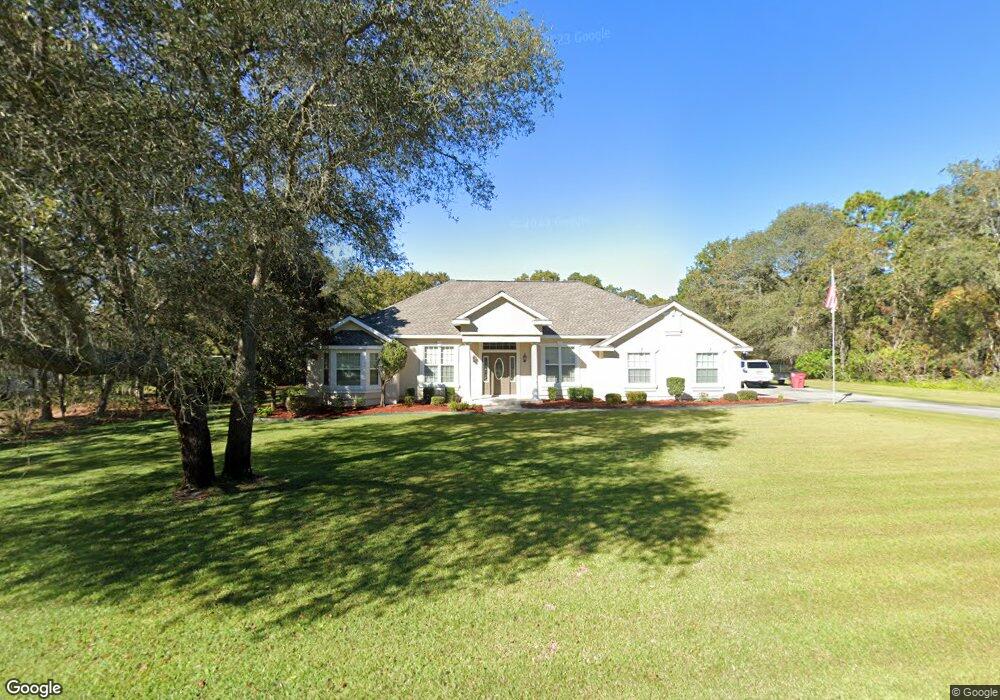
6417 Brooks Cir Blackshear, GA 31516
Estimated Value: $363,360 - $426,000
3
Beds
2
Baths
2,217
Sq Ft
$181/Sq Ft
Est. Value
About This Home
This home is located at 6417 Brooks Cir, Blackshear, GA 31516 and is currently estimated at $401,090, approximately $180 per square foot. 6417 Brooks Cir is a home located in Pierce County with nearby schools including Pierce County High School.
Ownership History
Date
Name
Owned For
Owner Type
Purchase Details
Closed on
Feb 13, 2006
Sold by
Green John E
Bought by
Lightsey Susan F and Lightsey Charles W
Current Estimated Value
Purchase Details
Closed on
Jun 1, 2005
Sold by
Strickland A Doyle
Bought by
Green John E
Purchase Details
Closed on
Dec 22, 2004
Sold by
Strickland Geraldine H
Bought by
Moody Joyce S and Doyle Strickland A
Purchase Details
Closed on
Dec 8, 1994
Sold by
Strickland A Doyle
Bought by
Strickland Geraldine H
Purchase Details
Closed on
Jan 2, 1980
Sold by
Brooks Charles E
Bought by
Strickland Strickland A and Strickland Geraldine H
Create a Home Valuation Report for This Property
The Home Valuation Report is an in-depth analysis detailing your home's value as well as a comparison with similar homes in the area
Purchase History
| Date | Buyer | Sale Price | Title Company |
|---|---|---|---|
| Lightsey Susan F | $27,500 | -- | |
| Green John E | $18,500 | -- | |
| Moody Joyce S | -- | -- | |
| Strickland Geraldine H | -- | -- | |
| Strickland Strickland A | $51,000 | -- |
Source: Public Records
Tax History
| Year | Tax Paid | Tax Assessment Tax Assessment Total Assessment is a certain percentage of the fair market value that is determined by local assessors to be the total taxable value of land and additions on the property. | Land | Improvement |
|---|---|---|---|---|
| 2025 | $1,971 | $132,287 | $13,800 | $118,487 |
| 2024 | $1,896 | $129,422 | $13,800 | $115,622 |
| 2023 | $1,896 | $128,090 | $13,800 | $114,290 |
| 2022 | $2,176 | $91,484 | $9,286 | $82,198 |
| 2021 | $2,135 | $88,068 | $9,286 | $78,782 |
| 2020 | $2,168 | $84,653 | $9,286 | $75,367 |
| 2019 | $2,183 | $84,653 | $9,286 | $75,367 |
| 2018 | $2,142 | $81,238 | $9,286 | $71,952 |
| 2017 | $2,149 | $78,224 | $9,286 | $68,938 |
| 2016 | $2,078 | $78,224 | $9,286 | $68,938 |
| 2015 | $2,187 | $78,224 | $9,286 | $68,938 |
| 2014 | $2,187 | $78,224 | $9,286 | $68,938 |
| 2013 | $2,187 | $78,224 | $9,285 | $68,938 |
Source: Public Records
Map
Nearby Homes
- 6223 Palmetto Way
- 1473 N River Oaks Dr
- 0 Plantation Pines Dr
- 1384 S River Oaks Dr
- 6121 Fairway Oaks Way
- 1296 N River Oaks Dr
- 6501 Harley Trail
- 2784 Autumn Ridge Ln
- 06 Alton Cir
- 03 Alton Cir
- 02 Alton Cir
- 04 Alton Cir
- 01 Alton Cir
- 0 Indian Trail
- 2068 Lentz Dr
- 2026 Ellis Ln
- 901 E Waring St
- 0 Ash Dr
- 5912 Yellow Bluff Rd
- 5641 Fleetwood Ln
- 1465 Golf Course Rd
- 6386 Brooks Cir
- 6321 Brooks Cir
- 1479 Golf Course Rd
- 6402 Brooks Cir
- 6201 Mara Brooke Ln
- 6318 Brooks Cir
- 6326 Brooks Cir
- 1490 Golf Course Rd
- 6202 Mara Brook Ln
- 6380 Brooks Cir
- 6344 Brooks Cir
- 6370 Brooks Cir
- 6203 Mara Brooke Ln
- 6358 Brooks Cir
- 6204 Mara Brooke Ln
- 6350 Brooks Cir
- 1702 Alexis Ln
- 6186 Sweet Bay Dr
- 1528 S River Oaks Dr
Your Personal Tour Guide
Ask me questions while you tour the home.