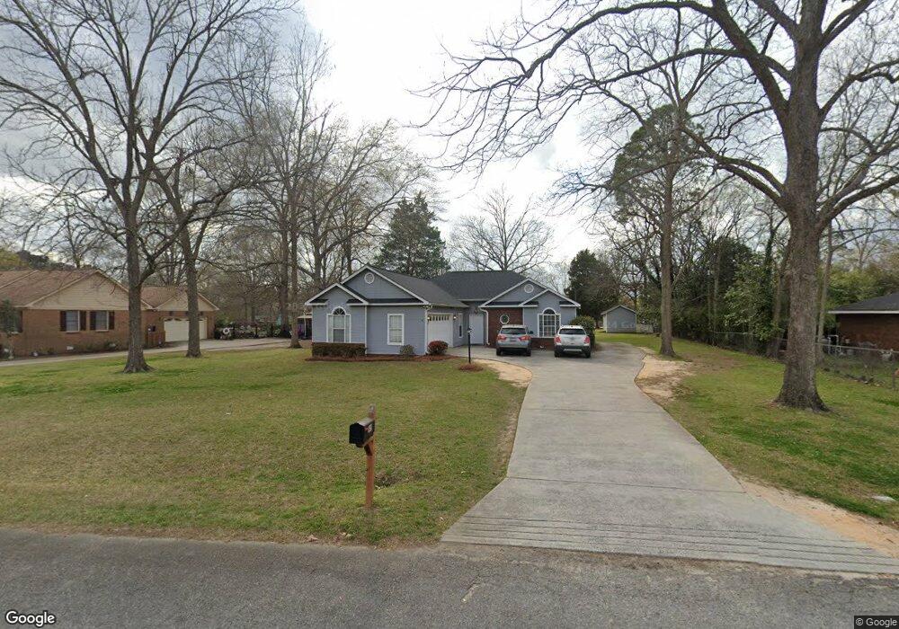
6419 Bevin Dr N Macon, GA 31216
Estimated Value: $201,000 - $231,000
3
Beds
2
Baths
1,364
Sq Ft
$160/Sq Ft
Est. Value
About This Home
This home is located at 6419 Bevin Dr N, Macon, GA 31216 and is currently estimated at $217,900, approximately $159 per square foot. 6419 Bevin Dr N is a home located in Bibb County with nearby schools including Heard Elementary School, Rutland Middle School, and Rutland High School.
Ownership History
Date
Name
Owned For
Owner Type
Purchase Details
Closed on
Mar 29, 2018
Sold by
Darity Thomas E and Darity Cheryl H
Bought by
Freeman Caroline E and Carson Irrevocable Trust
Current Estimated Value
Home Financials for this Owner
Home Financials are based on the most recent Mortgage that was taken out on this home.
Original Mortgage
$83,200
Interest Rate
4.4%
Mortgage Type
Future Advance Clause Open End Mortgage
Purchase Details
Closed on
Dec 22, 2003
Bought by
Darity Thomas and Darity Cheryl H
Purchase Details
Closed on
Dec 18, 2003
Purchase Details
Closed on
Dec 1, 2003
Purchase Details
Closed on
Oct 7, 2003
Purchase Details
Closed on
Jul 30, 2002
Create a Home Valuation Report for This Property
The Home Valuation Report is an in-depth analysis detailing your home's value as well as a comparison with similar homes in the area
Home Values in the Area
Average Home Value in this Area
Purchase History
| Date | Buyer | Sale Price | Title Company |
|---|---|---|---|
| Freeman Caroline E | $104,000 | None Available | |
| Darity Thomas | -- | -- | |
| -- | -- | -- | |
| -- | $96,500 | -- | |
| -- | $104,000 | -- | |
| -- | $103,400 | -- |
Source: Public Records
Mortgage History
| Date | Status | Borrower | Loan Amount |
|---|---|---|---|
| Closed | Freeman Caroline E | $83,200 |
Source: Public Records
Tax History Compared to Growth
Tax History
| Year | Tax Paid | Tax Assessment Tax Assessment Total Assessment is a certain percentage of the fair market value that is determined by local assessors to be the total taxable value of land and additions on the property. | Land | Improvement |
|---|---|---|---|---|
| 2025 | $1,653 | $67,260 | $14,140 | $53,120 |
| 2024 | $1,706 | $67,174 | $14,140 | $53,034 |
| 2023 | $1,584 | $62,374 | $14,140 | $48,234 |
| 2022 | $2,281 | $65,877 | $8,228 | $57,649 |
| 2021 | $2,065 | $54,342 | $6,582 | $47,760 |
| 2020 | $1,760 | $45,334 | $5,485 | $39,849 |
| 2019 | $1,628 | $45,334 | $5,485 | $39,849 |
| 2017 | $1,096 | $36,240 | $4,551 | $31,689 |
| 2016 | $1,012 | $36,240 | $4,551 | $31,689 |
| 2015 | $1,775 | $36,240 | $4,551 | $31,689 |
| 2014 | $1,777 | $36,240 | $4,551 | $31,689 |
Source: Public Records
Map
Nearby Homes
- 6429 Bevin Dr N
- 3010 Liberty Church Rd
- 6441 Bevin Dr N
- 2986 Liberty Church Rd
- 3020 Liberty Church Rd
- 6424 Bevin Dr N
- 0 Bevin Dr N Unit 7424184
- 0 Bevin Dr N Unit 3221391
- 0 Bevin Dr N Unit 8870233
- 0 Bevin Dr N
- 6455 Bevin Dr N
- 6438 Bevin Dr N
- 6465 Bevin Drd N
- 2960 Liberty Church Rd
- 6465 Bevin Dr N
- 6452 Bevin Dr N
- 6456 Ponderosa Dr
- 6458 Ponderosa Dr
- 6475 Bevin Dr N
- 6466 Bevin Dr N