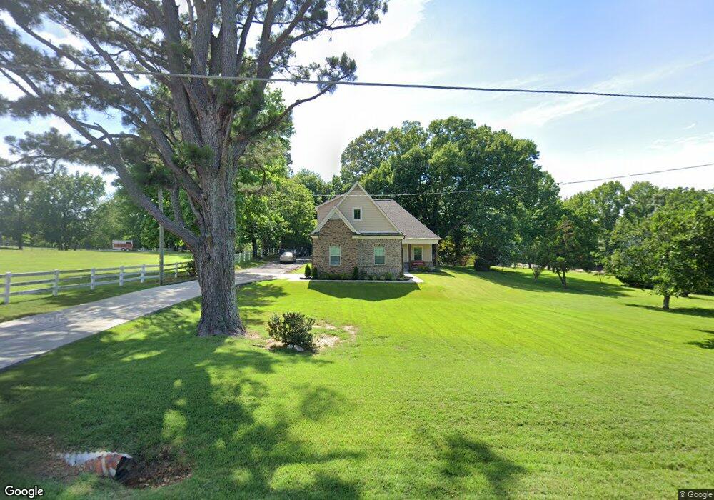
6419 Malone Rd Olive Branch, MS 38654
Pleasant Hill NeighborhoodEstimated Value: $282,747 - $355,000
3
Beds
--
Bath
2,013
Sq Ft
$154/Sq Ft
Est. Value
About This Home
This home is located at 6419 Malone Rd, Olive Branch, MS 38654 and is currently estimated at $310,937, approximately $154 per square foot. 6419 Malone Rd is a home with nearby schools including DeSoto Central Elementary School, DeSoto Central Primary School, and DeSoto Central Middle School.
Ownership History
Date
Name
Owned For
Owner Type
Purchase Details
Closed on
Apr 21, 2021
Sold by
Love Nichole and Hoskins Renisa
Bought by
Hoskins Terri Michelle and Hoskins Bobbie Lue
Current Estimated Value
Home Financials for this Owner
Home Financials are based on the most recent Mortgage that was taken out on this home.
Original Mortgage
$225,074
Interest Rate
2.96%
Mortgage Type
Future Advance Clause Open End Mortgage
Create a Home Valuation Report for This Property
The Home Valuation Report is an in-depth analysis detailing your home's value as well as a comparison with similar homes in the area
Home Values in the Area
Average Home Value in this Area
Purchase History
| Date | Buyer | Sale Price | Title Company |
|---|---|---|---|
| Hoskins Terri Michelle | -- | Select Title & Escrow Llc |
Source: Public Records
Mortgage History
| Date | Status | Borrower | Loan Amount |
|---|---|---|---|
| Closed | Hoskins Terri Michelle | $225,074 |
Source: Public Records
Tax History
| Year | Tax Paid | Tax Assessment Tax Assessment Total Assessment is a certain percentage of the fair market value that is determined by local assessors to be the total taxable value of land and additions on the property. | Land | Improvement |
|---|---|---|---|---|
| 2025 | $2,365 | $19,515 | $1,000 | $18,515 |
| 2024 | $1,995 | $13,784 | $1,000 | $12,784 |
| 2023 | $1,995 | $13,784 | $0 | $0 |
| 2022 | $1,953 | $13,784 | $1,000 | $12,784 |
| 2021 | $433 | $3,056 | $1,000 | $2,056 |
| 2020 | $410 | $2,891 | $1,000 | $1,891 |
| 2019 | $406 | $2,891 | $1,000 | $1,891 |
| 2017 | $0 | $4,700 | $2,850 | $1,850 |
| 2016 | $406 | $2,850 | $1,000 | $1,850 |
| 2015 | $406 | $4,700 | $2,850 | $1,850 |
| 2014 | $292 | $2,850 | $0 | $0 |
| 2013 | $292 | $2,850 | $0 | $0 |
Source: Public Records
Map
Nearby Homes
- 4130 Aberleigh Ln
- 4121 Aberleigh Ln
- 4114 Kayley Ln
- 3525 Bailey Ln
- 6110 Nellwood Dr
- 6459 Carson Dr
- 5915 Roman Hill Dr
- 4597 Graham Lake Dr
- 6782 Snowden Ln
- 5900 Foxdale Loop S
- 4472 Stone Cross Dr
- 5921 Foxdale Loop S
- 7199 Terrace Stone Dr
- 3281 Foxdale Loop
- 5891 Foxdale Loop S
- 7205 Whitten Place Cove
- 3228 Foxdale Loop
- 3208 Foxdale Loop
- 5943 Savannah Crossing
- 4570 Stone Park Blvd
- 6435 Malone Rd
- 3911 Freeman Ln
- 6375 Malone Rd
- 6490 Malone Rd
- 3909 Freeman Ln
- 4075 Oakland Dr
- 6509 Malone Rd
- 6350 Malone Rd
- 3916 Liscott Rd
- 3835 Freeman Ln
- 3870 Liscott Rd
- 4070 Redwood Dr
- 4101 Oakland Dr
- 3915 Liscott Rd
- 4135 Oakland Dr
- 4090 Redwood Dr
- 6363 Morgan Dr
- 6546 Malone Rd
- 4155 Oakland Dr
- 6375 Morgan Dr
Your Personal Tour Guide
Ask me questions while you tour the home.