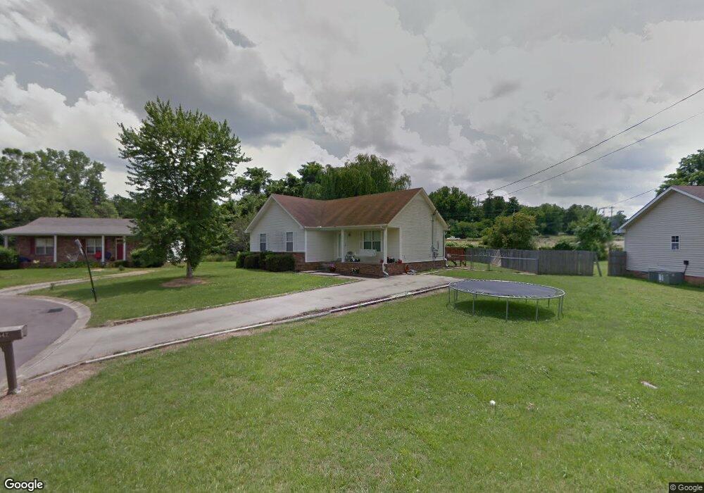
642 David Ray Ct Clarksville, TN 37042
Estimated Value: $197,219 - $237,000
--
Bed
2
Baths
1,234
Sq Ft
$180/Sq Ft
Est. Value
About This Home
This home is located at 642 David Ray Ct, Clarksville, TN 37042 and is currently estimated at $222,305, approximately $180 per square foot. 642 David Ray Ct is a home located in Montgomery County with nearby schools including Liberty Elementary School, New Providence Middle School, and Northwest High School.
Ownership History
Date
Name
Owned For
Owner Type
Purchase Details
Closed on
Jul 30, 2008
Sold by
Figueroa Jose A
Bought by
Dail Janice E
Current Estimated Value
Home Financials for this Owner
Home Financials are based on the most recent Mortgage that was taken out on this home.
Original Mortgage
$96,239
Outstanding Balance
$63,102
Interest Rate
6.31%
Estimated Equity
$159,203
Purchase Details
Closed on
Jun 5, 2006
Sold by
Robertson Christopher T
Bought by
Figueroa Jose A
Home Financials for this Owner
Home Financials are based on the most recent Mortgage that was taken out on this home.
Original Mortgage
$79,758
Interest Rate
6.51%
Purchase Details
Closed on
Oct 12, 2001
Sold by
Bub Walter W
Bought by
Robertson Christopher T
Create a Home Valuation Report for This Property
The Home Valuation Report is an in-depth analysis detailing your home's value as well as a comparison with similar homes in the area
Home Values in the Area
Average Home Value in this Area
Purchase History
| Date | Buyer | Sale Price | Title Company |
|---|---|---|---|
| Dail Janice E | $97,000 | -- | |
| Figueroa Jose A | $81,000 | -- | |
| Robertson Christopher T | $73,900 | -- |
Source: Public Records
Mortgage History
| Date | Status | Borrower | Loan Amount |
|---|---|---|---|
| Open | Robertson Christopher T | $96,239 | |
| Previous Owner | Robertson Christopher T | $79,758 |
Source: Public Records
Tax History Compared to Growth
Tax History
| Year | Tax Paid | Tax Assessment Tax Assessment Total Assessment is a certain percentage of the fair market value that is determined by local assessors to be the total taxable value of land and additions on the property. | Land | Improvement |
|---|---|---|---|---|
| 2024 | $1,616 | $54,225 | $0 | $0 |
| 2023 | $1,616 | $27,325 | $0 | $0 |
| 2022 | $1,153 | $27,325 | $0 | $0 |
| 2021 | $1,153 | $27,100 | $0 | $0 |
| 2020 | $1,089 | $27,100 | $0 | $0 |
| 2019 | $1,089 | $27,100 | $0 | $0 |
| 2018 | $1,063 | $20,275 | $0 | $0 |
| 2017 | $306 | $24,650 | $0 | $0 |
| 2016 | $757 | $24,650 | $0 | $0 |
| 2015 | $1,039 | $24,650 | $0 | $0 |
| 2014 | $1,025 | $24,650 | $0 | $0 |
| 2013 | $1,083 | $24,725 | $0 | $0 |
Source: Public Records
Map
Nearby Homes
- 567 Matthew Ct
- 573 Donna Dr
- 571 Donna Dr
- 524 Inver Ln
- 634 Inver Ln
- 554 Roselawn Dr
- 628 Wolfchase Dr
- 605 Marigold Dr
- 640 Wolfchase Dr
- 616 Liberty Park
- 548 Buckeye Ln
- 544 Roselawn Dr
- 638 Linda Ln
- 541 Roselawn Dr
- 576 Cabot Cove
- 652 Deer Ridge Dr
- 578 Cabot Cove
- 504 Linda Ln
- 583 Orman Dr
- 507 Medallion Cir
- 644 David Ray Ct
- 640 David Ray Ct
- 646 David Ray Ct
- 638 David Ray Ct
- 579 Matthew Ct
- 641 David Ray Ct
- 639 David Ray Ct
- 648 David Ray Ct
- 649 David Ray Ct
- 578 Matthew Ct
- 571 Matthew Ct
- 651 David Ray Ct
- 625 Dover Rd
- 619 Dover Rd
- 576 Matthew Ct
- 635 Dover Rd
- 581 Brady Dr
- 569 Matthew Ct
- 623 Dover Rd
- 579 Brady Dr