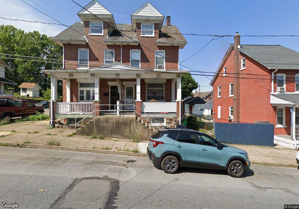
642 Fiot Ave Bethlehem, PA 18015
Downtown Bethlehem NeighborhoodEstimated Value: $176,000 - $230,000
3
Beds
1
Bath
1,326
Sq Ft
$156/Sq Ft
Est. Value
About This Home
This home is located at 642 Fiot Ave, Bethlehem, PA 18015 and is currently estimated at $207,414, approximately $156 per square foot. 642 Fiot Ave is a home located in Northampton County with nearby schools including Fountain Hill Elementary School, Broughal Middle School, and Liberty High School.
Ownership History
Date
Name
Owned For
Owner Type
Purchase Details
Closed on
Jan 31, 2008
Sold by
Bucko Andrea J
Bought by
Hess Irene E
Current Estimated Value
Home Financials for this Owner
Home Financials are based on the most recent Mortgage that was taken out on this home.
Original Mortgage
$127,225
Outstanding Balance
$80,836
Interest Rate
6.2%
Mortgage Type
Purchase Money Mortgage
Estimated Equity
$126,578
Purchase Details
Closed on
May 1, 1989
Bought by
Bucko Andrea J
Create a Home Valuation Report for This Property
The Home Valuation Report is an in-depth analysis detailing your home's value as well as a comparison with similar homes in the area
Home Values in the Area
Average Home Value in this Area
Purchase History
| Date | Buyer | Sale Price | Title Company |
|---|---|---|---|
| Hess Irene E | $127,225 | -- | |
| Hess Irene E | $127,225 | None Available | |
| Bucko Andrea J | -- | -- |
Source: Public Records
Mortgage History
| Date | Status | Borrower | Loan Amount |
|---|---|---|---|
| Open | Hess Irene E | $127,225 | |
| Closed | Hess Irene E | $127,225 |
Source: Public Records
Tax History Compared to Growth
Tax History
| Year | Tax Paid | Tax Assessment Tax Assessment Total Assessment is a certain percentage of the fair market value that is determined by local assessors to be the total taxable value of land and additions on the property. | Land | Improvement |
|---|---|---|---|---|
| 2025 | $294 | $27,200 | $8,400 | $18,800 |
| 2024 | $2,404 | $27,200 | $8,400 | $18,800 |
| 2023 | $2,404 | $27,200 | $8,400 | $18,800 |
| 2022 | $2,385 | $27,200 | $8,400 | $18,800 |
| 2021 | $2,369 | $27,200 | $8,400 | $18,800 |
| 2020 | $2,347 | $27,200 | $8,400 | $18,800 |
| 2019 | $2,339 | $27,200 | $8,400 | $18,800 |
| 2018 | $2,282 | $27,200 | $8,400 | $18,800 |
| 2017 | $2,255 | $27,200 | $8,400 | $18,800 |
| 2016 | -- | $27,200 | $8,400 | $18,800 |
| 2015 | -- | $27,200 | $8,400 | $18,800 |
| 2014 | -- | $27,200 | $8,400 | $18,800 |
Source: Public Records
Map
Nearby Homes
- 608 Fiot Ave
- 634 Ontario St
- 501 Sioux St
- 963 Wyandotte St
- 901 Vernon St
- 1021 Wyandotte St
- 527 Bradley St
- 531 Carlton Ave
- 1037 Seneca St
- 463 Montclair Ave
- 432 Cherokee St
- 1042 Delaware Ave
- 413 Pawnee St
- 1050 Delaware Ave
- 424 W 4th St
- 419 W 4th St
- 1224 Graham St
- 1373 Puggy Ln
- 4315 Stonebridge Dr
- 4255 Stonebridge Dr
- 638 Fiot Ave
- 634 Fiot Ave
- 801 Sioux St
- 700 Fiot Ave
- 632 Fiot Ave
- 630 Fiot Ave
- 704 Fiot Ave
- 635 S Bishopthorpe St
- 639 S Bishopthorpe St
- 633 S Bishopthorpe St
- 628 Fiot Ave
- 706 Fiot Ave
- 629 S Bishopthorpe St
- 639 Fiot Ave
- 626 Fiot Ave
- 641 Fiot Ave
- 643 Fiot Ave
- 637 Fiot Ave
- 635 Fiot Ave
- 627 S Bishopthorpe St