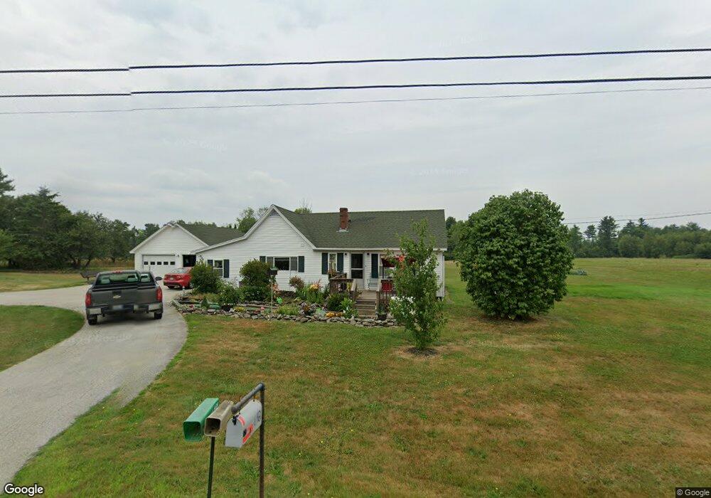
642 Stetson Rd Newport, ME 04953
Estimated Value: $226,000 - $283,000
3
Beds
1
Bath
978
Sq Ft
$252/Sq Ft
Est. Value
About This Home
This home is located at 642 Stetson Rd, Newport, ME 04953 and is currently estimated at $246,686, approximately $252 per square foot. 642 Stetson Rd is a home with nearby schools including Sebasticook Valley Elementary School and Nokomis Regional Middle School/High School.
Ownership History
Date
Name
Owned For
Owner Type
Purchase Details
Closed on
Jun 3, 2015
Sold by
Borden Ronald R and Borden Vivian R
Bought by
Bjork Richard C and Bjork Tina I
Current Estimated Value
Create a Home Valuation Report for This Property
The Home Valuation Report is an in-depth analysis detailing your home's value as well as a comparison with similar homes in the area
Home Values in the Area
Average Home Value in this Area
Purchase History
| Date | Buyer | Sale Price | Title Company |
|---|---|---|---|
| Bjork Richard C | -- | -- |
Source: Public Records
Tax History Compared to Growth
Tax History
| Year | Tax Paid | Tax Assessment Tax Assessment Total Assessment is a certain percentage of the fair market value that is determined by local assessors to be the total taxable value of land and additions on the property. | Land | Improvement |
|---|---|---|---|---|
| 2024 | $2,578 | $147,300 | $36,700 | $110,600 |
| 2023 | $2,243 | $137,600 | $34,300 | $103,300 |
| 2022 | $2,132 | $108,800 | $27,100 | $81,700 |
| 2021 | $2,140 | $103,900 | $25,900 | $78,000 |
| 2020 | $2,101 | $102,000 | $25,400 | $76,600 |
| 2019 | $2,051 | $96,300 | $24,000 | $72,300 |
| 2018 | $1,983 | $102,700 | $24,000 | $78,700 |
| 2017 | $2,054 | $102,700 | $24,000 | $78,700 |
| 2016 | $1,992 | $102,700 | $24,000 | $78,700 |
| 2015 | $1,838 | $102,700 | $24,000 | $78,700 |
| 2014 | $1,768 | $102,800 | $24,000 | $78,800 |
Source: Public Records
Map
Nearby Homes
- 626 Stetson Rd
- 625 Stetson Rd
- 614 Stetson Rd
- 670 Stetson Rd
- 608 Stetson Rd
- 684 Stetson Rd
- 601 Stetson Rd
- 585 Stetson Rd
- 579 Stetson Rd
- Lot42-5 Sunrise Dr
- 563 Stetson Rd
- 728 Stetson
- 547 Stetson Rd
- 741 Stetson Rd
- 749 Stetson Rd
- 527 Stetson Rd
- 0 E Newport Rd
- 523 Stetson Rd
- 524 Stetson Rd
- 517 Stetson Rd