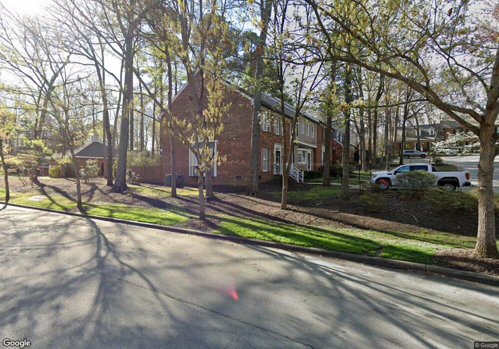
642 Weathergreen Dr Raleigh, NC 27615
Six Forks NeighborhoodEstimated Value: $333,000 - $361,000
3
Beds
3
Baths
1,970
Sq Ft
$176/Sq Ft
Est. Value
About This Home
This home is located at 642 Weathergreen Dr, Raleigh, NC 27615 and is currently estimated at $346,357, approximately $175 per square foot. 642 Weathergreen Dr is a home located in Wake County with nearby schools including North Ridge Elementary School, West Millbrook Middle School, and Sanderson High School.
Ownership History
Date
Name
Owned For
Owner Type
Purchase Details
Closed on
Dec 8, 2003
Sold by
Brothers Nancy Jane Langley and Brothers Henry Warren
Bought by
Aquatex Llc
Current Estimated Value
Purchase Details
Closed on
May 31, 2002
Sold by
Sasser Karin Tracy and Sasser Christopher
Bought by
Langley Nancy Jane
Home Financials for this Owner
Home Financials are based on the most recent Mortgage that was taken out on this home.
Original Mortgage
$92,000
Interest Rate
6.12%
Create a Home Valuation Report for This Property
The Home Valuation Report is an in-depth analysis detailing your home's value as well as a comparison with similar homes in the area
Home Values in the Area
Average Home Value in this Area
Purchase History
| Date | Buyer | Sale Price | Title Company |
|---|---|---|---|
| Aquatex Llc | $132,500 | -- | |
| Langley Nancy Jane | $135,000 | -- |
Source: Public Records
Mortgage History
| Date | Status | Borrower | Loan Amount |
|---|---|---|---|
| Previous Owner | Langley Nancy Jane | $92,000 |
Source: Public Records
Tax History Compared to Growth
Tax History
| Year | Tax Paid | Tax Assessment Tax Assessment Total Assessment is a certain percentage of the fair market value that is determined by local assessors to be the total taxable value of land and additions on the property. | Land | Improvement |
|---|---|---|---|---|
| 2025 | $2,843 | $323,660 | $65,000 | $258,660 |
| 2024 | $2,831 | $323,660 | $65,000 | $258,660 |
| 2023 | $2,456 | $223,521 | $55,000 | $168,521 |
| 2022 | $2,283 | $223,521 | $55,000 | $168,521 |
| 2021 | $2,195 | $223,521 | $55,000 | $168,521 |
| 2020 | $2,155 | $223,521 | $55,000 | $168,521 |
| 2019 | $1,965 | $167,793 | $40,000 | $127,793 |
| 2018 | $1,853 | $167,793 | $40,000 | $127,793 |
| 2017 | $1,766 | $167,793 | $40,000 | $127,793 |
| 2016 | $1,729 | $167,793 | $40,000 | $127,793 |
| 2015 | $1,665 | $158,825 | $32,000 | $126,825 |
| 2014 | $1,579 | $158,825 | $32,000 | $126,825 |
Source: Public Records
Map
Nearby Homes
- 723 Weathergreen Dr
- 8716 Mourning Dove Rd
- 8713 Mourning Dove Rd
- 8112 Running Cedar Trail
- 8304 Wycombe Ln
- 127 Skylark Way
- 8009 Running Cedar Trail
- 7401 Fiesta Way
- 7716 Fiesta Way
- 7208 Tanbark Way
- 7412 Penny Hill Ln
- 6917 Justice Dr
- 8325 Stryker Ct
- 7425 Grist Mill Rd
- 204 Bracken Ct
- 7013 Buckhead Dr
- 1404 Rock Dam Ct
- 906 Albany Ct
- 213 Bracken Ct
- 7715 Kingsberry Ct
- 644 Weathergreen Dr
- 640 Weathergreen Dr
- 636 Weathergreen Dr
- 646 Weathergreen Dr
- 634 Weathergreen Dr
- 632 Weathergreen Dr
- 7701 Heathfield Dr
- 630 Weathergreen Dr
- 7703 Heathfield Dr
- 631 Weathergreen Dr
- 629 Weathergreen Dr
- 628 Weathergreen Dr
- 626 Weathergreen Dr
- 7705 Heathfield Dr
- 627 Weathergreen Dr
- 624 Weathergreen Dr
- 622 Weathergreen Dr
- 718 Weathergreen Dr
- 7707 Heathfield Dr
- 625 Weathergreen Dr