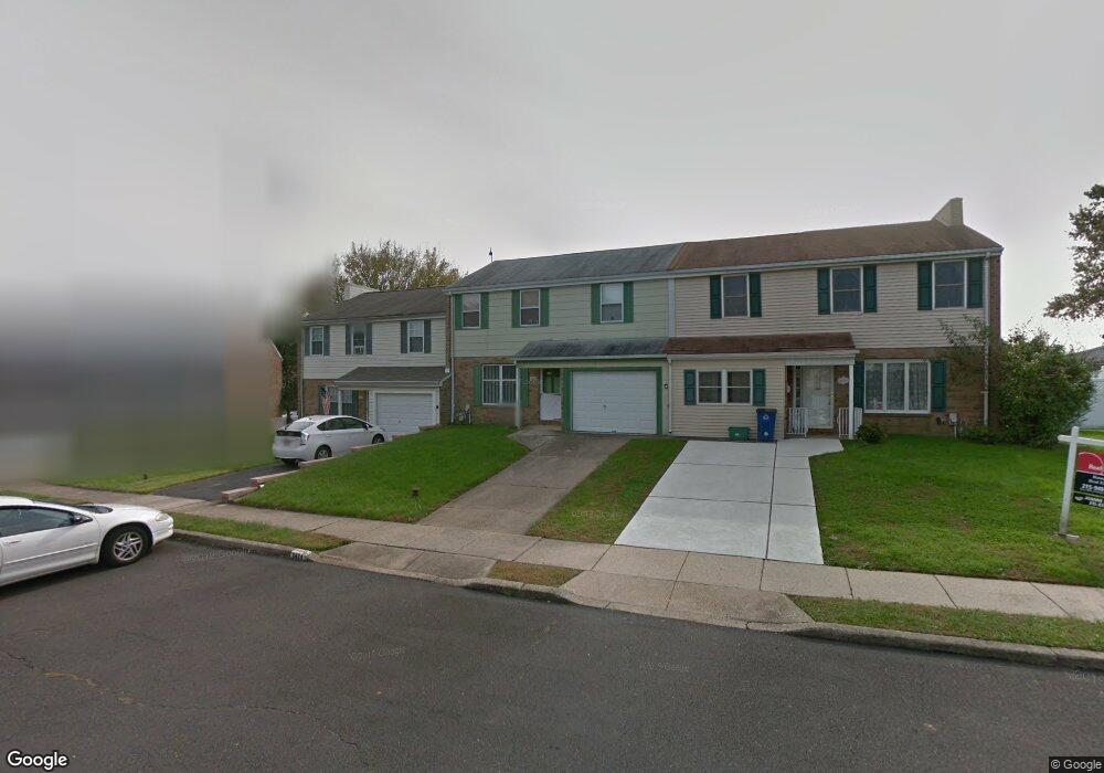
6420 Lenox Ct Bensalem, PA 19020
Neshaminy Valley NeighborhoodEstimated Value: $382,000 - $419,000
3
Beds
2
Baths
1,988
Sq Ft
$201/Sq Ft
Est. Value
About This Home
This home is located at 6420 Lenox Ct, Bensalem, PA 19020 and is currently estimated at $400,267, approximately $201 per square foot. 6420 Lenox Ct is a home located in Bucks County with nearby schools including Valley Elementary School, St. Ephrem School, and Bensalem Baptist School.
Ownership History
Date
Name
Owned For
Owner Type
Purchase Details
Closed on
Aug 30, 2011
Sold by
Rivers Patrick and Banner Shannon A
Bought by
Sheehy James J
Current Estimated Value
Purchase Details
Closed on
Nov 8, 2010
Sold by
Rivers Patrick
Bought by
Rivers Patrick and Banner Shannon A
Purchase Details
Closed on
Jan 15, 2008
Sold by
Estate Of James C King and King Harold Clyde
Bought by
Rivers Patrick
Home Financials for this Owner
Home Financials are based on the most recent Mortgage that was taken out on this home.
Original Mortgage
$115,000
Interest Rate
6.18%
Mortgage Type
Purchase Money Mortgage
Create a Home Valuation Report for This Property
The Home Valuation Report is an in-depth analysis detailing your home's value as well as a comparison with similar homes in the area
Home Values in the Area
Average Home Value in this Area
Purchase History
| Date | Buyer | Sale Price | Title Company |
|---|---|---|---|
| Sheehy James J | $233,000 | None Available | |
| Rivers Patrick | -- | Accommodation | |
| Rivers Patrick | $180,000 | None Available |
Source: Public Records
Mortgage History
| Date | Status | Borrower | Loan Amount |
|---|---|---|---|
| Previous Owner | Rivers Patrick | $115,000 |
Source: Public Records
Tax History Compared to Growth
Tax History
| Year | Tax Paid | Tax Assessment Tax Assessment Total Assessment is a certain percentage of the fair market value that is determined by local assessors to be the total taxable value of land and additions on the property. | Land | Improvement |
|---|---|---|---|---|
| 2025 | $4,715 | $21,600 | $3,320 | $18,280 |
| 2024 | $4,715 | $21,600 | $3,320 | $18,280 |
| 2023 | $4,582 | $21,600 | $3,320 | $18,280 |
| 2022 | $4,555 | $21,600 | $3,320 | $18,280 |
| 2021 | $4,555 | $21,600 | $3,320 | $18,280 |
| 2020 | $4,510 | $21,600 | $3,320 | $18,280 |
| 2019 | $4,409 | $21,600 | $3,320 | $18,280 |
| 2018 | $4,307 | $21,600 | $3,320 | $18,280 |
| 2017 | $4,280 | $21,600 | $3,320 | $18,280 |
| 2016 | $4,280 | $21,600 | $3,320 | $18,280 |
| 2015 | -- | $21,600 | $3,320 | $18,280 |
| 2014 | -- | $21,600 | $3,320 | $18,280 |
Source: Public Records
Map
Nearby Homes
- 6313 Congress Ct
- 6504 Timothy Ct
- 6369 Powder Horn Ct
- 3351 Carroll Ct Unit S
- 3225 Ethan Allen Ct
- 2548 Nashua Rd
- 3325 Pasqualone Blvd
- 681 Pennhill Dr
- 2937 Hamilton Ct
- 3191 Drexel Rd
- 6351 Shewell Rd
- 927 Bellevue Ave
- 3162 Sheppard Rd
- 5967 Griscomb Dr
- 4525 Winding Brook Dr Unit 4525
- 3021 Claridge Rd
- 4912 Oxford Ct Unit 2
- 4828 Oxford Ct
- 4702 A Chelsea Ct Unit A
- 4902 Oxford Ct
- 6424 Lenox Ct
- 6425 Brandywine Ct
- 6429 Brandywine Ct
- 6421 Brandywine Ct
- 6428 Lenox Ct
- 6417 Brandywine Ct
- 6433 Brandywine Ct
- 6416 Lenox Ct
- 6413 Brandywine Ct
- 6368 Congress Ct
- 6360 John Hancock Ct
- 6441 Lenox Ct
- 6412 Lenox Ct
- 6353 Congress Ct
- 6356 John Hancock Ct
- 6409 Brandywine Ct
- 6437 Brandywine Ct
- 6437 Lenox Ct
- 6364 Congress Ct
- 6364 John Hancock Ct