Estimated Value: $301,836 - $499,000
3
Beds
2
Baths
2,093
Sq Ft
$181/Sq Ft
Est. Value
About This Home
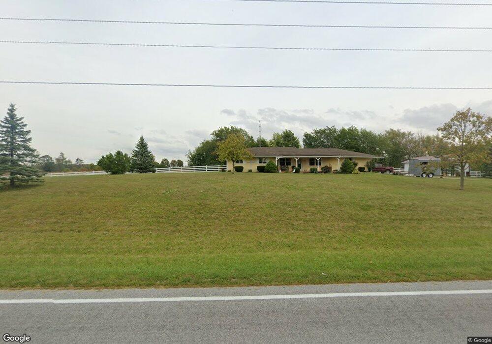
This home is located at 6427 State Route 196, Lima, OH 45806 and is currently estimated at $377,959, approximately $180 per square foot. 6427 State Route 196 is a home located in Allen County with nearby schools including Allen East Elementary School, Allen East Middle School, and Allen East High School.
Ownership History
Date
Name
Owned For
Owner Type
Purchase Details
Closed on
Jul 17, 1998
Sold by
Naylor Mary
Bought by
Sims Kenneth and Sims Barbara
Current Estimated Value
Home Financials for this Owner
Home Financials are based on the most recent Mortgage that was taken out on this home.
Original Mortgage
$68,800
Interest Rate
7.15%
Mortgage Type
Balloon
Purchase Details
Closed on
Nov 1, 1996
Sold by
Naylor Mary
Bought by
Sneary Cameron and Sneary Christine
Purchase Details
Closed on
Apr 21, 1989
Bought by
Naylor Richard N
Create a Home Valuation Report for This Property
The Home Valuation Report is an in-depth analysis detailing your home's value as well as a comparison with similar homes in the area
Purchase History
| Date | Buyer | Sale Price | Title Company |
|---|---|---|---|
| Sims Kenneth | $86,000 | -- | |
| Sneary Cameron | $30,000 | -- | |
| Naylor Richard N | $21,500 | -- |
Source: Public Records
Mortgage History
| Date | Status | Borrower | Loan Amount |
|---|---|---|---|
| Closed | Sims Kenneth | $68,800 |
Source: Public Records
Tax History
| Year | Tax Paid | Tax Assessment Tax Assessment Total Assessment is a certain percentage of the fair market value that is determined by local assessors to be the total taxable value of land and additions on the property. | Land | Improvement |
|---|---|---|---|---|
| 2024 | $2,701 | $77,460 | $11,170 | $66,290 |
| 2023 | $2,426 | $60,980 | $8,790 | $52,190 |
| 2022 | $2,356 | $60,980 | $8,790 | $52,190 |
| 2021 | $2,356 | $60,980 | $8,790 | $52,190 |
| 2020 | $1,905 | $55,520 | $7,670 | $47,850 |
| 2019 | $1,905 | $48,340 | $7,670 | $40,670 |
| 2018 | $1,983 | $48,340 | $7,670 | $40,670 |
| 2017 | $2,043 | $41,340 | $7,460 | $33,880 |
| 2016 | $2,020 | $41,340 | $7,460 | $33,880 |
| 2015 | $2,018 | $41,340 | $7,460 | $33,880 |
| 2014 | $2,018 | $40,400 | $6,200 | $34,200 |
| 2013 | $1,978 | $40,400 | $6,200 | $34,200 |
Source: Public Records
Map
Nearby Homes
- 25353 Buckland Holden Rd
- 8150 Amherst Rd
- 24702 Buckland Holden Rd
- 4850 Bowdle Rd
- 18544 Santa Fe Line Rd
- 101 Sunrise Dr
- 533 N Westminster St
- 7165 Faulkner Rd
- 3300 Johnston Rd
- 404 N Westminster St
- 105 Guthrie St
- 6381 McPheron Rd
- 211 E Wapakoneta St
- 25702 Ohio 67
- 204 S Westminster St
- 5600 E Hanthorn Rd
- 5490 E Hanthorn Rd
- 21320 Fairmount Rd
- 4160 E Hanthorn Rd
- 9373 Harrod Rd
- 6396 State Route 196
- 6396 Waynesfield Rd
- 6440 State Route 196
- 6440 Waynesfield Rd
- 6450 State Route 196
- 6900 Amherst Rd
- 6535 State Route 196
- 6464 State Route 196
- 6200 State Route 196
- 6200 Waynesfield Rd
- 6565 State Route 196
- 6565 Waynesfield Rd
- 6895 Amherst Rd
- 6821 Amherst Rd
- 6570 State Route 196
- 6787 Amherst Rd
- 6753 Amherst Rd
- 6664 Amherst Rd
- 6597 Waynesfield Rd
- 6100 State Route 196
Your Personal Tour Guide
Ask me questions while you tour the home.