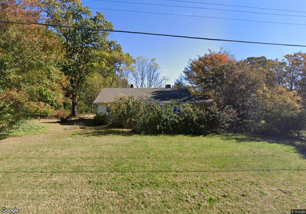
643 S Main St Dobson, NC 27017
Estimated Value: $109,000 - $178,000
2
Beds
1
Bath
1,040
Sq Ft
$138/Sq Ft
Est. Value
About This Home
This home is located at 643 S Main St, Dobson, NC 27017 and is currently estimated at $143,268, approximately $137 per square foot. 643 S Main St is a home located in Surry County with nearby schools including Dobson Elementary School, Central Middle School, and Surry Central High School.
Ownership History
Date
Name
Owned For
Owner Type
Purchase Details
Closed on
Jul 7, 2023
Sold by
Jonczak John G and Jonczak Jessica R
Bought by
Pqa Healthcare Inc
Current Estimated Value
Purchase Details
Closed on
May 16, 2023
Sold by
Snow Fred Roger and Snow Kathy Ann
Bought by
Jonczak John G and Jonczak Jessica R
Purchase Details
Closed on
Jan 20, 2022
Sold by
Kevin Rosendahl
Bought by
Triplett Gayle D and Snow Kathy Ann
Purchase Details
Closed on
Jan 1, 1999
Purchase Details
Closed on
Sep 1, 1988
Purchase Details
Closed on
Dec 1, 1951
Create a Home Valuation Report for This Property
The Home Valuation Report is an in-depth analysis detailing your home's value as well as a comparison with similar homes in the area
Purchase History
| Date | Buyer | Sale Price | Title Company |
|---|---|---|---|
| Pqa Healthcare Inc | $118,000 | None Listed On Document | |
| Jonczak John G | $80,000 | None Listed On Document | |
| Triplett Gayle D | $55,000 | Royster Mark S | |
| Rosendahl Kevin | $55,000 | None Listed On Document | |
| -- | -- | -- | |
| -- | -- | -- | |
| -- | -- | -- |
Source: Public Records
Tax History
| Year | Tax Paid | Tax Assessment Tax Assessment Total Assessment is a certain percentage of the fair market value that is determined by local assessors to be the total taxable value of land and additions on the property. | Land | Improvement |
|---|---|---|---|---|
| 2025 | $782 | $76,860 | $20,000 | $56,860 |
| 2024 | $617 | $57,700 | $13,000 | $44,700 |
| 2023 | $611 | $57,700 | $13,000 | $44,700 |
| 2022 | $606 | $58,340 | $13,000 | $45,340 |
| 2021 | $334 | $57,800 | $13,000 | $44,800 |
| 2020 | $331 | $56,570 | $13,000 | $43,570 |
| 2019 | $328 | $56,570 | $0 | $0 |
| 2018 | $575 | $56,570 | $0 | $0 |
| 2017 | $583 | $56,570 | $0 | $0 |
| 2016 | $583 | $56,570 | $0 | $0 |
| 2013 | -- | $56,870 | $0 | $0 |
Source: Public Records
Map
Nearby Homes
- 149 Vance St
- 209 Freeman St
- 215 Freeman St
- 00 U S 601
- 00 US Highway 601 U S 601 Unit 10
- 00 US Highway 601 U S 601 Unit 9
- 311 James St
- 111 Arthur Haney Rd
- 308 Main St Unit Tract 2 land only
- 331 Collins Rd
- Grover Simmons Rd
- Grover Simmons Rd
- 215 Arthur Haney Rd
- TBD Norman Ln
- 621 W Atkins St
- TBD Caves Mill Rd
- 0 Main St Unit 1127207
- 504 Cody Trail
- 164 Royal Ln
- 4043 Old Highway 601
- 647 S Main St
- 631 S Main St
- 629 S Main St
- 2182 Old Rockford Rd
- 00 Knight Ln
- 300 Knight Ln
- 300 Knight Ln Unit G1
- 300 Knight Ln Unit G
- 1451 Old Rockford Rd
- 400 College Place Ave Unit E1
- 400 College Place Ave
- 400 College Place Ave Unit E
- 2177 Old Rockford Rd
- 0 S Main St
- 715 S Main St
- 800 College Place Ave
- 800 College Place Ave Unit D
- 700 College Place Ave Unit B-9
- 700 College Place Ave
- 700 College Place Ave Unit B16
Your Personal Tour Guide
Ask me questions while you tour the home.