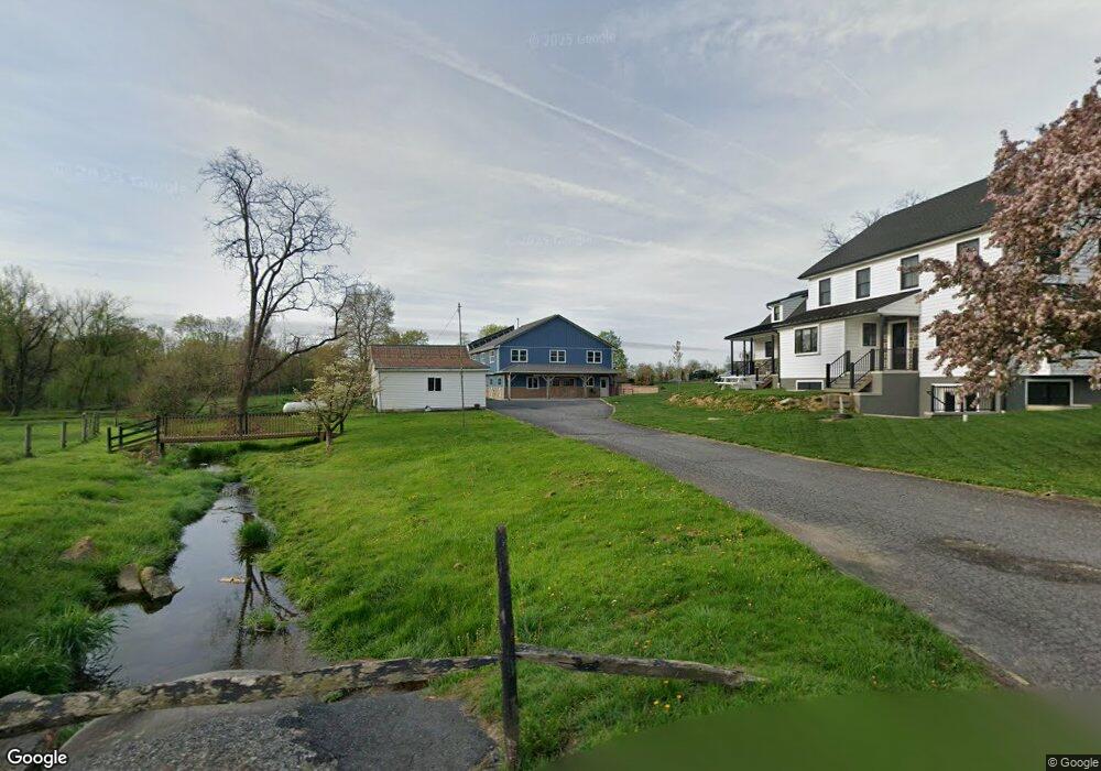
6430 Emery Rd Narvon, PA 17555
Estimated Value: $691,000
3
Beds
3
Baths
3,154
Sq Ft
$219/Sq Ft
Est. Value
About This Home
This home is located at 6430 Emery Rd, Narvon, PA 17555 and is currently priced at $691,000, approximately $219 per square foot. 6430 Emery Rd is a home located in Chester County with nearby schools including Honey Brook Elementary Center, Twin Valley Middle School, and Twin Valley High School.
Ownership History
Date
Name
Owned For
Owner Type
Purchase Details
Closed on
Oct 7, 2014
Sold by
Stoltzfus Elam S and Stoltzfus Linda S
Bought by
Stoltzfus Jonas A and Stoltzfus Susie B
Current Estimated Value
Home Financials for this Owner
Home Financials are based on the most recent Mortgage that was taken out on this home.
Original Mortgage
$203,000
Outstanding Balance
$154,301
Interest Rate
3.87%
Mortgage Type
Adjustable Rate Mortgage/ARM
Create a Home Valuation Report for This Property
The Home Valuation Report is an in-depth analysis detailing your home's value as well as a comparison with similar homes in the area
Home Values in the Area
Average Home Value in this Area
Purchase History
| Date | Buyer | Sale Price | Title Company |
|---|---|---|---|
| Stoltzfus Jonas A | -- | None Available |
Source: Public Records
Mortgage History
| Date | Status | Borrower | Loan Amount |
|---|---|---|---|
| Open | Stoltzfus Jonas A | $203,000 |
Source: Public Records
Tax History Compared to Growth
Tax History
| Year | Tax Paid | Tax Assessment Tax Assessment Total Assessment is a certain percentage of the fair market value that is determined by local assessors to be the total taxable value of land and additions on the property. | Land | Improvement |
|---|---|---|---|---|
| 2025 | $19,175 | $499,410 | $46,400 | $453,010 |
| 2024 | $19,175 | $499,410 | $46,400 | $453,010 |
| 2023 | $9,087 | $242,200 | $47,870 | $194,330 |
| 2022 | $3,104 | $83,660 | $47,870 | $35,790 |
| 2021 | $6,368 | $176,770 | $47,870 | $128,900 |
| 2020 | $6,336 | $176,770 | $47,870 | $128,900 |
| 2019 | $6,147 | $176,770 | $47,870 | $128,900 |
| 2018 | $6,147 | $176,770 | $47,870 | $128,900 |
| 2017 | $6,002 | $176,770 | $47,870 | $128,900 |
| 2016 | $4,975 | $176,770 | $47,870 | $128,900 |
| 2015 | $4,975 | $176,770 | $47,870 | $128,900 |
| 2014 | $4,975 | $176,770 | $47,870 | $128,900 |
Source: Public Records
Map
Nearby Homes
- 0 Westbrook Dr
- 0 Westbrook Dr
- 0 Westbrook Dr
- 0 Westbrook Dr
- 650 Broad St
- 407 Cahill Cir Unit 4
- 110 Petrelia Dr
- 1022 Elwood St
- 607 Buchland Rd
- 5892 Meadville Rd
- 339 Churchtown Rd
- 490 Red Hill Rd
- 14 Blue Spruce Dr
- 2085 Main St
- 112 Maxwell Hill Rd
- 5490 Division Hwy
- 211 Michael Rd
- 241 Dove Dr
- 40 Cupola Rd
- 5235 Honeysuckle Ln
- 455 Mill Rd
- 450 Mill Rd
- 460 Mill Rd
- 6365 Davis Ln
- 605 Mill Rd
- 1765 Walnut Rd
- 175 Mill Rd
- 628 Mill Rd
- 135 Mill Rd
- 135 Whitehorse Dr
- 133 Whitehorse Dr Unit 13
- 133 Whitehorse Dr
- 137 Whitehorse Dr
- 137 Whitehorse Dr Unit 15
- 111 Mill Rd
- 139 Whitehorse Dr
- 131 Whitehorse Dr
- 134 Whitehorse Dr
- 130 Whitehorse Dr
- 136 Whitehorse Dr