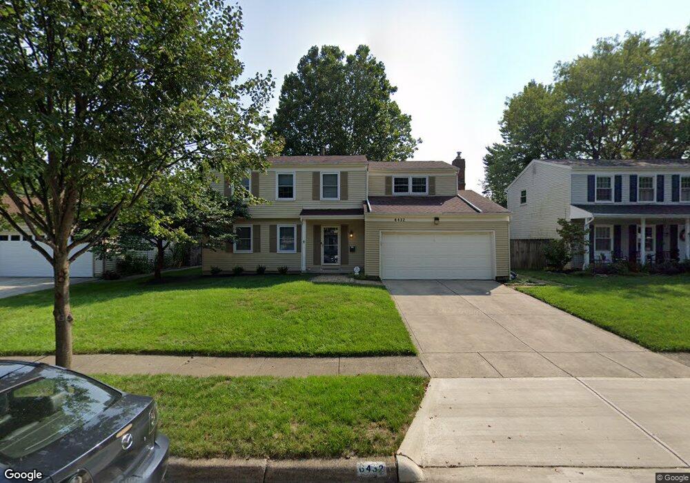
6432 Peardale Rd E Columbus, OH 43229
Northgate NeighborhoodEstimated Value: $295,000 - $337,000
3
Beds
3
Baths
1,920
Sq Ft
$161/Sq Ft
Est. Value
About This Home
This home is located at 6432 Peardale Rd E, Columbus, OH 43229 and is currently estimated at $308,377, approximately $160 per square foot. 6432 Peardale Rd E is a home located in Franklin County with nearby schools including Alpine Elementary School, Northgate Intermediate, and Woodward Park Middle School.
Ownership History
Date
Name
Owned For
Owner Type
Purchase Details
Closed on
Mar 30, 2021
Sold by
Myers George E and Myers Martha A
Bought by
Jones Trent
Current Estimated Value
Home Financials for this Owner
Home Financials are based on the most recent Mortgage that was taken out on this home.
Original Mortgage
$200,000
Interest Rate
2.9%
Mortgage Type
New Conventional
Purchase Details
Closed on
Dec 30, 2003
Sold by
Myers George E and Myers Martha A
Bought by
Myers George E and Myers Martha A
Purchase Details
Closed on
May 11, 1977
Bought by
Myers George E
Create a Home Valuation Report for This Property
The Home Valuation Report is an in-depth analysis detailing your home's value as well as a comparison with similar homes in the area
Home Values in the Area
Average Home Value in this Area
Purchase History
| Date | Buyer | Sale Price | Title Company |
|---|---|---|---|
| Jones Trent | $200,000 | Northwest Select Ttl Agcy Ll | |
| Myers George E | -- | -- | |
| Myers George E | -- | -- |
Source: Public Records
Mortgage History
| Date | Status | Borrower | Loan Amount |
|---|---|---|---|
| Previous Owner | Jones Trent | $200,000 |
Source: Public Records
Tax History
| Year | Tax Paid | Tax Assessment Tax Assessment Total Assessment is a certain percentage of the fair market value that is determined by local assessors to be the total taxable value of land and additions on the property. | Land | Improvement |
|---|---|---|---|---|
| 2025 | $4,205 | $93,700 | $19,780 | $73,920 |
| 2024 | $4,205 | $93,700 | $19,780 | $73,920 |
| 2023 | $4,151 | $93,695 | $19,775 | $73,920 |
| 2022 | $3,366 | $64,900 | $12,850 | $52,050 |
| 2021 | $2,917 | $64,900 | $12,850 | $52,050 |
| 2020 | $2,921 | $64,900 | $12,850 | $52,050 |
| 2019 | $2,614 | $51,840 | $10,290 | $41,550 |
| 2018 | $2,277 | $51,840 | $10,290 | $41,550 |
| 2017 | $2,377 | $51,840 | $10,290 | $41,550 |
| 2016 | $2,142 | $41,090 | $7,770 | $33,320 |
| 2015 | $1,945 | $41,090 | $7,770 | $33,320 |
| 2014 | $1,949 | $41,090 | $7,770 | $33,320 |
| 2013 | $1,098 | $45,675 | $8,645 | $37,030 |
Source: Public Records
Map
Nearby Homes
- 6425 Deer Ridge Ln
- 1806 Balsamridge Rd
- 1852 Balsamridge Rd
- 6416 Faircrest Rd
- 1635 Tendril Ct
- 6245 Sharon Woods Blvd
- 1755 Hillandale Ave
- 6166 Harrington Ct
- 6148 Sharon Woods Blvd
- 1946 Rockdale Dr Unit 57
- 6336 Archmere Square E
- 6233 Karl Rd
- 2125 Keltonshire Ave
- 1421 Bosworth Place
- 6348 Birkewood St
- 2154-2156 Jewett Dr
- 6100 Darby Ln
- 6019 Beechcroft Rd
- 6050 Karl Rd
- 2197 Bayfield Dr
- 6420 Peardale Rd E
- 6438 Peardale Rd E
- 6425 Skywae Dr
- 6412 Peardale Rd E
- 6417 Skywae Dr
- 1740 Peardale Rd N
- 6435 Peardale Rd E
- 6437 Skywae Dr
- 1730 Gypsy Ln
- 6404 Peardale Rd E
- 1719 Peardale Rd N
- 6449 Skywae Dr
- 1734 Peardale Rd N
- 6399 Skywae Dr
- 6459 Skywae Dr
- 6396 Peardale Rd E
- 6401 Peardale Rd E
- 1716 Gypsy Ln
- 1717 Peardale Rd N
- 6389 Skywae Dr
Your Personal Tour Guide
Ask me questions while you tour the home.