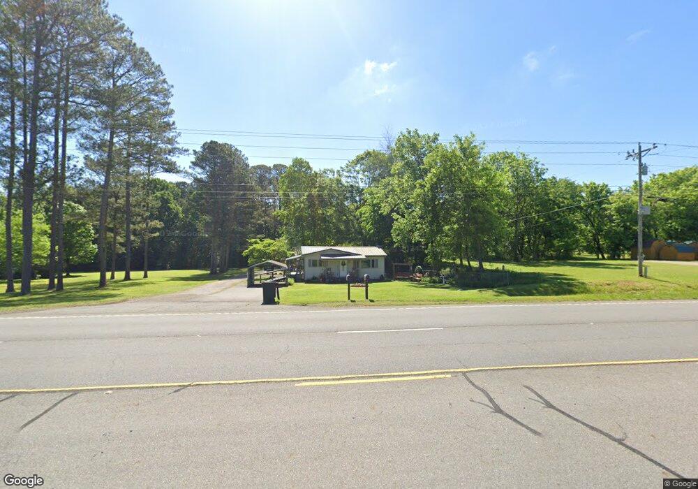
6436 N Highway 27 La Fayette, GA 30728
Noble NeighborhoodEstimated Value: $112,654 - $195,000
--
Bed
1
Bath
780
Sq Ft
$211/Sq Ft
Est. Value
About This Home
This home is located at 6436 N Highway 27, La Fayette, GA 30728 and is currently estimated at $164,914, approximately $211 per square foot. 6436 N Highway 27 is a home located in Walker County with nearby schools including Rock Spring Elementary School and Lafayette High School.
Ownership History
Date
Name
Owned For
Owner Type
Purchase Details
Closed on
Mar 15, 2017
Sold by
Cooper Russell G
Bought by
Cooper Russell G and Cooper Vicky A
Current Estimated Value
Purchase Details
Closed on
Dec 17, 1975
Sold by
Administration Of Veterans Af
Bought by
Cooper Russell
Purchase Details
Closed on
Jul 3, 1975
Sold by
Rossville Federal Savings & L
Bought by
Administration Of Veterans Af
Purchase Details
Closed on
Jul 1, 1975
Sold by
Mcwhorter Cecil Larry 7 Wf Sh
Bought by
Rossville Federal Savings & L
Purchase Details
Closed on
Aug 1, 1973
Sold by
Mcwhorter Cecil Larry
Bought by
Mcwhorter Cecil Larry 7 Wf Sh
Purchase Details
Closed on
Sep 11, 1971
Bought by
Mcwhorter Cecil Larry
Create a Home Valuation Report for This Property
The Home Valuation Report is an in-depth analysis detailing your home's value as well as a comparison with similar homes in the area
Home Values in the Area
Average Home Value in this Area
Purchase History
| Date | Buyer | Sale Price | Title Company |
|---|---|---|---|
| Cooper Russell G | -- | -- | |
| Cooper Russell | -- | -- | |
| Administration Of Veterans Af | -- | -- | |
| Rossville Federal Savings & L | -- | -- | |
| Mcwhorter Cecil Larry 7 Wf Sh | -- | -- | |
| Mcwhorter Cecil Larry | -- | -- |
Source: Public Records
Tax History Compared to Growth
Tax History
| Year | Tax Paid | Tax Assessment Tax Assessment Total Assessment is a certain percentage of the fair market value that is determined by local assessors to be the total taxable value of land and additions on the property. | Land | Improvement |
|---|---|---|---|---|
| 2024 | $129 | $43,689 | $3,605 | $40,084 |
| 2023 | $130 | $41,039 | $2,861 | $38,178 |
| 2022 | $737 | $36,074 | $3,480 | $32,594 |
| 2021 | $478 | $23,158 | $3,480 | $19,678 |
| 2020 | $302 | $15,840 | $3,480 | $12,360 |
| 2019 | $308 | $15,840 | $3,480 | $12,360 |
| 2018 | $419 | $15,840 | $3,480 | $12,360 |
| 2017 | $378 | $15,840 | $3,480 | $12,360 |
| 2016 | $336 | $15,840 | $3,480 | $12,360 |
| 2015 | $535 | $17,556 | $1,408 | $16,148 |
| 2014 | $457 | $17,556 | $1,408 | $16,148 |
| 2013 | -- | $17,556 | $1,408 | $16,148 |
Source: Public Records
Map
Nearby Homes
- 23 Willow Cir
- 16 Willow Cir
- 15 Willow Cir
- 11 Willow Cir
- The Pearson Plan at Laurel Ridge
- The Benson II Plan at Laurel Ridge
- The Langford Plan at Laurel Ridge
- The Lawson Plan at Laurel Ridge
- The Piedmont Plan at Laurel Ridge
- The Coleman Plan at Laurel Ridge
- The McGinnis Plan at Laurel Ridge
- The Caldwell Plan at Laurel Ridge
- 10180 Us Highway 27
- 0 Veeler Rd Unit 1522679
- 0 Veeler Rd Unit 10628696
- 1003 Highway N Old 27
- 1370 Old Highway 27
- 701 Bicentennial Trail
- 5602 Georgia 95
- 00 Georgia 95
- 6434 N Highway 27
- 6432 N Highway 27
- 84 Chastain Dr
- 6421 N Highway 27
- 6455 Us Highway 27
- 6455 N Highway 27
- 6381 Us Highway 27
- 83 Chastain Dr
- 83 Chastain Dr
- 6508 N Highway 27
- 27 Chastain Dr
- 6381 N Highway 27
- 6363 N Highway 27
- 6346 N Highway 27
- 6503 N Highway 27
- 6346 Highway 27
- 6503 Us Highway 27
- 80 Chastain Dr
- 6527 N Highway 27
- 6553 N Highway 27