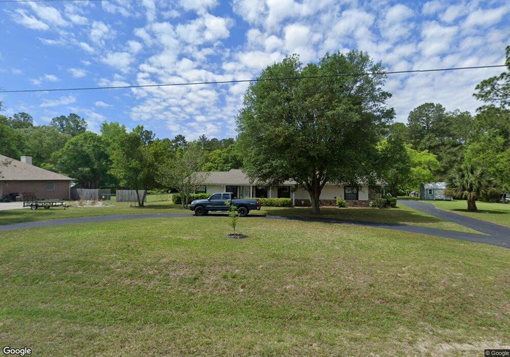
6436 W River Circle Extension MacClenny, FL 32063
Estimated Value: $331,000 - $410,000
Studio
2
Baths
1,820
Sq Ft
$207/Sq Ft
Est. Value
About This Home
This home is located at 6436 W River Circle Extension, MacClenny, FL 32063 and is currently estimated at $376,056, approximately $206 per square foot. 6436 W River Circle Extension is a home located in Baker County with nearby schools including Keller Intermediate School, MacClenny Elementary School, and Baker County Middle School.
Ownership History
Date
Name
Owned For
Owner Type
Purchase Details
Closed on
Nov 16, 2017
Sold by
Alton Lane
Bought by
Grant Steven Coleman
Current Estimated Value
Home Financials for this Owner
Home Financials are based on the most recent Mortgage that was taken out on this home.
Original Mortgage
$172,796
Outstanding Balance
$144,103
Interest Rate
3.85%
Mortgage Type
New Conventional
Estimated Equity
$231,953
Purchase Details
Closed on
Sep 12, 2003
Sold by
Altom Lane
Bought by
Farnesi Vincent J
Create a Home Valuation Report for This Property
The Home Valuation Report is an in-depth analysis detailing your home's value as well as a comparison with similar homes in the area
Home Values in the Area
Average Home Value in this Area
Purchase History
| Date | Buyer | Sale Price | Title Company |
|---|---|---|---|
| Grant Steven Coleman | $187,900 | Oscelola Land Title Inc | |
| Farnesi Vincent J | -- | -- |
Source: Public Records
Mortgage History
| Date | Status | Borrower | Loan Amount |
|---|---|---|---|
| Open | Grant Steven Coleman | $172,796 |
Source: Public Records
Tax History
| Year | Tax Paid | Tax Assessment Tax Assessment Total Assessment is a certain percentage of the fair market value that is determined by local assessors to be the total taxable value of land and additions on the property. | Land | Improvement |
|---|---|---|---|---|
| 2025 | $2,791 | $236,204 | -- | -- |
| 2024 | $2,708 | $229,547 | -- | -- |
| 2023 | $2,645 | $222,861 | $0 | $0 |
| 2022 | $2,578 | $216,370 | $0 | $0 |
| 2021 | $2,566 | $210,068 | $0 | $0 |
| 2020 | $2,553 | $207,168 | $0 | $0 |
| 2019 | $2,505 | $202,510 | $0 | $0 |
| 2018 | $2,480 | $198,734 | $0 | $0 |
| 2017 | $453 | $242,547 | $0 | $0 |
| 2016 | $458 | $238,600 | $0 | $0 |
| 2015 | $669 | $231,602 | $0 | $0 |
| 2014 | $665 | $125,327 | $0 | $0 |
Source: Public Records
Map
Nearby Homes
- 6191 W River Cir
- 6121 Michele Rd
- 6897 Miltondale Rd
- 369 Owen Acres Dr
- 10399 Greystone Dr
- 820 Golf Club Rd
- 583 Heritage Crossing
- 551 Heritage Crossing
- 570 Independence Dr
- 594 Independence Dr
- 10359 Greystone Dr
- 10364 Greystone Dr
- 10358 Greystone Dr
- 10346 Greystone Dr
- 724 Miltondale Rd
- 10333 Greystone Dr
- 10394 Greystone Dr
- 10388 Greystone Dr
- 10382 Greystone Dr
- 10393 Greystone Dr
- 6436 W River Circle Extension
- 6396 W River Circle Extension
- 6396 W River Cir
- 6427 W River Circle Extension
- 6435 W River Circle Extension
- 6436 River Ext Cir W
- 6368 W River Circle Extension
- 6363 W River Circle Extension
- 6393 W River Cir
- 6324 W River Cir
- 6204 Michele Rd
- 6331 W River Cir
- 6216 Michele Rd
- 6228 Michele Rd
- 6298 W River Cir
- 6186 Michele Rd
- 6315 N River Cir
- 6274 Burnsed Ln
- 6246 Michele Rd
- 6246 Michele Rd
Your Personal Tour Guide
Ask me questions while you tour the home.