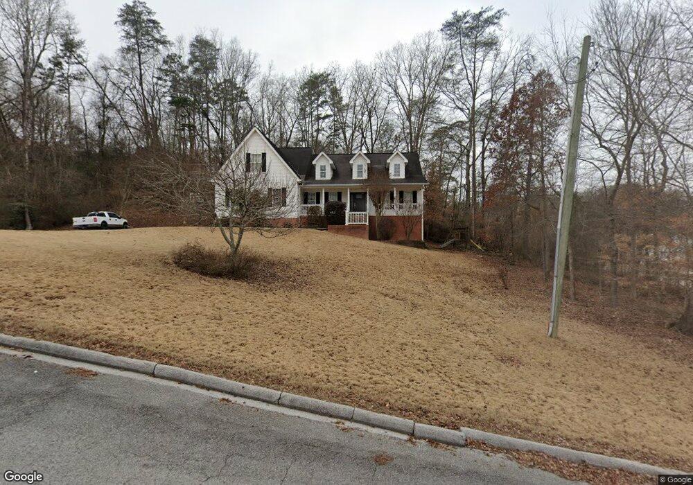
6437 Forest Meade Dr Hixson, TN 37343
Valleybrook NeighborhoodEstimated Value: $395,000 - $525,000
--
Bed
1
Bath
2,512
Sq Ft
$176/Sq Ft
Est. Value
About This Home
This home is located at 6437 Forest Meade Dr, Hixson, TN 37343 and is currently estimated at $442,475, approximately $176 per square foot. 6437 Forest Meade Dr is a home located in Hamilton County with nearby schools including Hixson Elementary School, Hixson Middle School, and Hixson High School.
Ownership History
Date
Name
Owned For
Owner Type
Purchase Details
Closed on
Mar 3, 2000
Sold by
Bull Ronald W and Bull Michelle
Bought by
Tanner Jeffery C and Tanner Kellie A
Current Estimated Value
Home Financials for this Owner
Home Financials are based on the most recent Mortgage that was taken out on this home.
Original Mortgage
$140,000
Outstanding Balance
$47,721
Interest Rate
8.37%
Estimated Equity
$394,754
Purchase Details
Closed on
Aug 20, 1999
Sold by
Bull Marcel T
Bought by
Bull Ronald W and Bull Michelle
Home Financials for this Owner
Home Financials are based on the most recent Mortgage that was taken out on this home.
Original Mortgage
$153,600
Interest Rate
7.58%
Purchase Details
Closed on
Jan 12, 1996
Sold by
Lane Bryan H and Lane Hazel B
Bought by
Bull Ronnie
Create a Home Valuation Report for This Property
The Home Valuation Report is an in-depth analysis detailing your home's value as well as a comparison with similar homes in the area
Home Values in the Area
Average Home Value in this Area
Purchase History
| Date | Buyer | Sale Price | Title Company |
|---|---|---|---|
| Tanner Jeffery C | $206,029 | -- | |
| Bull Ronald W | -- | -- | |
| Bull Ronnie | $10,000 | -- |
Source: Public Records
Mortgage History
| Date | Status | Borrower | Loan Amount |
|---|---|---|---|
| Open | Tanner Jeffery C | $140,000 | |
| Previous Owner | Bull Ronald W | $153,600 |
Source: Public Records
Tax History Compared to Growth
Tax History
| Year | Tax Paid | Tax Assessment Tax Assessment Total Assessment is a certain percentage of the fair market value that is determined by local assessors to be the total taxable value of land and additions on the property. | Land | Improvement |
|---|---|---|---|---|
| 2024 | $1,821 | $81,375 | $0 | $0 |
| 2023 | $1,821 | $81,375 | $0 | $0 |
| 2022 | $1,821 | $81,375 | $0 | $0 |
| 2021 | $1,821 | $81,375 | $0 | $0 |
| 2020 | $1,945 | $70,325 | $0 | $0 |
| 2019 | $1,945 | $70,325 | $0 | $0 |
| 2018 | $1,728 | $70,325 | $0 | $0 |
| 2017 | $1,945 | $70,325 | $0 | $0 |
| 2016 | $1,900 | $0 | $0 | $0 |
| 2015 | $3,602 | $68,725 | $0 | $0 |
| 2014 | $3,602 | $0 | $0 | $0 |
Source: Public Records
Map
Nearby Homes
- 743 Ashley Forest Dr
- 497 Candytuft Ln
- 1000 Olde Mill Ln
- 437 English Oaks Dr
- 421 Golden Oaks Dr
- 808 Fox Chase Ln
- 434 Stoneridge Dr
- 1225 Dreamcatcher Way
- 311 Branch Dr
- 5848 Grubb Rd
- 6043 Mill Rd
- 1016 Woodfern Trail
- 790 Wood Grove Cir
- 753 Wood Grove Cir
- 5967 Winding Ln
- 5741 Lyle Cir
- 5700 Lyle Cir
- 7155 Crestfield Cir
- 5929 Winding Ln
- 1117 Fieldstone Dr
- 1030 Lower Mill Rd
- 1033 Lower Mill Rd
- 1035 Lower Mill Rd
- 1031 Lower Mill Rd
- 1026 Lower Mill Rd
- 1026 Lower Mill Rd Unit 51
- 6440 Forest Meade Dr
- 741 Ashley Forest Dr
- 1039 Lower Mill Rd
- 1027 Lower Mill Rd
- 739 Ashley Forest Dr
- 6436 Forest Meade Dr
- 6433 Forest Meade Dr
- 1024 Lower Mill Rd
- 745 Ashley Forest Dr
- 908 Old Lower Mill Rd
- 6432 Forest Meade Dr
- 737 Ashley Forest Dr
- 0 Ashley Forest Dr
- 906 Old Lower Mill Rd