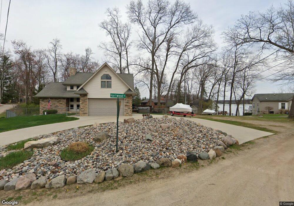
6439 Hartwood Dr Fenton, MI 48430
Estimated Value: $465,000 - $552,000
--
Bed
1
Bath
1,888
Sq Ft
$260/Sq Ft
Est. Value
About This Home
This home is located at 6439 Hartwood Dr, Fenton, MI 48430 and is currently estimated at $490,299, approximately $259 per square foot. 6439 Hartwood Dr is a home located in Livingston County with nearby schools including Hyatt Elementary School, Linden Middle School, and Linden High School.
Ownership History
Date
Name
Owned For
Owner Type
Purchase Details
Closed on
Feb 6, 2025
Sold by
Peters James G
Bought by
Peters James G and Peters Hannah M
Current Estimated Value
Purchase Details
Closed on
Jun 13, 2019
Sold by
Stecco Phillip Est
Bought by
Sawa Haleena M
Purchase Details
Closed on
Feb 26, 2001
Sold by
Peters Deborah J
Bought by
Peters James G
Home Financials for this Owner
Home Financials are based on the most recent Mortgage that was taken out on this home.
Original Mortgage
$202,800
Interest Rate
7.18%
Create a Home Valuation Report for This Property
The Home Valuation Report is an in-depth analysis detailing your home's value as well as a comparison with similar homes in the area
Home Values in the Area
Average Home Value in this Area
Purchase History
| Date | Buyer | Sale Price | Title Company |
|---|---|---|---|
| Peters James G | -- | None Listed On Document | |
| Sawa Haleena M | -- | Liberty Title | |
| Peters James G | -- | Guaranty Title Company |
Source: Public Records
Mortgage History
| Date | Status | Borrower | Loan Amount |
|---|---|---|---|
| Previous Owner | Peters James G | $202,800 |
Source: Public Records
Tax History Compared to Growth
Tax History
| Year | Tax Paid | Tax Assessment Tax Assessment Total Assessment is a certain percentage of the fair market value that is determined by local assessors to be the total taxable value of land and additions on the property. | Land | Improvement |
|---|---|---|---|---|
| 2025 | $3,175 | $250,300 | $0 | $0 |
| 2024 | $1,642 | $253,500 | $0 | $0 |
| 2023 | $1,568 | $218,000 | $0 | $0 |
| 2022 | $2,846 | $176,500 | $0 | $0 |
| 2021 | $2,846 | $172,300 | $0 | $0 |
| 2020 | $2,719 | $169,400 | $0 | $0 |
| 2019 | $2,740 | $172,400 | $0 | $0 |
| 2018 | $2,684 | $181,855 | $0 | $0 |
| 2017 | $2,617 | $181,855 | $0 | $0 |
| 2016 | $2,659 | $155,245 | $0 | $0 |
| 2014 | $2,400 | $101,424 | $0 | $0 |
| 2012 | $2,400 | $90,024 | $0 | $0 |
Source: Public Records
Map
Nearby Homes
- 11476 Delmar Dr
- 7351 Selma Dr
- 16431 Oak Hill Dr
- 16172 Crest Dr
- 16186 Softwater Lake Dr
- South of 12111 Linde Linden Rd
- 5382 Spring Meadows Way Unit 53
- 16083 Whitehead Dr
- 8466 Silver Lake Rd
- 16191 Seymour Rd
- 0 Cohoctah Rd Unit 20251035697
- 16100 River Ridge Trail
- 9127 Pineview Lake
- 11476 Koth Dr
- VL Pineview Lake Dr
- 9203 Pine Walk Pass Unit 67
- 8410 Pineview Lake Dr
- 16534 W Horseshoe Trail
- 16396 Shadow Ln
- 16368 Shadow Ln
- 6439 Hartwood Dr
- 6445 Hartwood Dr
- 6423 Hartwood Dr
- 6421 Hartwood Dr
- 6463 Hartwood Dr
- 6419 Hartwood Dr
- 6451 Hartwood Dr
- 6485 Hartwood Dr
- 6414 Hartwood Dr
- 6405 Hartwood Dr
- 6487 Hartwood Dr
- 0 Hartwood Dr
- 6497 Hartwood Dr
- 6497 Hartwood Dr
- 6401 Hartwood Dr
- 6400 Hartwood Dr
- 6503 Hartwood Dr
- 6313 Hartwood Dr
- 6509 Hartwood Dr
- 6515 Hartwood Dr