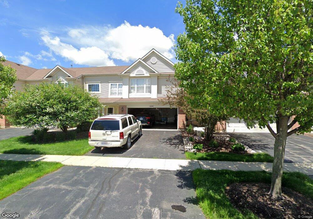
644 Lancaster Dr Unit 1 Pingree Grove, IL 60140
Estimated Value: $282,000 - $305,000
About This Home
This home is located at 644 Lancaster Dr Unit 1, Pingree Grove, IL 60140 and is currently estimated at $289,166, approximately $190 per square foot. 644 Lancaster Dr Unit 1 is a home located in Kane County with nearby schools including Hampshire Middle School, Hampshire High School, and Cambridge Lakes Charter School.
Ownership History
We collect this data history from publicly available records. To have your information removed, we recommend requesting removal directly through your county’s website.
Purchase Details
Home Financials for this Owner
Home Financials are based on the most recent Mortgage that was taken out on this home.Purchase Details
Home Financials for this Owner
Home Financials are based on the most recent Mortgage that was taken out on this home.Purchase Details
Home Financials for this Owner
Home Financials are based on the most recent Mortgage that was taken out on this home.Purchase Details
Home Financials for this Owner
Home Financials are based on the most recent Mortgage that was taken out on this home.Purchase Details
Home Financials for this Owner
Home Financials are based on the most recent Mortgage that was taken out on this home.Home Values in the Area
Average Home Value in this Area
Purchase History
We collect this data history from publicly available records. To have your information removed, we recommend requesting removal directly through your county’s website.
| Date | Buyer | Sale Price | Title Company |
|---|---|---|---|
| $258,000 | Premier Title | ||
| -- | None Available | ||
| -- | Citywide Title Corporation | ||
| $160,000 | First American Title | ||
| $192,000 | First American Title |
Mortgage History
We collect this data history from publicly available records. To have your information removed, we recommend requesting removal directly through your county’s website.
| Date | Status | Borrower | Loan Amount |
|---|---|---|---|
| Open | $245,100 | ||
| Previous Owner | $143,000 | ||
| Previous Owner | $155,214 | ||
| Previous Owner | $157,916 | ||
| Previous Owner | $192,000 |
Tax History
We collect this data history from publicly available records. To have your information removed, we recommend requesting removal directly through your county’s website.
| Year | Tax Paid | Tax Assessment Tax Assessment Total Assessment is a certain percentage of the fair market value that is determined by local assessors to be the total taxable value of land and additions on the property. | Land | Improvement |
|---|---|---|---|---|
| 2024 | $5,825 | $79,192 | $14,428 | $64,764 |
| 2023 | $5,657 | $71,616 | $13,048 | $58,568 |
| 2022 | $5,381 | $63,976 | $12,030 | $51,946 |
| 2021 | $5,236 | $60,173 | $11,315 | $48,858 |
| 2020 | $5,141 | $58,637 | $11,026 | $47,611 |
| 2019 | $5,024 | $56,279 | $10,583 | $45,696 |
| 2018 | $4,687 | $50,373 | $9,932 | $40,441 |
| 2017 | $4,599 | $47,970 | $9,458 | $38,512 |
| 2016 | $4,578 | $45,668 | $9,004 | $36,664 |
| 2015 | -- | $43,132 | $8,504 | $34,628 |
| 2014 | -- | $43,132 | $8,504 | $34,628 |
| 2013 | -- | $45,014 | $8,660 | $36,354 |
Map
- Lot 019 Old Stage Rd
- 746 Bluebell Ln
- 875 Emerald Dr
- 1243 Derry Ln
- 1682 Francis Dr
- 941 Emerald Dr
- 955 Emerald Dr
- 1276 Shamrock Ln Unit 2
- 979 Crestview Ln
- 1753 Hannah Ln
- 955 Valley Stream Dr
- 1769 Hannah Ln
- 821 Glen Cove Ln
- 905 Shelter Island Ln
- 422 Westport Dr Unit 6
- 1155 Heritage Ct
- 561 Autumn Cir
- 1116 Crestview Ln
- 605 N Falls Cir
- 918 Scottsdale Dr
- 676 Lancaster Dr
- 676 Lancaster Dr Unit 664
- 674 Lancaster Dr Unit 3
- 674 Lancaster Dr Unit 474
- 672 Lancaster Dr
- 670 Lancaster Dr
- 686 Lancaster Dr
- 684 Lancaster Dr
- 682 Lancaster Dr
- 648 Lancaster Dr Unit 3
- 680 Lancaster Dr
- 646 Lancaster Dr
- 644 Lancaster Dr
- 704 Lancaster Dr
- 702 Lancaster Dr
- 706 Lancaster Dr
- 700 Lancaster Dr
- 642 Lancaster Dr
- 640 Lancaster Dr
- 664 Yorkshire Ln
Ask me questions while you tour the home.