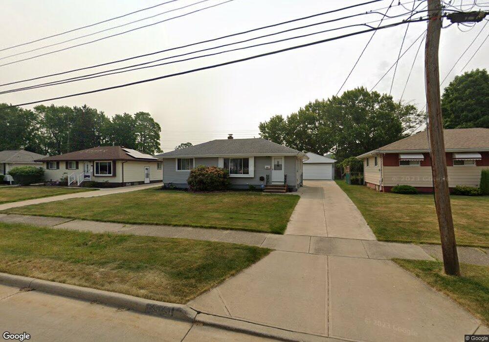
6441 Michael Dr Brookpark, OH 44142
Estimated Value: $200,000 - $222,000
3
Beds
2
Baths
960
Sq Ft
$220/Sq Ft
Est. Value
About This Home
This home is located at 6441 Michael Dr, Brookpark, OH 44142 and is currently estimated at $211,165, approximately $219 per square foot. 6441 Michael Dr is a home located in Cuyahoga County with nearby schools including Berea-Midpark Middle School, Berea-Midpark High School, and Huber Heights Preparatory Academy Parma Academy.
Ownership History
Date
Name
Owned For
Owner Type
Purchase Details
Closed on
Nov 3, 2005
Sold by
Tuckosh Linda M and Tuckosh Kenneth E
Bought by
Skvara Robert F
Current Estimated Value
Purchase Details
Closed on
Jul 7, 2005
Sold by
Tuckosh Linda M
Bought by
Skvara Robert F and Jelar Julie M
Purchase Details
Closed on
Aug 21, 1986
Sold by
Hector David A
Bought by
Skvara Robert F and Skvara Allerta
Purchase Details
Closed on
Jun 25, 1984
Sold by
Katherine E Mcnamara
Bought by
Hector David A
Purchase Details
Closed on
Nov 15, 1979
Sold by
Mcnamara Paul R and Mcnamara Katherine
Bought by
Katherine E Mcnamara
Purchase Details
Closed on
Jan 1, 1975
Bought by
Mcnamara Paul R and Mcnamara Katherine
Create a Home Valuation Report for This Property
The Home Valuation Report is an in-depth analysis detailing your home's value as well as a comparison with similar homes in the area
Home Values in the Area
Average Home Value in this Area
Purchase History
| Date | Buyer | Sale Price | Title Company |
|---|---|---|---|
| Skvara Robert F | -- | Attorney | |
| Skvara Robert F | -- | Attorney | |
| Skvara Robert F | $58,000 | -- | |
| Hector David A | $58,000 | -- | |
| Katherine E Mcnamara | -- | -- | |
| Mcnamara Paul R | -- | -- |
Source: Public Records
Tax History
| Year | Tax Paid | Tax Assessment Tax Assessment Total Assessment is a certain percentage of the fair market value that is determined by local assessors to be the total taxable value of land and additions on the property. | Land | Improvement |
|---|---|---|---|---|
| 2024 | $2,726 | $65,205 | $12,880 | $52,325 |
| 2023 | $2,527 | $50,720 | $10,750 | $39,970 |
| 2022 | $2,505 | $50,720 | $10,750 | $39,970 |
| 2021 | $2,487 | $50,720 | $10,750 | $39,970 |
| 2020 | $2,152 | $40,250 | $8,540 | $31,710 |
| 2019 | $2,088 | $115,000 | $24,400 | $90,600 |
| 2018 | $1,916 | $40,250 | $8,540 | $31,710 |
| 2017 | $1,898 | $35,320 | $7,600 | $27,720 |
| 2016 | $1,883 | $35,320 | $7,600 | $27,720 |
| 2015 | $1,767 | $35,320 | $7,600 | $27,720 |
| 2014 | $1,767 | $35,320 | $7,600 | $27,720 |
Source: Public Records
Map
Nearby Homes
- 14396 Park Dr
- 14398 Sheldon Rd
- 6386 Sandfield Dr
- 14801 Larkfield Dr
- 14761 Larkfield Dr
- 6330 Sandfield Dr
- 6377 Ledgebrook Dr
- 15424 Holland Rd
- 6330 Ledgebrook Dr
- 15496 Shaleside Ct
- 6095 Stark Dr
- 6707 Woodruff Ct
- 6759 Quarrystone Ln
- 6771 Wood Creek Dr
- 6103 Westbrook Dr
- 6749 Rockridge Ct
- 14024 Donald Dr
- 6815 Middlebrook Blvd
- 6453 Terre Dr
- 6871 Franke Rd
- 6433 Michael Dr
- 6447 Michael Dr
- 6425 Michael Dr
- 6453 Michael Dr
- 6459 Michael Dr
- 6417 Michael Dr
- 6444 Michael Dr
- 6438 Michael Dr
- 6430 Michael Dr
- 6409 Michael Dr
- 6465 Michael Dr
- 6422 Michael Dr
- 6450 Michael Dr
- 6405 Michael Dr
- 6471 Michael Dr
- 6456 Michael Dr
- 6394 Wolf Rd
- 15043 Montvale Dr
- 6462 Michael Dr
- 6408 Michael Dr
Your Personal Tour Guide
Ask me questions while you tour the home.