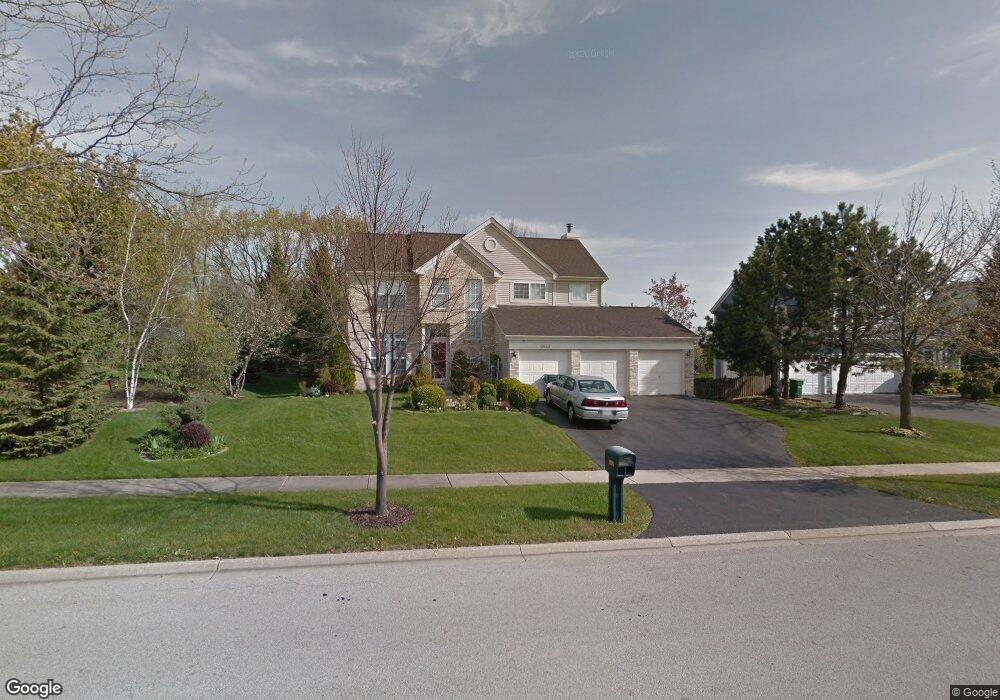
6442 Andover Dr Gurnee, IL 60031
Estimated Value: $456,317 - $486,000
4
Beds
3
Baths
2,254
Sq Ft
$209/Sq Ft
Est. Value
About This Home
This home is located at 6442 Andover Dr, Gurnee, IL 60031 and is currently estimated at $471,829, approximately $209 per square foot. 6442 Andover Dr is a home located in Lake County with nearby schools including Woodland Primary School, Woodland Elementary School, and Woodland Intermediate School.
Ownership History
Date
Name
Owned For
Owner Type
Purchase Details
Closed on
Sep 12, 1996
Sold by
The Northern Trust Company
Bought by
Chrzanowski Sylvester and Chrzanowski Irena
Current Estimated Value
Home Financials for this Owner
Home Financials are based on the most recent Mortgage that was taken out on this home.
Original Mortgage
$116,000
Interest Rate
8.26%
Create a Home Valuation Report for This Property
The Home Valuation Report is an in-depth analysis detailing your home's value as well as a comparison with similar homes in the area
Home Values in the Area
Average Home Value in this Area
Purchase History
| Date | Buyer | Sale Price | Title Company |
|---|---|---|---|
| Chrzanowski Sylvester | $237,500 | -- |
Source: Public Records
Mortgage History
| Date | Status | Borrower | Loan Amount |
|---|---|---|---|
| Previous Owner | Chrzanowski Sylvester | $116,000 |
Source: Public Records
Tax History
| Year | Tax Paid | Tax Assessment Tax Assessment Total Assessment is a certain percentage of the fair market value that is determined by local assessors to be the total taxable value of land and additions on the property. | Land | Improvement |
|---|---|---|---|---|
| 2024 | $10,106 | $137,090 | $20,145 | $116,945 |
| 2023 | $9,794 | $118,840 | $17,463 | $101,377 |
| 2022 | $9,794 | $111,475 | $17,471 | $94,004 |
| 2021 | $8,832 | $107,002 | $16,770 | $90,232 |
| 2020 | $8,534 | $104,372 | $16,358 | $88,014 |
| 2019 | $8,283 | $101,342 | $15,883 | $85,459 |
| 2018 | $8,705 | $102,226 | $19,586 | $82,640 |
| 2017 | $8,612 | $99,297 | $19,025 | $80,272 |
| 2016 | $8,543 | $94,876 | $18,178 | $76,698 |
| 2015 | $8,319 | $89,981 | $17,240 | $72,741 |
| 2014 | $7,696 | $84,238 | $17,106 | $67,132 |
| 2012 | $7,295 | $84,883 | $17,237 | $67,646 |
Source: Public Records
Map
Nearby Homes
- 33430 N Hunt Club Rd
- 6349 Braxton Ct
- 755 Darnell Ln
- 6167 Golfview Dr
- 920 Vose Dr Unit 304
- 920 Vose Dr Unit 106
- 6480 Doral Dr
- 6296 Doral Dr
- 758 Chandler Rd Unit U159
- 748 Chandler Rd
- 690 Chandler Rd Unit 302
- 650 Whitney Ct Unit 211
- 598 Dunham Rd Unit U297
- 727 Colby Ct Unit U57
- 17796 W Greentree Rd
- 705 Colby Ct Unit U78
- 1611 Burr Oak Dr
- 256 Hill n Dale Ct
- 17914 W Twin Lakes Blvd
- 33639 N Greentree Rd
- 6434 Andover Dr
- 6426 Andover Dr
- 6439 Andover Dr
- 6431 Andover Dr
- 17141 W Huntington Cir
- 6423 Andover Dr
- 17127 W Huntington Cir
- 6418 Andover Dr
- 17155 W Huntington Cir
- 17123 W Huntington Cir Unit 6
- 17169 W Huntington Cir
- 6415 Andover Dr
- 17109 W Huntington Cir
- 6410 Andover Dr
- 33175 N Hunt Club Rd
- 17179 W Huntington Cir
- 17091 W Huntington Cir
- 6407 Andover Dr
- 17582 W Huntington Cir
- 814 Halifax Rd
Your Personal Tour Guide
Ask me questions while you tour the home.