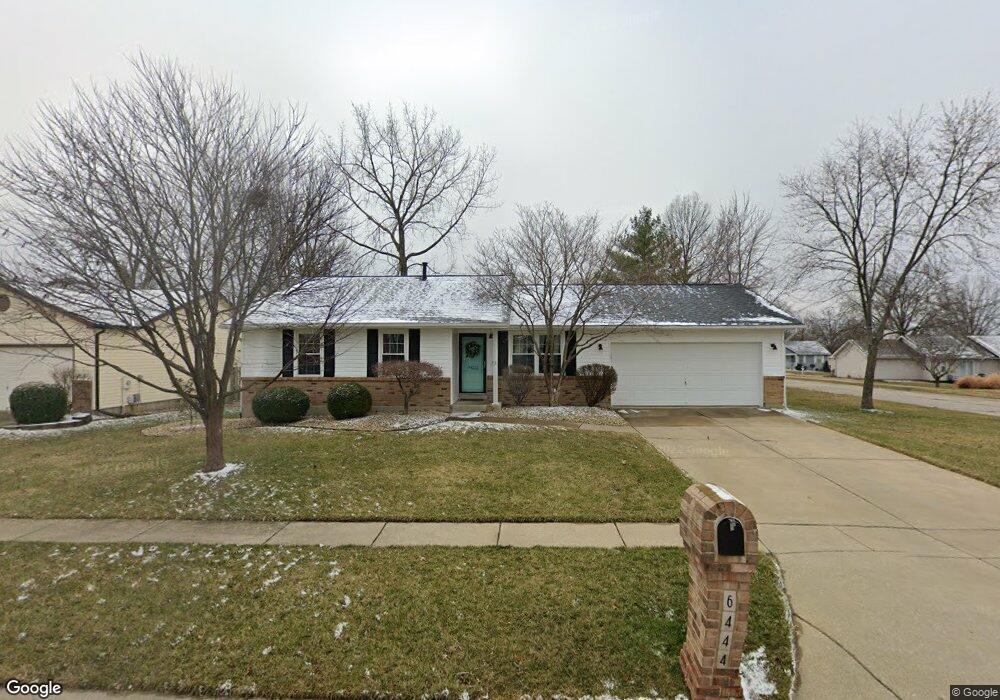
6444 High Meadow Dr O Fallon, MO 63368
Estimated Value: $289,257 - $339,000
3
Beds
2
Baths
1,057
Sq Ft
$294/Sq Ft
Est. Value
About This Home
This home is located at 6444 High Meadow Dr, O Fallon, MO 63368 and is currently estimated at $310,314, approximately $293 per square foot. 6444 High Meadow Dr is a home located in St. Charles County with nearby schools including Pheasant Point Elementary School, Fort Zumwalt South Middle School, and Fort Zumwalt South High School.
Ownership History
Date
Name
Owned For
Owner Type
Purchase Details
Closed on
May 28, 2003
Sold by
Gecas William G and Gecas June L
Bought by
Mathews Dustin L and Mathews Elizabeth A
Current Estimated Value
Home Financials for this Owner
Home Financials are based on the most recent Mortgage that was taken out on this home.
Original Mortgage
$107,400
Outstanding Balance
$46,910
Interest Rate
5.74%
Mortgage Type
Purchase Money Mortgage
Estimated Equity
$263,404
Create a Home Valuation Report for This Property
The Home Valuation Report is an in-depth analysis detailing your home's value as well as a comparison with similar homes in the area
Home Values in the Area
Average Home Value in this Area
Purchase History
| Date | Buyer | Sale Price | Title Company |
|---|---|---|---|
| Mathews Dustin L | $134,309 | -- |
Source: Public Records
Mortgage History
| Date | Status | Borrower | Loan Amount |
|---|---|---|---|
| Open | Mathews Dustin L | $107,400 | |
| Closed | Mathews Dustin L | $20,100 |
Source: Public Records
Tax History
| Year | Tax Paid | Tax Assessment Tax Assessment Total Assessment is a certain percentage of the fair market value that is determined by local assessors to be the total taxable value of land and additions on the property. | Land | Improvement |
|---|---|---|---|---|
| 2025 | $2,900 | $46,881 | -- | -- |
| 2023 | $2,903 | $43,888 | $0 | $0 |
| 2022 | $2,544 | $35,805 | $0 | $0 |
| 2021 | $2,550 | $35,805 | $0 | $0 |
| 2020 | $2,356 | $31,836 | $0 | $0 |
| 2019 | $2,361 | $31,836 | $0 | $0 |
| 2018 | $2,223 | $28,657 | $0 | $0 |
| 2017 | $2,182 | $28,657 | $0 | $0 |
| 2016 | $1,894 | $23,873 | $0 | $0 |
| 2015 | $1,765 | $23,873 | $0 | $0 |
| 2014 | $1,871 | $24,971 | $0 | $0 |
Source: Public Records
Map
Nearby Homes
- 6519 Star Buck Dr
- 703 Tinsley Ct
- 174 Christina Marie Dr
- 1343 Avondale Spring Dr
- 71 Harrisburg Ct
- 249 Dardenne Farms Dr
- 531 John Pitman Dr
- 112 Auburn Trace Pointe Ct
- 527 Auburn Trace Ln
- 206 Cherrywood Parc Dr
- 101 Winterbrooke Ct
- 180 Jacobs Way
- 103 Auburn Trace Point
- 2662 Breckenridge Cir
- 3 Royallbend Ct
- 367 Shamrock St
- 361 Shamrock St
- 2695 Highway K
- 1319 Commons Cir
- 425 Round Tower Dr W
- 6440 High Meadow Dr
- 6445 Sprucefield Dr
- 6441 Sprucefield Dr
- 3001 Long Wheat Dr
- 6436 High Meadow Dr
- 6443 High Meadow Dr
- 6447 High Meadow Dr
- 6439 High Meadow Dr
- 6437 Sprucefield Dr
- 6501 High Meadow Dr
- 6432 High Meadow Dr
- 6435 High Meadow Dr
- 6506 High Meadow Dr
- 6433 Sprucefield Dr
- 6505 Sprucefield Dr
- 6505 High Meadow Dr
- 3010 Long Wheat Dr
- 6446 Clover Farm Dr
- 6442 Clover Farm Dr
- 6431 High Meadow Dr
Your Personal Tour Guide
Ask me questions while you tour the home.