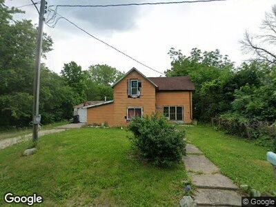
645 Maple St Lehigh, IA 50557
Estimated Value: $61,904 - $87,000
4
Beds
1
Bath
1,504
Sq Ft
$51/Sq Ft
Est. Value
About This Home
This home is located at 645 Maple St, Lehigh, IA 50557 and is currently estimated at $77,301, approximately $51 per square foot. 645 Maple St is a home located in Webster County with nearby schools including Dayton Center and Southeast Webster-Grand Southeast Valley Middle School.
Ownership History
Date
Name
Owned For
Owner Type
Purchase Details
Closed on
Aug 29, 2023
Sold by
Ferguson Stephanie L
Bought by
Hurtt Felicia
Current Estimated Value
Purchase Details
Closed on
Feb 12, 2021
Sold by
Ferguson Noah B K
Bought by
Ferguson Stephanie L
Purchase Details
Closed on
Jul 7, 2014
Sold by
Widen Twila and Trueblood Paul Eldon
Bought by
Widen Twila
Purchase Details
Closed on
Nov 1, 2013
Sold by
Seiser Patricia and Widen Twila
Bought by
Ferguson Noah B K and Ryder Stephanie
Create a Home Valuation Report for This Property
The Home Valuation Report is an in-depth analysis detailing your home's value as well as a comparison with similar homes in the area
Home Values in the Area
Average Home Value in this Area
Purchase History
| Date | Buyer | Sale Price | Title Company |
|---|---|---|---|
| Hurtt Felicia | -- | None Listed On Document | |
| Ferguson Stephanie L | -- | -- | |
| Ferguson Noah B K | $11,000 | None Available |
Source: Public Records
Mortgage History
| Date | Status | Borrower | Loan Amount |
|---|---|---|---|
| Previous Owner | Ferguson Noah B K | $16,000 |
Source: Public Records
Tax History Compared to Growth
Tax History
| Year | Tax Paid | Tax Assessment Tax Assessment Total Assessment is a certain percentage of the fair market value that is determined by local assessors to be the total taxable value of land and additions on the property. | Land | Improvement |
|---|---|---|---|---|
| 2024 | $6 | $43,270 | $2,250 | $41,020 |
| 2023 | $610 | $43,700 | $2,250 | $41,450 |
| 2022 | $634 | $38,210 | $2,250 | $35,960 |
| 2021 | $636 | $38,210 | $2,250 | $35,960 |
| 2020 | $636 | $35,010 | $2,250 | $32,760 |
| 2019 | $608 | $35,050 | $2,700 | $32,350 |
| 2018 | $616 | $31,860 | $2,450 | $29,410 |
| 2017 | $698 | $35,390 | $0 | $0 |
| 2016 | $718 | $35,390 | $0 | $0 |
| 2015 | $718 | $35,390 | $0 | $0 |
| 2014 | $742 | $35,390 | $0 | $0 |
Source: Public Records
Map
Nearby Homes
- 475 Bluff St
- 359 E Main St
- 0 Racine Ave
- 000 Racine Ave
- TBD Quail Ave
- 2586 310th St
- 3111 Taylor Ave
- 2823 280th St
- 2427 Woodmans Hollow Rd
- 502 3rd St NE
- 102 5th Ave NW
- 1914251008 Parcel Nos 1914251008 and 1914251003
- 24 4th Ave NE
- 301 2nd Ave NE
- 104 N Main St
- 2414 Poplar Ave
- 2141 320th St
- 3090 Stagecoach Rd
- 2417 240th St
- 308 3rd Ave SW
