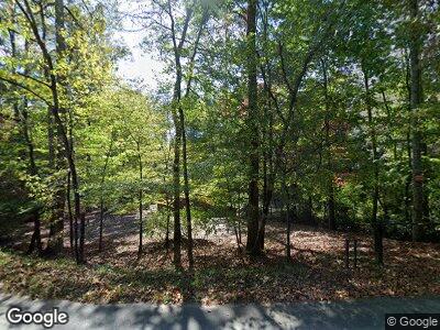
645 Rock Creek Rd Suches, GA 30572
Estimated Value: $364,000 - $737,000
--
Bed
1
Bath
984
Sq Ft
$545/Sq Ft
Est. Value
About This Home
This home is located at 645 Rock Creek Rd, Suches, GA 30572 and is currently estimated at $536,333, approximately $545 per square foot. 645 Rock Creek Rd is a home located in Fannin County with nearby schools including Fannin County High School.
Ownership History
Date
Name
Owned For
Owner Type
Purchase Details
Closed on
Jan 22, 2014
Sold by
Douglass Glinda F
Bought by
Cochran Christopher Chad
Current Estimated Value
Purchase Details
Closed on
Sep 30, 2013
Sold by
Douglass Craig K
Bought by
Douglass Glinda F and Douglass Christopher Chad E
Purchase Details
Closed on
Jun 27, 1997
Sold by
Mcgill Kevin B and Mcgill Ori
Bought by
Douglass Craig K
Purchase Details
Closed on
Mar 20, 1992
Bought by
Mcgill Kevin B and Mcgill Ori
Purchase Details
Closed on
Jul 31, 1989
Bought by
Lance Lamar and Lance Ray G
Create a Home Valuation Report for This Property
The Home Valuation Report is an in-depth analysis detailing your home's value as well as a comparison with similar homes in the area
Home Values in the Area
Average Home Value in this Area
Purchase History
| Date | Buyer | Sale Price | Title Company |
|---|---|---|---|
| Cochran Christopher Chad | -- | -- | |
| Douglass Glinda F | -- | -- | |
| Douglass Craig K | $86,500 | -- | |
| Mcgill Kevin B | $49,000 | -- | |
| Mcgill Kevin B | -- | -- | |
| Lance Lamar | -- | -- |
Source: Public Records
Tax History Compared to Growth
Tax History
| Year | Tax Paid | Tax Assessment Tax Assessment Total Assessment is a certain percentage of the fair market value that is determined by local assessors to be the total taxable value of land and additions on the property. | Land | Improvement |
|---|---|---|---|---|
| 2024 | $1,322 | $144,238 | $43,106 | $101,132 |
| 2023 | $1,192 | $116,931 | $37,800 | $79,130 |
| 2022 | $1,204 | $118,082 | $37,800 | $80,282 |
| 2021 | $978 | $69,727 | $36,076 | $33,651 |
| 2020 | $994 | $69,727 | $36,076 | $33,651 |
| 2019 | $875 | $60,223 | $36,076 | $24,147 |
| 2018 | $964 | $62,545 | $38,398 | $24,147 |
| 2017 | $1,107 | $62,587 | $38,132 | $24,455 |
| 2016 | $824 | $48,513 | $26,195 | $22,318 |
| 2015 | $866 | $48,815 | $26,195 | $22,620 |
| 2014 | $1,220 | $68,581 | $43,106 | $25,475 |
| 2013 | -- | $58,248 | $43,106 | $15,142 |
Source: Public Records
Map
Nearby Homes
- 46 Rivers End Way
- 130 Rivers End Trail
- Lt 56,57 Hemlock Dr
- 184 River Forest Place
- 184 River Forest Place Unit B
- 33 Spruce Dr
- 133 Hemlock Dr
- 540 White Pine Trail
- 346 Woodeye Cir
- Lot 22 Woodeye Cir
- 787 White Pine Trail
- 24481 Morganton Hwy
- 24444 Morganton Hwy
- 24376 Morganton Hwy
- 0 Coopers Creek Rd Unit 10360775
- 0 Old Rock Creek Rd Unit 7531196
- 0 Old Rock Creek Rd
- 0 Old Rock Creek Rd Unit 326602
- 28452 Morganton Hwy
- 47 Downy Rd
- 645 Rock Creek Rd
- 620 Rock Creek Rd
- 620 Rock Creek Rd Unit 5
- 40 Rivers End Trail
- 40 Rivers End Trail
- 119 White Pine Trail
- 546 Rock Creek Rd
- 68 Deer Ln
- 64 White Pine Trail
- 97 Nellies Big Fish Rd
- LT2 Rivers End Trail
- 0 Rivers End Trail Unit 134355
- 0 Rivers End Trail Unit LOT 4 9029136
- LOT 4 Rivers End Trail
- 0 Rivers End Trail Unit Lot 5 8586130
- 0 Rivers End Trail Unit Lot 5 8826687
- 0 Rivers End Trail Unit 6756446
- 0 Rivers End Trail Unit 8826737
- 0 Rivers End Trail Unit 6701394
- 0 Rivers End Trail Unit Lot 5 8760159
