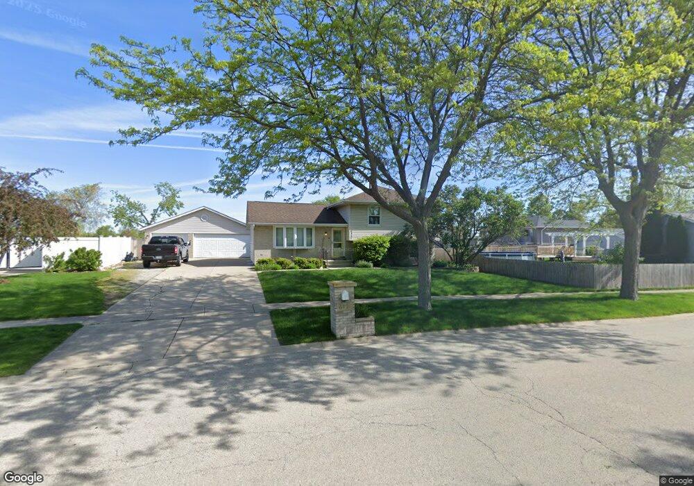
6451 Langsford Ln Plainfield, IL 60586
Fall Creek NeighborhoodEstimated Value: $332,961 - $354,000
--
Bed
--
Bath
1,792
Sq Ft
$192/Sq Ft
Est. Value
About This Home
This home is located at 6451 Langsford Ln, Plainfield, IL 60586 and is currently estimated at $343,490, approximately $191 per square foot. 6451 Langsford Ln is a home located in Will County with nearby schools including Meadow View Elementary School, Aux Sable Middle School, and Plainfield South High School.
Ownership History
Date
Name
Owned For
Owner Type
Purchase Details
Closed on
Jul 12, 2001
Sold by
Smith Stephen J and Smith Gail A
Bought by
Brill Michael R and Brill Diane
Current Estimated Value
Home Financials for this Owner
Home Financials are based on the most recent Mortgage that was taken out on this home.
Original Mortgage
$163,922
Outstanding Balance
$63,263
Interest Rate
7.16%
Mortgage Type
FHA
Estimated Equity
$280,227
Purchase Details
Closed on
Dec 1, 1995
Sold by
First National Bank Of Joliet
Bought by
Stefanich Daniel S and Stefanich Michelle L
Home Financials for this Owner
Home Financials are based on the most recent Mortgage that was taken out on this home.
Original Mortgage
$118,350
Interest Rate
7.19%
Mortgage Type
FHA
Create a Home Valuation Report for This Property
The Home Valuation Report is an in-depth analysis detailing your home's value as well as a comparison with similar homes in the area
Home Values in the Area
Average Home Value in this Area
Purchase History
| Date | Buyer | Sale Price | Title Company |
|---|---|---|---|
| Brill Michael R | $179,000 | First American Title | |
| Stefanich Daniel S | $128,000 | -- |
Source: Public Records
Mortgage History
| Date | Status | Borrower | Loan Amount |
|---|---|---|---|
| Open | Brill Michael R | $163,922 | |
| Previous Owner | Stefanich Daniel S | $118,350 |
Source: Public Records
Tax History Compared to Growth
Tax History
| Year | Tax Paid | Tax Assessment Tax Assessment Total Assessment is a certain percentage of the fair market value that is determined by local assessors to be the total taxable value of land and additions on the property. | Land | Improvement |
|---|---|---|---|---|
| 2024 | $6,602 | $100,188 | $21,940 | $78,248 |
| 2023 | $6,602 | $90,488 | $19,816 | $70,672 |
| 2022 | $5,911 | $81,270 | $17,797 | $63,473 |
| 2021 | $5,373 | $73,129 | $16,633 | $56,496 |
| 2020 | $5,289 | $71,054 | $16,161 | $54,893 |
| 2019 | $5,099 | $67,703 | $15,399 | $52,304 |
| 2018 | $4,874 | $63,611 | $14,469 | $49,142 |
| 2017 | $4,723 | $60,450 | $13,750 | $46,700 |
| 2016 | $4,622 | $57,654 | $13,114 | $44,540 |
| 2015 | $4,300 | $54,009 | $12,285 | $41,724 |
| 2014 | $4,300 | $52,102 | $11,851 | $40,251 |
| 2013 | $4,300 | $52,102 | $11,851 | $40,251 |
Source: Public Records
Map
Nearby Homes
- 2617 Ruth Fitzgerald Dr Unit 7
- 6517 Langsford Ln
- 3007 Art Schultz Dr
- 0001 S State Route 59
- 0002 S State Route 59
- 25602 W Cerena Cir
- 6507 Goldhaber Ln Unit 15
- 25424 W Ashton Dr
- 6615 Bazz Dr
- 6610 Leupold Ln Unit 12
- 6304 Southridge Dr
- 25415 Rock Dr
- 16514 S Mueller Cir
- 25110 W Catherine Dr Unit 1
- BELLAMY Plan at Ashford Place
- COVENTRY Plan at Ashford Place
- HENLEY Plan at Ashford Place
- HOLCOMBE Plan at Ashford Place
- HAVEN Plan at Ashford Place
- 25405 Rock Dr
- 6453 Langsford Ln
- 2713 Frank Turk Dr
- 6449 Langsford Ln
- 2715 Frank Turk Dr
- 2710 Ruth Fitzgerald Dr
- 6452 Langsford Ln
- 2707 Frank Turk Dr
- 2717 Frank Turk Dr
- 2706 Ruth Fitzgerald Dr Unit 8A
- 2803 Frank Turk Dr
- 2712 Ruth Fitzgerald Dr Unit 8A
- 2705 Frank Turk Dr
- 6445 Langsford Ln
- 2704 Ruth Fitzgerald Dr
- 2714 Ruth Fitzgerald Dr Unit 8B
- 2716 Frank Turk Dr
- 2798 Lektorich Ln
- 2805 Frank Turk Dr
- 2703 Frank Turk Dr
- 2708 Frank Turk Dr