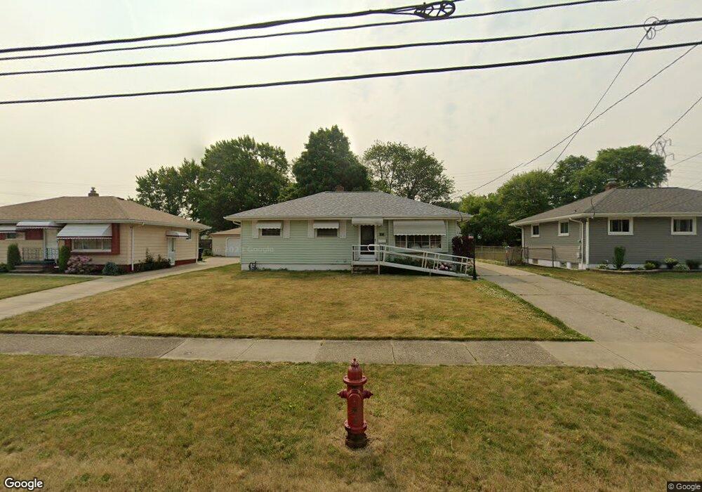
6453 Michael Dr Brookpark, OH 44142
Estimated Value: $203,862 - $223,000
3
Beds
2
Baths
1,254
Sq Ft
$173/Sq Ft
Est. Value
About This Home
This home is located at 6453 Michael Dr, Brookpark, OH 44142 and is currently estimated at $217,216, approximately $173 per square foot. 6453 Michael Dr is a home located in Cuyahoga County with nearby schools including Berea-Midpark Middle School, Berea-Midpark High School, and Huber Heights Preparatory Academy Parma Academy.
Ownership History
Date
Name
Owned For
Owner Type
Purchase Details
Closed on
Apr 13, 2010
Sold by
Curiale Ann E and Curiale Anne
Bought by
Lindquist Erik M
Current Estimated Value
Home Financials for this Owner
Home Financials are based on the most recent Mortgage that was taken out on this home.
Original Mortgage
$103,683
Outstanding Balance
$69,140
Interest Rate
5.5%
Mortgage Type
FHA
Estimated Equity
$148,076
Purchase Details
Closed on
Oct 13, 1992
Sold by
Curiale Anthony and Curiale Ann
Bought by
Curiale Ann E
Purchase Details
Closed on
Jan 1, 1975
Bought by
Curiale Anthony and Curiale Ann
Create a Home Valuation Report for This Property
The Home Valuation Report is an in-depth analysis detailing your home's value as well as a comparison with similar homes in the area
Home Values in the Area
Average Home Value in this Area
Purchase History
| Date | Buyer | Sale Price | Title Company |
|---|---|---|---|
| Lindquist Erik M | $111,900 | Land Title Group | |
| Curiale Ann E | -- | -- | |
| Curiale Anthony | -- | -- |
Source: Public Records
Mortgage History
| Date | Status | Borrower | Loan Amount |
|---|---|---|---|
| Open | Lindquist Erik M | $103,683 |
Source: Public Records
Tax History
| Year | Tax Paid | Tax Assessment Tax Assessment Total Assessment is a certain percentage of the fair market value that is determined by local assessors to be the total taxable value of land and additions on the property. | Land | Improvement |
|---|---|---|---|---|
| 2024 | $3,738 | $60,095 | $12,880 | $47,215 |
| 2023 | $2,968 | $48,730 | $10,750 | $37,980 |
| 2022 | $2,947 | $48,720 | $10,750 | $37,980 |
| 2021 | $2,930 | $48,720 | $10,750 | $37,980 |
| 2020 | $2,642 | $38,680 | $8,540 | $30,140 |
| 2019 | $2,563 | $110,500 | $24,400 | $86,100 |
| 2018 | $2,425 | $38,680 | $8,540 | $30,140 |
| 2017 | $2,489 | $34,830 | $7,600 | $27,230 |
| 2016 | $2,468 | $34,830 | $7,600 | $27,230 |
| 2015 | $2,316 | $34,830 | $7,600 | $27,230 |
| 2014 | $2,316 | $34,830 | $7,600 | $27,230 |
Source: Public Records
Map
Nearby Homes
- 14396 Park Dr
- 6386 Sandfield Dr
- 6377 Ledgebrook Dr
- 6330 Sandfield Dr
- 14801 Larkfield Dr
- 14761 Larkfield Dr
- 6330 Ledgebrook Dr
- 15496 Shaleside Ct
- 6448 Delores Blvd
- 6707 Woodruff Ct
- 6759 Quarrystone Ln
- 6749 Rockridge Ct
- 6771 Wood Creek Dr
- 6815 Middlebrook Blvd
- 6095 Stark Dr
- 6103 Westbrook Dr
- 6871 Franke Rd
- 14024 Donald Dr
- 6188 Barbara Ln
- 6453 Terre Dr
- 6459 Michael Dr
- 6447 Michael Dr
- 6441 Michael Dr
- 6465 Michael Dr
- 6433 Michael Dr
- 6471 Michael Dr
- 6444 Michael Dr
- 6425 Michael Dr
- 6479 Michael Dr
- 6438 Michael Dr
- 6456 Michael Dr
- 6450 Michael Dr
- 6462 Michael Dr
- 6394 Wolf Rd
- 6470 Michael Dr
- 6430 Michael Dr
- 6402 Wolf Rd
- 6487 Michael Dr
- 6417 Michael Dr
- 6412 Wolf Rd
Your Personal Tour Guide
Ask me questions while you tour the home.