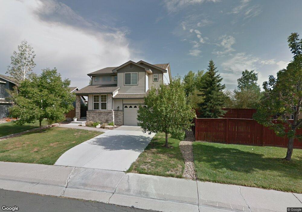
6454 S Wright St Littleton, CO 80127
Summit Ridge at West Meadows NeighborhoodEstimated Value: $732,000 - $800,000
3
Beds
3
Baths
3,222
Sq Ft
$235/Sq Ft
Est. Value
About This Home
This home is located at 6454 S Wright St, Littleton, CO 80127 and is currently estimated at $756,018, approximately $234 per square foot. 6454 S Wright St is a home located in Jefferson County with nearby schools including Powderhorn Elementary School, Summit Ridge Middle School, and Dakota Ridge Senior High School.
Ownership History
Date
Name
Owned For
Owner Type
Purchase Details
Closed on
Oct 16, 2009
Sold by
Cunningham Todd Michael and Cunningham Margaret Ann
Bought by
Moore Michael D and Moore Maureen P
Current Estimated Value
Home Financials for this Owner
Home Financials are based on the most recent Mortgage that was taken out on this home.
Original Mortgage
$310,337
Outstanding Balance
$197,862
Interest Rate
5.1%
Mortgage Type
FHA
Estimated Equity
$558,156
Create a Home Valuation Report for This Property
The Home Valuation Report is an in-depth analysis detailing your home's value as well as a comparison with similar homes in the area
Home Values in the Area
Average Home Value in this Area
Purchase History
| Date | Buyer | Sale Price | Title Company |
|---|---|---|---|
| Moore Michael D | $328,000 | None Available |
Source: Public Records
Mortgage History
| Date | Status | Borrower | Loan Amount |
|---|---|---|---|
| Open | Moore Michael D | $310,337 |
Source: Public Records
Tax History
| Year | Tax Paid | Tax Assessment Tax Assessment Total Assessment is a certain percentage of the fair market value that is determined by local assessors to be the total taxable value of land and additions on the property. | Land | Improvement |
|---|---|---|---|---|
| 2025 | $5,294 | $48,681 | $11,960 | $36,721 |
| 2024 | $4,516 | $44,083 | $11,845 | $32,238 |
| 2023 | $4,516 | $44,083 | $11,845 | $32,238 |
| 2022 | $3,994 | $38,311 | $10,440 | $27,871 |
| 2021 | $4,048 | $39,413 | $10,740 | $28,673 |
| 2020 | $3,554 | $34,684 | $8,300 | $26,384 |
| 2019 | $3,512 | $34,684 | $8,300 | $26,384 |
| 2018 | $3,343 | $31,935 | $7,932 | $24,003 |
| 2017 | $3,064 | $31,935 | $7,932 | $24,003 |
| 2016 | $3,186 | $32,096 | $8,733 | $23,363 |
| 2015 | $2,962 | $32,096 | $8,733 | $23,363 |
| 2014 | $2,962 | $28,059 | $7,642 | $20,417 |
Source: Public Records
Map
Nearby Homes
- 6527 S Xenon St
- 12826 W Brittany Dr
- 12713 W Bowles Place
- 12138 W Brittany Ave
- 5948 S Van Gordon St
- 5915 S Union St
- 12851 W Roxbury Place
- 11456 W Cooper Place
- 11826 W Bowles Cir
- 11632 W Lake Ave
- 7125 S Youngfield Way
- 5818 S Urban Way
- 5884 S Taft Ct Unit G
- 5864 S Taft Ct
- 11246 W Coal Mine Dr
- 11445 W Maplewood Ave
- 5813 S Taft Way
- 7195 S Youngfield Way
- 12699 W Dorado Place
- 11411 W Lake Dr
- 6444 S Wright St
- 6443 S Xenon Ct
- 6423 S Xenon Ct
- 6434 S Wright St
- 6420 S Wright St
- 6435 S Wright St
- 6455 S Wright St
- 6403 S Xenon Ct
- 6425 S Wright St
- 6465 S Wright St
- 6414 S Wright St
- 6415 S Wright St
- 6442 S Xenon Ct
- 6402 S Xenon Ct
- 6471 S Wright St
- 6422 S Xenon Ct
- 6490 S Xenon St
- 6485 S Wright St
- 6450 S Youngfield Ct
- 6401 S Wright St
Your Personal Tour Guide
Ask me questions while you tour the home.