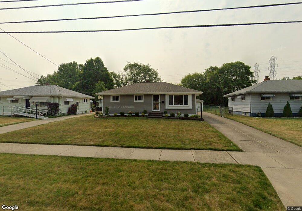
6459 Michael Dr Brookpark, OH 44142
Estimated Value: $190,000 - $219,000
3
Beds
1
Bath
988
Sq Ft
$207/Sq Ft
Est. Value
About This Home
This home is located at 6459 Michael Dr, Brookpark, OH 44142 and is currently estimated at $204,190, approximately $206 per square foot. 6459 Michael Dr is a home located in Cuyahoga County with nearby schools including Berea-Midpark Middle School, Berea-Midpark High School, and Huber Heights Preparatory Academy Parma Academy.
Ownership History
Date
Name
Owned For
Owner Type
Purchase Details
Closed on
Nov 22, 2011
Sold by
Ramsey Roy J and Ramsey Jacalyn Donavan
Bought by
Ramsey Jason R
Current Estimated Value
Home Financials for this Owner
Home Financials are based on the most recent Mortgage that was taken out on this home.
Original Mortgage
$88,000
Outstanding Balance
$60,006
Interest Rate
4.4%
Mortgage Type
FHA
Estimated Equity
$144,184
Purchase Details
Closed on
Sep 13, 1999
Sold by
Ramsey Kathleen M and Ramsey Roy J
Bought by
Ramsey Roy J
Purchase Details
Closed on
Mar 30, 1985
Sold by
Ramsey Kathleen M
Bought by
Ramsey Roy J
Purchase Details
Closed on
Dec 28, 1983
Sold by
Cunningham Raymond and Cunningham Dolores
Bought by
Ramsey Kathleen M
Purchase Details
Closed on
Jan 1, 1975
Bought by
Cunningham Raymond and Cunningham Dolores
Create a Home Valuation Report for This Property
The Home Valuation Report is an in-depth analysis detailing your home's value as well as a comparison with similar homes in the area
Home Values in the Area
Average Home Value in this Area
Purchase History
| Date | Buyer | Sale Price | Title Company |
|---|---|---|---|
| Ramsey Jason R | $105,000 | Patriot | |
| Ramsey Roy J | -- | -- | |
| Ramsey Roy J | -- | -- | |
| Ramsey Kathleen M | $59,000 | -- | |
| Cunningham Raymond | -- | -- |
Source: Public Records
Mortgage History
| Date | Status | Borrower | Loan Amount |
|---|---|---|---|
| Open | Ramsey Jason R | $88,000 |
Source: Public Records
Tax History
| Year | Tax Paid | Tax Assessment Tax Assessment Total Assessment is a certain percentage of the fair market value that is determined by local assessors to be the total taxable value of land and additions on the property. | Land | Improvement |
|---|---|---|---|---|
| 2025 | $3,106 | $61,950 | $12,880 | $49,070 |
| 2024 | $3,124 | $61,950 | $12,880 | $49,070 |
| 2023 | $2,977 | $48,870 | $10,750 | $38,120 |
| 2022 | $2,956 | $48,860 | $10,750 | $38,120 |
| 2021 | $2,938 | $48,860 | $10,750 | $38,120 |
| 2020 | $2,649 | $38,780 | $8,540 | $30,240 |
| 2019 | $2,570 | $110,800 | $24,400 | $86,400 |
| 2018 | $2,448 | $38,780 | $8,540 | $30,240 |
| 2017 | $2,532 | $35,430 | $7,600 | $27,830 |
| 2016 | $2,511 | $35,430 | $7,600 | $27,830 |
| 2015 | $2,356 | $35,430 | $7,600 | $27,830 |
| 2014 | $2,356 | $35,430 | $7,600 | $27,830 |
Source: Public Records
Map
Nearby Homes
- 14396 Park Dr
- 6386 Sandfield Dr
- 6377 Ledgebrook Dr
- 6330 Sandfield Dr
- 14801 Larkfield Dr
- 6330 Ledgebrook Dr
- 14761 Larkfield Dr
- 6757 Smith Rd
- 15496 Shaleside Ct
- 6448 Delores Blvd
- 6707 Woodruff Ct
- 6759 Quarrystone Ln
- 6771 Wood Creek Dr
- 6095 Stark Dr
- 6065 Mercer Dr
- 6871 Franke Rd
- 6103 Westbrook Dr
- 6188 Barbara Ln
- 14024 Donald Dr
- 6453 Terre Dr
- 6453 Michael Dr
- 6465 Michael Dr
- 6447 Michael Dr
- 6471 Michael Dr
- 6441 Michael Dr
- 6479 Michael Dr
- 6433 Michael Dr
- 6487 Michael Dr
- 6444 Michael Dr
- 6462 Michael Dr
- 6456 Michael Dr
- 6470 Michael Dr
- 6450 Michael Dr
- 6484 Michael Dr
- 6402 Wolf Rd
- 6394 Wolf Rd
- 6438 Michael Dr
- 6412 Wolf Rd
- 6425 Michael Dr
- 6495 Michael Dr
Your Personal Tour Guide
Ask me questions while you tour the home.