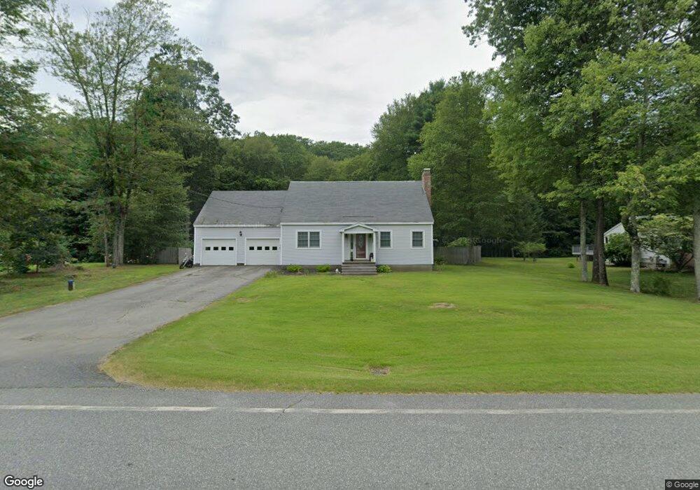
646 Mt Hermon Station Rd Northfield, MA 01360
Estimated Value: $363,549 - $399,000
3
Beds
2
Baths
1,814
Sq Ft
$214/Sq Ft
Est. Value
About This Home
This home is located at 646 Mt Hermon Station Rd, Northfield, MA 01360 and is currently estimated at $388,637, approximately $214 per square foot. 646 Mt Hermon Station Rd is a home located in Franklin County with nearby schools including Pioneer Valley Regional and Full Circle School.
Ownership History
Date
Name
Owned For
Owner Type
Purchase Details
Closed on
Mar 18, 2005
Sold by
Burdick Lawrence R and Burdick Samantha R
Bought by
Chiaputti Daniel
Current Estimated Value
Home Financials for this Owner
Home Financials are based on the most recent Mortgage that was taken out on this home.
Original Mortgage
$63,000
Outstanding Balance
$32,003
Interest Rate
5.64%
Mortgage Type
Purchase Money Mortgage
Estimated Equity
$356,634
Create a Home Valuation Report for This Property
The Home Valuation Report is an in-depth analysis detailing your home's value as well as a comparison with similar homes in the area
Home Values in the Area
Average Home Value in this Area
Purchase History
| Date | Buyer | Sale Price | Title Company |
|---|---|---|---|
| Chiaputti Daniel | $135,000 | -- |
Source: Public Records
Mortgage History
| Date | Status | Borrower | Loan Amount |
|---|---|---|---|
| Open | Chiaputti Daniel | $63,000 |
Source: Public Records
Tax History Compared to Growth
Tax History
| Year | Tax Paid | Tax Assessment Tax Assessment Total Assessment is a certain percentage of the fair market value that is determined by local assessors to be the total taxable value of land and additions on the property. | Land | Improvement |
|---|---|---|---|---|
| 2025 | $4,576 | $330,600 | $48,600 | $282,000 |
| 2024 | $4,367 | $321,600 | $45,900 | $275,700 |
| 2023 | $3,937 | $289,900 | $45,500 | $244,400 |
| 2022 | $3,522 | $254,300 | $45,500 | $208,800 |
| 2021 | $3,774 | $234,100 | $43,100 | $191,000 |
| 2020 | $3,724 | $224,200 | $41,200 | $183,000 |
| 2019 | $3,713 | $213,400 | $39,200 | $174,200 |
| 2018 | $3,742 | $209,500 | $39,200 | $170,300 |
| 2017 | $3,446 | $209,500 | $39,200 | $170,300 |
| 2016 | $3,329 | $209,500 | $39,200 | $170,300 |
| 2015 | $3,531 | $212,100 | $39,200 | $172,900 |
Source: Public Records
Map
Nearby Homes
- 719 Mount Hermon Station Rd
- 181 Main St
- 14 Wood Way
- 94 Main St
- 12 Parker Ave Unit 1
- 49 Whitetail Dr
- 294 Capt Beers Plain Rd
- 22 Old Turnpike Rd
- 801 Newton Rd
- 339 Burt Hill Rd
- 430 Huckle Hill Rd
- 430 Hucklehill Rd
- Lot 18 Central Park Estates
- Lot 14 Central Park Estates
- Lot 15 Central Park Estates
- Lot 12 Central Park Estates
- 0 Old Tipping Rock Rd Unit 34
- 406 Back Ashuelot Rd
- 180 Bald Mountain Rd
- 0 Huckle Hill Rd Unit 5059719
- 644 Mt Hermon Station Rd
- 656 Mt Hermon Station Rd
- 651 Mount Hermon Station Rd
- 651 Mt Hermon Station Rd
- 664 Mt Hermon Station Rd
- 636 Mt Hermon Station Rd
- 659 Mt Hermon Station Rd
- 637 Mt Hermon Station Rd
- 639 Mt Hermon Station Rd
- 668 Mt Hermon Station Rd
- 663 Mt Hermon Station Rd
- 629 Mt Hermon Station Rd
- 676 Mt Hermon Station Rd
- 671 Mt Hermon Station Rd
- 620 Mt Hermon Station Rd
- 667 Mt Hermon Station Rd
- 602 Mt Hermon Station Rd
- 692 Mt Hermon Station Rd
- 692 Mt Hermon Station Rd
- 601A Mt Hermon Station Rd