Estimated Value: $90,000 - $182,000
--
Bed
--
Bath
1,114
Sq Ft
$120/Sq Ft
Est. Value
About This Home
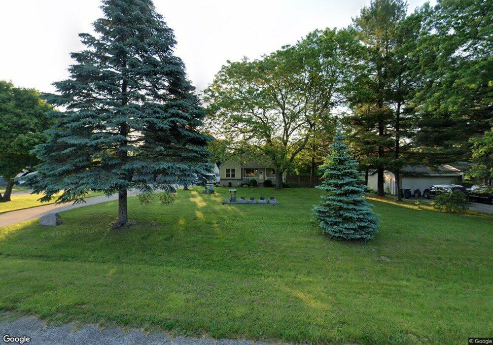
This home is located at 6460 Bray Rd, Flint, MI 48505 and is currently estimated at $133,204, approximately $119 per square foot. 6460 Bray Rd is a home located in Genesee County with nearby schools including Weston Elementary School, Leota Fiedler Elementary School, and Kate Dowdall Elementary School.
Ownership History
Date
Name
Owned For
Owner Type
Purchase Details
Closed on
May 14, 2024
Sold by
Hescott John D
Bought by
Hescott John D and Hescott Benjamin J
Current Estimated Value
Purchase Details
Closed on
Jan 11, 2021
Sold by
Hescott Patsy C
Bought by
Hescott John D
Purchase Details
Closed on
Jul 13, 2017
Sold by
Hescott John D
Bought by
Hescott John D and Hescott Patsy C
Purchase Details
Closed on
Mar 13, 2008
Sold by
Hescott John D
Bought by
Hescott John D and Hescott Patsy C
Purchase Details
Closed on
Dec 7, 2001
Sold by
Goddell Diane J and Estate Of Eva B Michelson
Bought by
Hescott John D
Home Financials for this Owner
Home Financials are based on the most recent Mortgage that was taken out on this home.
Original Mortgage
$84,255
Interest Rate
6.52%
Mortgage Type
VA
Create a Home Valuation Report for This Property
The Home Valuation Report is an in-depth analysis detailing your home's value as well as a comparison with similar homes in the area
Home Values in the Area
Average Home Value in this Area
Purchase History
| Date | Buyer | Sale Price | Title Company |
|---|---|---|---|
| Hescott John D | -- | None Listed On Document | |
| Hescott John D | -- | None Available | |
| Hescott John D | -- | Cislo Title Co | |
| Hescott John D | -- | Cislo Title Company | |
| Hescott John D | $82,000 | Greco Title |
Source: Public Records
Mortgage History
| Date | Status | Borrower | Loan Amount |
|---|---|---|---|
| Previous Owner | Hescott John D | $84,255 |
Source: Public Records
Tax History Compared to Growth
Tax History
| Year | Tax Paid | Tax Assessment Tax Assessment Total Assessment is a certain percentage of the fair market value that is determined by local assessors to be the total taxable value of land and additions on the property. | Land | Improvement |
|---|---|---|---|---|
| 2025 | $2,227 | $60,600 | $0 | $0 |
| 2024 | $426 | $58,000 | $0 | $0 |
| 2023 | $406 | $52,500 | $0 | $0 |
| 2022 | $1,712 | $44,700 | $0 | $0 |
| 2021 | $1,702 | $38,200 | $0 | $0 |
| 2020 | $340 | $34,500 | $0 | $0 |
| 2019 | $335 | $32,300 | $0 | $0 |
| 2018 | $2,109 | $31,900 | $0 | $0 |
| 2017 | $1,572 | $31,700 | $0 | $0 |
| 2016 | $2,039 | $29,900 | $0 | $0 |
| 2015 | $1,415 | $28,400 | $0 | $0 |
| 2014 | $309 | $27,000 | $0 | $0 |
| 2012 | -- | $26,200 | $26,200 | $0 |
Source: Public Records
Map
Nearby Homes
- 7164 N Bray Rd
- 2135 E Coldwater Rd
- 0 E Stanley Rd Unit 50168578
- 0 E Stanley Rd Unit 50134069
- 7306 N Bray Rd
- 6463 N Dort Hwy
- 7010 Lewis Rd
- 6086 Lewis Rd
- 1404 E Kurtz Ave
- 5462 Harry St
- 7047 Birchwood Dr
- 1463 Ida Ct
- 7 Clydesdale St
- 59 Clydesdale St
- 1133 Dunkirk Ave
- 1145 Laport Ave
- 1134 Dowagiac Ave
- 737 Walton Rd
- 1116 Morris Hills Pkwy
- 4045 E Mount Morris Rd