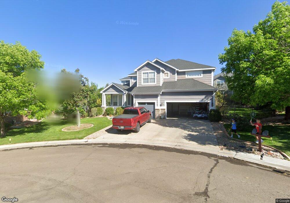
6461 S Quemoy Way Aurora, CO 80016
Saddle Rock NeighborhoodEstimated Value: $825,353 - $927,000
4
Beds
4
Baths
5,310
Sq Ft
$167/Sq Ft
Est. Value
About This Home
This home is located at 6461 S Quemoy Way, Aurora, CO 80016 and is currently estimated at $884,838, approximately $166 per square foot. 6461 S Quemoy Way is a home located in Arapahoe County with nearby schools including Creekside Elementary School, Liberty Middle School, and Grandview High School.
Ownership History
Date
Name
Owned For
Owner Type
Purchase Details
Closed on
Apr 10, 2015
Sold by
Anderson Traci and Salmans Scott
Bought by
Nelson Thomas Dean and Nelson Elizabeth Ashley
Current Estimated Value
Home Financials for this Owner
Home Financials are based on the most recent Mortgage that was taken out on this home.
Original Mortgage
$384,000
Outstanding Balance
$296,468
Interest Rate
3.82%
Mortgage Type
New Conventional
Estimated Equity
$588,370
Purchase Details
Closed on
Jul 26, 2011
Sold by
Gimbel Brian M
Bought by
Anderson Traci and Salmans Scott
Home Financials for this Owner
Home Financials are based on the most recent Mortgage that was taken out on this home.
Original Mortgage
$409,353
Interest Rate
4.5%
Mortgage Type
FHA
Purchase Details
Closed on
Sep 27, 2007
Sold by
Deutsche Bank National Trust Co
Bought by
Gimbel Brian M
Home Financials for this Owner
Home Financials are based on the most recent Mortgage that was taken out on this home.
Original Mortgage
$368,900
Interest Rate
6.66%
Mortgage Type
Purchase Money Mortgage
Purchase Details
Closed on
Jul 31, 2006
Sold by
Dickson Michael D and Dickson Valerie J
Bought by
Kira Ahmed
Home Financials for this Owner
Home Financials are based on the most recent Mortgage that was taken out on this home.
Original Mortgage
$470,000
Interest Rate
8.75%
Mortgage Type
Purchase Money Mortgage
Purchase Details
Closed on
May 29, 2001
Sold by
U S Home Corp
Bought by
Dickson Michael D and Dickson Valerie J
Home Financials for this Owner
Home Financials are based on the most recent Mortgage that was taken out on this home.
Original Mortgage
$309,300
Interest Rate
7.07%
Create a Home Valuation Report for This Property
The Home Valuation Report is an in-depth analysis detailing your home's value as well as a comparison with similar homes in the area
Home Values in the Area
Average Home Value in this Area
Purchase History
| Date | Buyer | Sale Price | Title Company |
|---|---|---|---|
| Nelson Thomas Dean | $480,000 | First American Title Ins Co | |
| Anderson Traci | $42,000 | Land Title Guarantee Company | |
| Gimbel Brian M | $409,900 | Empire Title | |
| Kira Ahmed | $470,000 | Land Title Guarantee Company | |
| Dickson Michael D | $387,970 | Stewart Title |
Source: Public Records
Mortgage History
| Date | Status | Borrower | Loan Amount |
|---|---|---|---|
| Open | Nelson Thomas Dean | $384,000 | |
| Previous Owner | Anderson Traci | $409,353 | |
| Previous Owner | Gimbel Brian M | $368,900 | |
| Previous Owner | Kira Ahmed | $470,000 | |
| Previous Owner | Dickson Michael D | $309,300 |
Source: Public Records
Tax History Compared to Growth
Tax History
| Year | Tax Paid | Tax Assessment Tax Assessment Total Assessment is a certain percentage of the fair market value that is determined by local assessors to be the total taxable value of land and additions on the property. | Land | Improvement |
|---|---|---|---|---|
| 2024 | $5,612 | $49,098 | -- | -- |
| 2023 | $4,881 | $49,098 | $0 | $0 |
| 2022 | $4,881 | $38,476 | $0 | $0 |
| 2021 | $4,879 | $38,476 | $0 | $0 |
| 2020 | $5,281 | $42,164 | $0 | $0 |
| 2019 | $5,174 | $42,164 | $0 | $0 |
| 2018 | $4,827 | $37,692 | $0 | $0 |
| 2017 | $4,789 | $37,692 | $0 | $0 |
| 2016 | $4,403 | $33,289 | $0 | $0 |
| 2015 | $4,244 | $33,289 | $0 | $0 |
| 2014 | -- | $32,509 | $0 | $0 |
| 2013 | -- | $28,160 | $0 | $0 |
Source: Public Records
Map
Nearby Homes
- 6533 S Quemoy Way
- 22019 E Arbor Dr
- 22463 E Weaver Dr
- 6261 S Sicily Way
- 6731 S Tempe Ct
- 6055 S Shawnee St
- 22685 E Calhoun Place
- 22545 E Ontario Dr Unit 103
- 22742 E Calhoun Place
- 22675 E Ontario Dr Unit 202
- 22675 E Ontario Dr Unit 104
- 22560 E Ontario Dr Unit 204
- 22580 E Ontario Dr Unit 104
- 22580 E Ontario Dr Unit 103
- 22610 E Ontario Dr Unit 102
- 22905 E Ontario Dr Unit 106
- 22771 E Briarwood Place
- 22782 E Briarwood Place
- 22801 E Briarwood Place
- 22192 E Alamo Ln
- 6471 S Quemoy Way
- 6451 S Quemoy Way
- 22014 E Peakview Dr
- 21992 E Peakview Dr
- 21962 E Peakview Dr
- 22044 E Peakview Dr
- 22106 E Peakview Dr
- 6485 S Quemoy Way
- 6472 S Quemoy Way
- 6452 S Quemoy Way
- 22074 E Peakview Dr
- 6462 S Quemoy Way
- 21991 E Peakview Dr
- 22136 E Peakview Dr
- 22023 E Peakview Dr
- 22015 E Hoover Dr
- 22003 E Peakview Dr
- 21921 E Peakview Dr
- 22043 E Peakview Dr
- 22045 E Hoover Dr