Estimated Value: $314,000 - $366,000
3
Beds
2
Baths
1,576
Sq Ft
$214/Sq Ft
Est. Value
About This Home
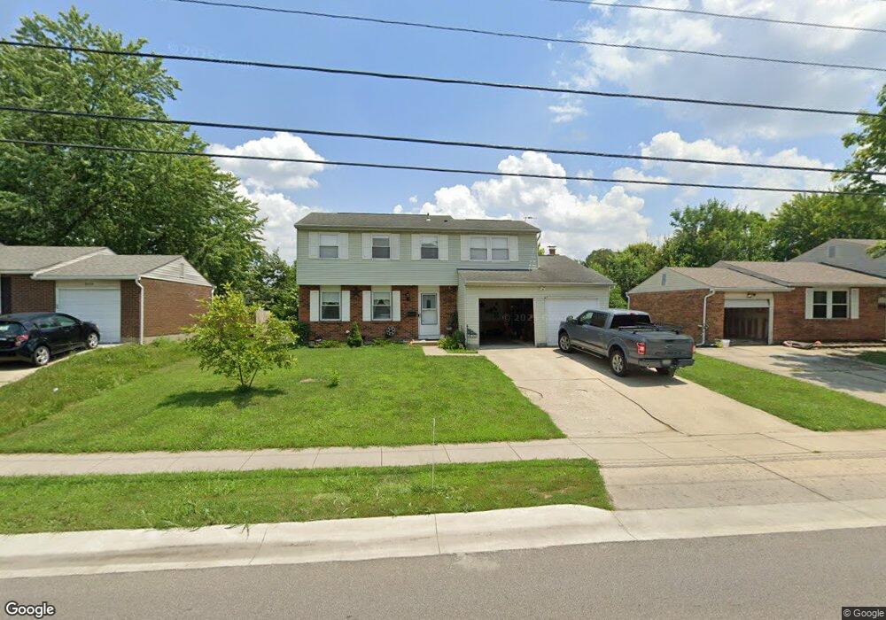
This home is located at 6466 Butler Warren Rd, Mason, OH 45040 and is currently estimated at $337,523, approximately $214 per square foot. 6466 Butler Warren Rd is a home located in Warren County with nearby schools including Mason Intermediate Elementary School, Mason Middle School, and William Mason High School.
Ownership History
Date
Name
Owned For
Owner Type
Purchase Details
Closed on
Jan 13, 2006
Sold by
Bryant Willard C and Bryant Allene R
Bought by
Smith Charles Forrest and Smith Charles F
Current Estimated Value
Home Financials for this Owner
Home Financials are based on the most recent Mortgage that was taken out on this home.
Original Mortgage
$145,000
Outstanding Balance
$82,223
Interest Rate
6.42%
Mortgage Type
Fannie Mae Freddie Mac
Estimated Equity
$255,300
Create a Home Valuation Report for This Property
The Home Valuation Report is an in-depth analysis detailing your home's value as well as a comparison with similar homes in the area
Home Values in the Area
Average Home Value in this Area
Purchase History
| Date | Buyer | Sale Price | Title Company |
|---|---|---|---|
| Smith Charles Forrest | $145,000 | Classic Title |
Source: Public Records
Mortgage History
| Date | Status | Borrower | Loan Amount |
|---|---|---|---|
| Open | Smith Charles Forrest | $145,000 |
Source: Public Records
Tax History Compared to Growth
Tax History
| Year | Tax Paid | Tax Assessment Tax Assessment Total Assessment is a certain percentage of the fair market value that is determined by local assessors to be the total taxable value of land and additions on the property. | Land | Improvement |
|---|---|---|---|---|
| 2024 | $3,607 | $88,880 | $24,500 | $64,380 |
| 2023 | $3,254 | $67,739 | $10,762 | $56,976 |
| 2022 | $3,212 | $67,739 | $10,763 | $56,977 |
| 2021 | $3,043 | $67,739 | $10,763 | $56,977 |
| 2020 | $2,885 | $55,073 | $8,750 | $46,323 |
| 2019 | $2,653 | $55,073 | $8,750 | $46,323 |
| 2018 | $2,661 | $55,073 | $8,750 | $46,323 |
| 2017 | $2,448 | $47,296 | $8,274 | $39,022 |
| 2016 | $2,522 | $47,296 | $8,274 | $39,022 |
| 2015 | $2,527 | $47,296 | $8,274 | $39,022 |
| 2014 | $2,533 | $44,200 | $7,730 | $36,470 |
| 2013 | $2,538 | $50,030 | $8,750 | $41,280 |
Source: Public Records
Map
Nearby Homes
- 921 Leslie Ct
- 873 Tradewind Dr
- 7986 Tylers Way
- 947 Olympia Dr
- 6955 Grand Oaks Ct
- 7843 Butler Warren Rd
- 6070 Fireside Dr Unit 45
- 6356 Amber Ct Unit 91
- 6138 Nicholas Way
- 6387 Coverage Ct
- 6369 Coverage Ct
- 6403 Coverage Ct
- 6357 Coverage Ct
- 6383 Coverage Ct
- 6407 Coverage Ct
- 6375 Coverage Ct
- 6365 Coverage Ct
- 6361 Coverage Ct
- 6379 Coverage Ct
- 6411 Coverage Ct
- 6478 Butler Warren Rd
- 913 Leslie Ct
- 6490 Butler Warren Rd
- 6442 Butler Warren Rd
- 909 Leslie Ct
- 917 Leslie Ct
- 905 Leslie Ct
- 8433 Ironside Ct
- 1495 Saint Lawrence Dr
- 1494 Windward Dr
- 1486 Windward Dr
- 901 Leslie Ct
- 8423 Ironside Ct
- 1480 Windward Dr
- 8373 White Hill Ln
- 1474 Windward Dr
- 8443 Ironside Ct
- 908 Leslie Ct
- 8413 Ironside Ct
- 904 Leslie Ct