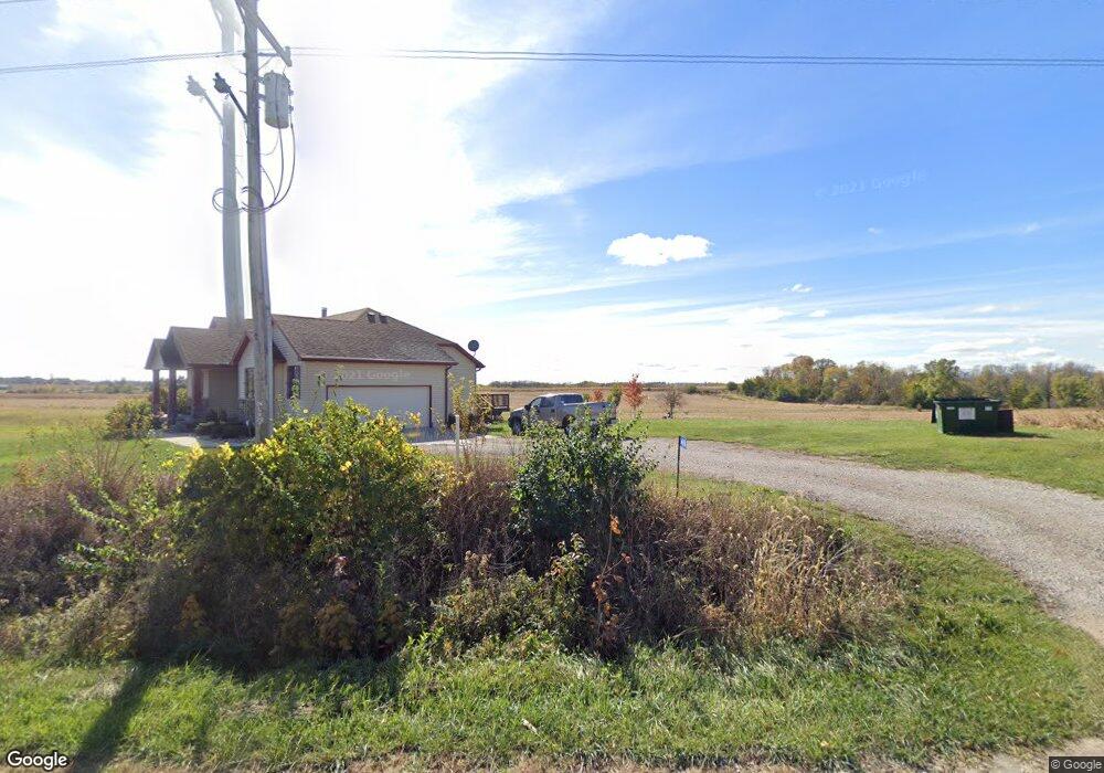
64694 295th St Maxwell, IA 50161
Estimated Value: $291,000 - $518,100
3
Beds
4
Baths
1,623
Sq Ft
$250/Sq Ft
Est. Value
About This Home
This home is located at 64694 295th St, Maxwell, IA 50161 and is currently estimated at $405,525, approximately $249 per square foot. 64694 295th St is a home with nearby schools including Collins-Maxwell Elementary School and Collins-Maxwell Middle/High School.
Ownership History
Date
Name
Owned For
Owner Type
Purchase Details
Closed on
Jul 9, 2010
Sold by
Wendt Noah R and Wendt Erin A
Bought by
Sharp Lee O and Sharp Sheri L
Current Estimated Value
Home Financials for this Owner
Home Financials are based on the most recent Mortgage that was taken out on this home.
Original Mortgage
$221,400
Interest Rate
4.74%
Mortgage Type
Construction
Create a Home Valuation Report for This Property
The Home Valuation Report is an in-depth analysis detailing your home's value as well as a comparison with similar homes in the area
Home Values in the Area
Average Home Value in this Area
Purchase History
| Date | Buyer | Sale Price | Title Company |
|---|---|---|---|
| Sharp Lee O | $36,000 | None Available |
Source: Public Records
Mortgage History
| Date | Status | Borrower | Loan Amount |
|---|---|---|---|
| Closed | Sharp Lee O | $221,400 |
Source: Public Records
Tax History Compared to Growth
Tax History
| Year | Tax Paid | Tax Assessment Tax Assessment Total Assessment is a certain percentage of the fair market value that is determined by local assessors to be the total taxable value of land and additions on the property. | Land | Improvement |
|---|---|---|---|---|
| 2025 | $5,738 | $481,200 | $159,700 | $321,500 |
| 2024 | $5,616 | $461,500 | $146,900 | $314,600 |
| 2023 | $5,180 | $461,500 | $146,900 | $314,600 |
| 2022 | $5,328 | $361,200 | $90,600 | $270,600 |
| 2021 | $5,484 | $361,200 | $90,600 | $270,600 |
| 2020 | $5,234 | $349,000 | $90,600 | $258,400 |
| 2019 | $5,234 | $349,000 | $90,600 | $258,400 |
| 2018 | $4,216 | $300,900 | $67,900 | $233,000 |
| 2017 | $4,216 | $300,900 | $67,900 | $233,000 |
| 2016 | $3,544 | $292,600 | $67,900 | $224,700 |
| 2015 | $3,544 | $256,100 | $67,900 | $188,200 |
| 2014 | $3,538 | $250,800 | $67,900 | $182,900 |
Source: Public Records
Map
Nearby Homes
- 32135 645th Ave
- 32019 645th Ave
- 32103 645th Ave
- 32075 645th Ave
- 906 Baldwin St
- 602 North St
- 512 Maxwell St
- 312 Maxwell St
- 220 Maxwell St
- 27015 Woods Rd
- 66677 270th St
- 33975 663rd Ave
- 923 Shagbark Dr
- 000 Nevada Iowa St
- 1521 S G Ave
- Parcel G 248th St
- 11 4th St
- 502 Southwoods Dr
- 412 2nd St
- 802 Academy Dr