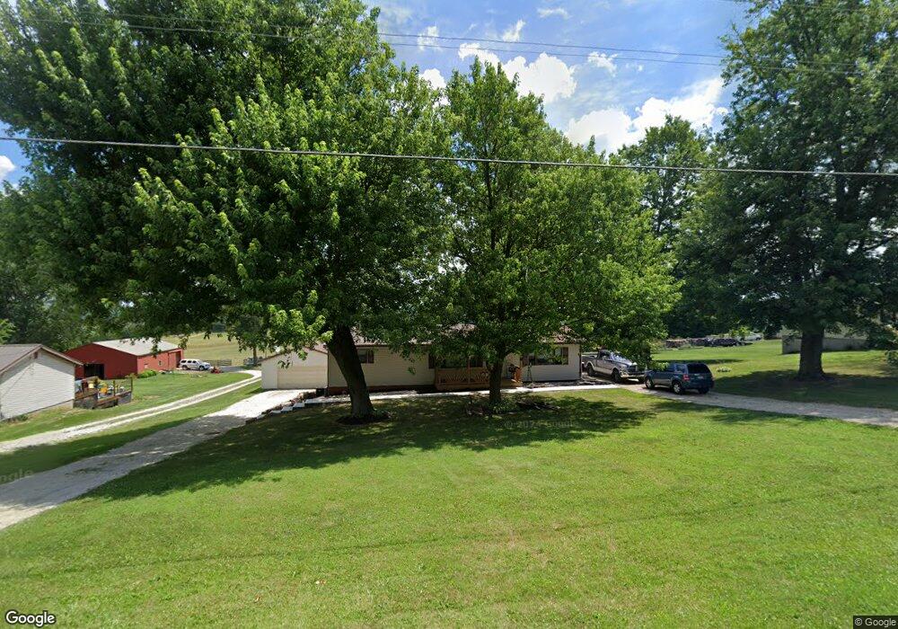
647 Pugh Rd Mansfield, OH 44903
Estimated Value: $182,024 - $214,000
3
Beds
1
Bath
1,248
Sq Ft
$162/Sq Ft
Est. Value
About This Home
This home is located at 647 Pugh Rd, Mansfield, OH 44903 and is currently estimated at $202,256, approximately $162 per square foot. 647 Pugh Rd is a home located in Richland County.
Ownership History
Date
Name
Owned For
Owner Type
Purchase Details
Closed on
Jun 17, 2022
Sold by
Fox Family Irrevocable Trust
Bought by
Jeffries Austin Robert and Fidler Micaela Marie
Current Estimated Value
Home Financials for this Owner
Home Financials are based on the most recent Mortgage that was taken out on this home.
Original Mortgage
$110,000
Outstanding Balance
$104,665
Interest Rate
5.27%
Mortgage Type
New Conventional
Estimated Equity
$97,591
Purchase Details
Closed on
Apr 2, 2014
Sold by
Fox Delayne Lantz and Fox Anthony
Bought by
The Fox Family Irrevocable Trust
Create a Home Valuation Report for This Property
The Home Valuation Report is an in-depth analysis detailing your home's value as well as a comparison with similar homes in the area
Home Values in the Area
Average Home Value in this Area
Purchase History
| Date | Buyer | Sale Price | Title Company |
|---|---|---|---|
| Jeffries Austin Robert | $480 | Hendrix Robert S | |
| Jeffries Austin Robert | $480 | None Listed On Document | |
| The Fox Family Irrevocable Trust | -- | Attorney |
Source: Public Records
Mortgage History
| Date | Status | Borrower | Loan Amount |
|---|---|---|---|
| Open | Jeffries Austin Robert | $110,000 | |
| Closed | Jeffries Austin Robert | $110,000 |
Source: Public Records
Tax History Compared to Growth
Tax History
| Year | Tax Paid | Tax Assessment Tax Assessment Total Assessment is a certain percentage of the fair market value that is determined by local assessors to be the total taxable value of land and additions on the property. | Land | Improvement |
|---|---|---|---|---|
| 2024 | $2,004 | $39,690 | $8,840 | $30,850 |
| 2023 | $2,004 | $39,690 | $8,840 | $30,850 |
| 2022 | $1,661 | $30,310 | $7,080 | $23,230 |
| 2021 | $1,661 | $30,310 | $7,080 | $23,230 |
| 2020 | $1,674 | $30,310 | $7,080 | $23,230 |
| 2019 | $1,518 | $25,660 | $5,950 | $19,710 |
| 2018 | $1,505 | $25,660 | $5,950 | $19,710 |
| 2017 | $1,459 | $25,660 | $5,950 | $19,710 |
| 2016 | $1,441 | $24,460 | $5,650 | $18,810 |
| 2015 | $1,441 | $24,460 | $5,650 | $18,810 |
| 2014 | $1,413 | $24,460 | $5,650 | $18,810 |
| 2012 | $1,362 | $25,750 | $5,950 | $19,800 |
Source: Public Records
Map
Nearby Homes
- 0 Mount Zion Rd Unit 9069748
- 2750 Lutz Ave
- 0 Peterson Rd
- 775 Touby Ln
- 0 McBride Road Parcel # 1 Unit 9066028
- 598 Impala Dr
- 945 Pike Dr
- 0 Satinwood Dr
- 2364 Satinwood Dr
- 2495 Emma Ln
- 19 Maine St
- 2172 Satinwood Dr
- 1183 County Road 30a
- 3290 Shad Dr W
- 640 Running Brook Way
- 174 W Main St
- 2236 Lakecrest Dr
- 76 Ford Rd N
- 0 State Route 39 & I-71 Northeast Quadrant
- 0 State Route 39 & I-71 Southeast Quadrant