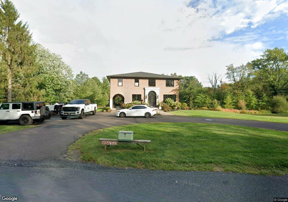
6470 Ferry Rd Doylestown, PA 18902
Plumstead NeighborhoodEstimated Value: $318,000 - $1,062,000
4
Beds
3
Baths
4,130
Sq Ft
$206/Sq Ft
Est. Value
About This Home
This home is located at 6470 Ferry Rd, Doylestown, PA 18902 and is currently estimated at $849,233, approximately $205 per square foot. 6470 Ferry Rd is a home located in Bucks County with nearby schools including Gayman Elementary School, Tohickon Middle School, and Central Bucks High School - East.
Ownership History
Date
Name
Owned For
Owner Type
Purchase Details
Closed on
May 23, 2013
Sold by
Froelich Daniel C and Froehlich Daniel C
Bought by
Froehlich Ii Daniel C and Froehlich Erika M Ramos
Current Estimated Value
Purchase Details
Closed on
Jan 30, 2004
Sold by
Froelich Daniel C and Froelich Roberta
Bought by
Froelich Ii Daniel C
Home Financials for this Owner
Home Financials are based on the most recent Mortgage that was taken out on this home.
Original Mortgage
$150,500
Outstanding Balance
$70,584
Interest Rate
5.83%
Mortgage Type
New Conventional
Estimated Equity
$778,649
Purchase Details
Closed on
May 17, 2002
Sold by
Imboden Thomas M and Imboden Holly S
Bought by
Dangelo James A and Coluccio Richard
Create a Home Valuation Report for This Property
The Home Valuation Report is an in-depth analysis detailing your home's value as well as a comparison with similar homes in the area
Home Values in the Area
Average Home Value in this Area
Purchase History
| Date | Buyer | Sale Price | Title Company |
|---|---|---|---|
| Froehlich Ii Daniel C | -- | Accommodation | |
| Froelich Ii Daniel C | -- | -- | |
| Dangelo James A | $100,000 | -- |
Source: Public Records
Mortgage History
| Date | Status | Borrower | Loan Amount |
|---|---|---|---|
| Open | Froelich Ii Daniel C | $150,500 |
Source: Public Records
Tax History
| Year | Tax Paid | Tax Assessment Tax Assessment Total Assessment is a certain percentage of the fair market value that is determined by local assessors to be the total taxable value of land and additions on the property. | Land | Improvement |
|---|---|---|---|---|
| 2025 | $9,280 | $53,410 | $4,560 | $48,850 |
| 2024 | $9,280 | $53,410 | $4,560 | $48,850 |
| 2023 | $8,985 | $53,410 | $4,560 | $48,850 |
| 2022 | $8,885 | $53,410 | $4,560 | $48,850 |
| 2021 | $8,785 | $53,410 | $4,560 | $48,850 |
| 2020 | $8,785 | $53,410 | $4,560 | $48,850 |
| 2019 | $746 | $4,560 | $4,560 | $0 |
| 2018 | $746 | $4,560 | $4,560 | $0 |
| 2017 | $2,644 | $16,400 | $4,560 | $11,840 |
| 2016 | $2,644 | $16,400 | $4,560 | $11,840 |
| 2015 | -- | $16,400 | $4,560 | $11,840 |
| 2014 | -- | $16,400 | $4,560 | $11,840 |
Source: Public Records
Map
Nearby Homes
- 6246 Point Pleasant Pike
- 6934 Greene Meadow Ln
- 5987 Point Pleasant Pike
- 5382 Wismer Rd
- 7021 Swagger Rd
- Lot 1 Groveland Rd
- 6469 Groveland Rd
- 5805 Ridgeview Dr
- 6163 Carversville Rd
- 5829 Ridgeview Dr
- 0 Old Durham Rd
- 7640 Tohickon Hill Rd
- 5380 Point Pleasant Pike
- 59 Byram Rd
- 159 Byram Ln
- 6680 Point Pleasant Pike
- 5182 Point Pleasant Pike
- 5895 Rodgers Rd
- Lot (# 1) 6465 Greenhill Rd
- 6465 Greenhill Rd
- 6452 Ferry Rd
- 6489 Ferry Rd
- 6475 Ferry Rd
- 6495 Ferry Rd
- 6488 Ferry Rd
- 6459 Ferry Rd
- 6436 Ferry Rd
- 4976 Ferry Rd
- 4793 Carversville Wismer Rd
- 6445 Ferry Rd
- 4785 Wismer Rd
- 6422 Ferry Rd
- 4762 Wismer Rd
- 4793 Wismer Rd
- 4836 Wismer Rd
- 4829 Wismer Rd
- 4754 Wismer Rd
- 6414 Ferry Rd
- 6406 Ferry Rd
- 4870 Wismer Rd
Your Personal Tour Guide
Ask me questions while you tour the home.