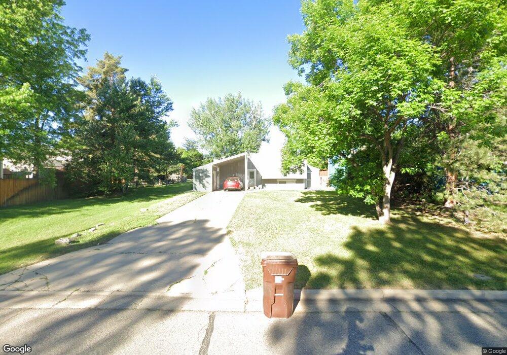
6470 Kalua Rd Boulder, CO 80301
Gunbarrel NeighborhoodEstimated Value: $618,934 - $676,000
3
Beds
2
Baths
900
Sq Ft
$712/Sq Ft
Est. Value
About This Home
This home is located at 6470 Kalua Rd, Boulder, CO 80301 and is currently estimated at $640,734, approximately $711 per square foot. 6470 Kalua Rd is a home located in Boulder County with nearby schools including Heatherwood Elementary School, Nevin Platt Middle School, and Boulder High School.
Ownership History
Date
Name
Owned For
Owner Type
Purchase Details
Closed on
Dec 12, 1984
Bought by
Giles Frank L and Giles Connie R
Current Estimated Value
Purchase Details
Closed on
Mar 27, 1981
Bought by
Giles Frank L and Giles Connie R
Purchase Details
Closed on
Feb 6, 1981
Bought by
Giles Frank L and Giles Connie R
Purchase Details
Closed on
May 6, 1975
Bought by
Giles Frank L and Giles Connie R
Create a Home Valuation Report for This Property
The Home Valuation Report is an in-depth analysis detailing your home's value as well as a comparison with similar homes in the area
Home Values in the Area
Average Home Value in this Area
Purchase History
| Date | Buyer | Sale Price | Title Company |
|---|---|---|---|
| Giles Frank L | $80,000 | -- | |
| Giles Frank L | $77,000 | -- | |
| Giles Frank L | $59,500 | -- | |
| Giles Frank L | $36,000 | -- |
Source: Public Records
Tax History
| Year | Tax Paid | Tax Assessment Tax Assessment Total Assessment is a certain percentage of the fair market value that is determined by local assessors to be the total taxable value of land and additions on the property. | Land | Improvement |
|---|---|---|---|---|
| 2025 | $3,801 | $41,963 | $20,800 | $21,163 |
| 2024 | $3,801 | $41,963 | $20,800 | $21,163 |
| 2023 | $3,739 | $40,964 | $19,879 | $24,770 |
| 2022 | $3,231 | $32,984 | $15,095 | $17,889 |
| 2021 | $3,082 | $33,934 | $15,530 | $18,404 |
| 2020 | $3,031 | $33,019 | $13,585 | $19,434 |
| 2019 | $2,985 | $33,019 | $13,585 | $19,434 |
| 2018 | $2,667 | $29,153 | $11,160 | $17,993 |
| 2017 | $2,588 | $32,230 | $12,338 | $19,892 |
| 2016 | $2,178 | $23,768 | $9,472 | $14,296 |
| 2015 | $2,069 | $20,752 | $7,403 | $13,349 |
| 2014 | $1,957 | $20,752 | $7,403 | $13,349 |
Source: Public Records
Map
Nearby Homes
- 4458 Driftwood Place
- 4559 Beachcomber Ct
- 6495 Barnacle Ct
- 4651 Portside Way
- 6239 Willow Ln Unit 6239
- 4584 Robinson Place
- 4647 Burgundy Ln Unit 2-4
- 6146 Willow Ln
- 6686 Jay Rd
- 6170 Habitat Dr Unit 6170
- 4471 Wellington Rd
- 4682 White Rock Cir Unit 10
- 4682 White Rock Cir Unit 5
- 4887 White Rock Cir Unit F
- 4839 White Rock Cir Unit D
- 4656 White Rock Cir Unit 7
- 4819 White Rock Cir Unit C
- 4767 White Rock Cir Unit D
- 4658 White Rock Cir Unit 5
- 4789 White Rock Cir Unit D
- 6474 Kalua Rd
- 6480 Kalua Rd
- 4418 Driftwood Place
- 4420-4422 Driftwood Place Unit 4420
- 4420-4422 Driftwood Place
- 4420 Driftwood Place
- 4424 Driftwood Place
- 4426 Driftwood Place
- 6485 Twin Lakes Rd
- 4421 Driftwood Place
- 4419 Driftwood Place
- 6424 Twin Lakes Rd
- 4423 Driftwood Place
- 6422 Twin Lakes Rd
- 6430 Outrigger Ct
- 4425 Driftwood Place
- 6440 Outrigger Ct
- 6420 Outrigger Ct
- 6398 Twin Lakes Rd
- 6545 Kalua Rd Unit 304D
Your Personal Tour Guide
Ask me questions while you tour the home.