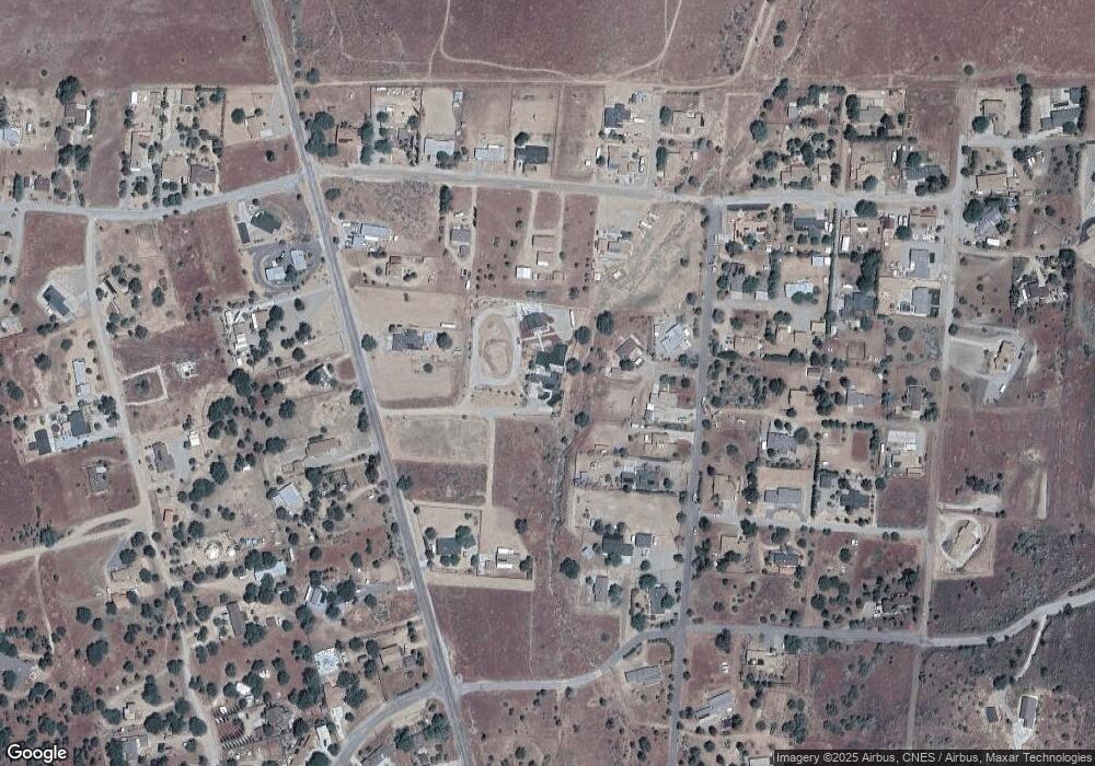
6471 Cottontail Rd Squirrel Mountai Rd Squirrel Moutain Valley, CA 93240
Squirrel Mountain Valley NeighborhoodEstimated Value: $208,000 - $312,000
3
Beds
2
Baths
1,682
Sq Ft
$167/Sq Ft
Est. Value
About This Home
This home is located at 6471 Cottontail Rd Squirrel Mountai Rd, Squirrel Moutain Valley, CA 93240 and is currently estimated at $280,793, approximately $166 per square foot. 6471 Cottontail Rd Squirrel Mountai Rd is a home with nearby schools including Kern Valley High School.
Ownership History
Date
Name
Owned For
Owner Type
Purchase Details
Closed on
Jun 23, 2017
Sold by
Younkin Robert L
Bought by
Younkin Robert L
Current Estimated Value
Purchase Details
Closed on
Jul 24, 2015
Sold by
Young Richard and Young Julie
Bought by
Richard & Julie Young Family Trust and Young Julie
Purchase Details
Closed on
Jul 8, 2011
Sold by
Younkin Esther L
Bought by
Younkin Esther L
Home Financials for this Owner
Home Financials are based on the most recent Mortgage that was taken out on this home.
Original Mortgage
$144,000
Interest Rate
4.46%
Purchase Details
Closed on
Jan 9, 2006
Sold by
Younkin Esther L
Bought by
Younkin Esther L
Create a Home Valuation Report for This Property
The Home Valuation Report is an in-depth analysis detailing your home's value as well as a comparison with similar homes in the area
Home Values in the Area
Average Home Value in this Area
Purchase History
| Date | Buyer | Sale Price | Title Company |
|---|---|---|---|
| Younkin Robert L | -- | None Available | |
| Richard & Julie Young Family Trust | -- | Stewart Title Of Ca Inc | |
| Younkin Esther L | -- | Chicago Title Company | |
| Younkin Esther L | -- | Chicago Title Company | |
| Younkin Esther L | -- | None Available |
Source: Public Records
Mortgage History
| Date | Status | Borrower | Loan Amount |
|---|---|---|---|
| Previous Owner | Younkin Esther L | $144,000 |
Source: Public Records
Tax History Compared to Growth
Tax History
| Year | Tax Paid | Tax Assessment Tax Assessment Total Assessment is a certain percentage of the fair market value that is determined by local assessors to be the total taxable value of land and additions on the property. | Land | Improvement |
|---|---|---|---|---|
| 2025 | $1,889 | $152,484 | $8,744 | $143,740 |
| 2024 | $1,807 | $149,495 | $8,573 | $140,922 |
| 2023 | $1,807 | $151,324 | $13,165 | $138,159 |
| 2022 | $1,755 | $148,357 | $12,907 | $135,450 |
| 2021 | $1,690 | $145,449 | $12,654 | $132,795 |
| 2020 | $1,647 | $143,959 | $12,525 | $131,434 |
| 2019 | $1,620 | $143,959 | $12,525 | $131,434 |
| 2018 | $1,583 | $138,371 | $12,040 | $126,331 |
| 2017 | $1,566 | $135,658 | $11,804 | $123,854 |
| 2016 | $1,467 | $132,999 | $11,573 | $121,426 |
| 2015 | $1,453 | $131,003 | $11,400 | $119,603 |
| 2014 | $1,427 | $128,438 | $11,177 | $117,261 |
Source: Public Records
Map
Nearby Homes
- 00 Sagebrush Rd
- 6504 Cook Peak
- 0 Cook Peak Indian Rock Unit 2605609
- 3609 Cook Peak Rd
- 6211 Sagebrush Rd
- 6201 Sagebrush Rd
- 4300 Poplar St
- 6605 Dogwood Ave
- 4312 Poplar St
- 3413 Piute Hill Rd
- 3565 Shadow Mountain Dr
- 3303 Piute Hill Rd
- 6353 Juniper Rd
- 6316 Park Ave
- 3500 Shadow Mountain Dr
- 6124 Juniper Rd
- 3300 Cook Peak Rd
- 6308 Lynch Canyon Dr
- 6301 Park Ave
- 6304 Lynch Canyon Dr
- 3803 Indian Rock Rd
- 6436 Cottontail Rd
- 3805 Indian Rock Rd
- 3793 Indian Rock Rd
- 3809 Indian Rock Rd
- 3801 Indian Rock Rd
- 6408 Sagebrush Rd
- 3772 Mccray Rd
- 6522 Sagebrush Rd
- 3708 Mccray Rd
- 3713 Cook Peak Rd
- 3816 Mccray Rd
- 3812 Indian Rock Rd
- 3709 Cook Peak Rd
- 6400 Sagebrush Rd
- 6509 Acorn Rd
- 000 Sagebrush Rd
- 0 Sagebrush Rd
- 3793 Mccray Rd
- 3816 Indian Rock Rd
