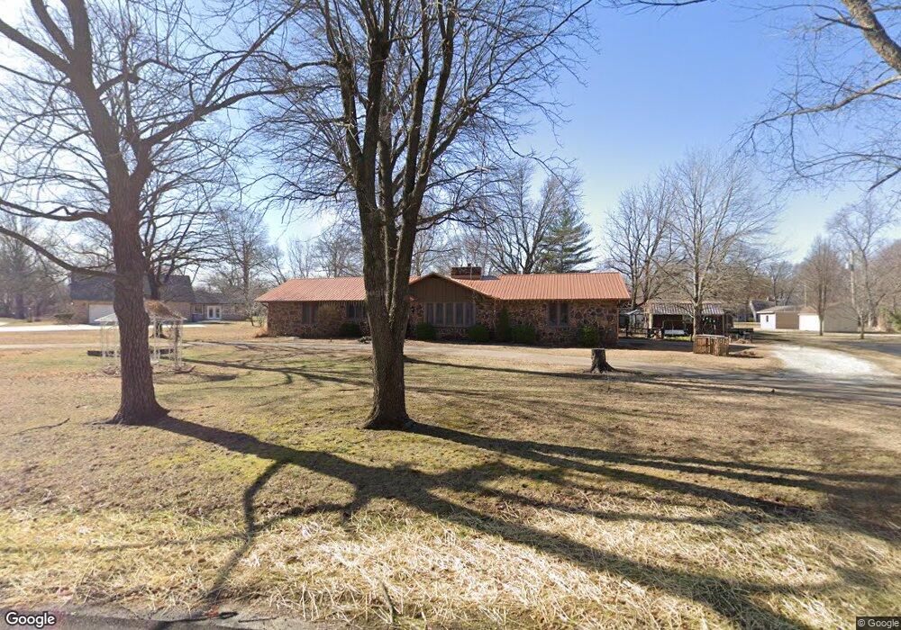
6478 Park Cir Joplin, MO 64801
Estimated Value: $257,217 - $297,000
--
Bed
--
Bath
1,788
Sq Ft
$156/Sq Ft
Est. Value
About This Home
This home is located at 6478 Park Cir, Joplin, MO 64801 and is currently estimated at $278,304, approximately $155 per square foot. 6478 Park Cir is a home located in Jasper County with nearby schools including Carl Junction Primary School (K-1), Carl Junction Intermediate School, and Carl Junction Primary School (2-3).
Ownership History
Date
Name
Owned For
Owner Type
Purchase Details
Closed on
Jun 22, 2015
Sold by
Farley Patricia L and Farley Leroy W
Bought by
Farley Family Trust and Farley
Current Estimated Value
Purchase Details
Closed on
Mar 8, 2013
Sold by
Schroeder Booke
Bought by
Farley Leroy W and Farley Patricia L
Purchase Details
Closed on
Nov 19, 2009
Sold by
Schroeder Greg and Schroeder Brooke
Bought by
Schroeder Brooke
Home Financials for this Owner
Home Financials are based on the most recent Mortgage that was taken out on this home.
Original Mortgage
$103,250
Interest Rate
5.06%
Mortgage Type
New Conventional
Purchase Details
Closed on
Jun 30, 2009
Sold by
Arnce Robert D and Arnce Ermadeen
Bought by
Schroeder Greg and Schroeder Brooke
Home Financials for this Owner
Home Financials are based on the most recent Mortgage that was taken out on this home.
Original Mortgage
$100,000
Interest Rate
4.84%
Mortgage Type
Purchase Money Mortgage
Create a Home Valuation Report for This Property
The Home Valuation Report is an in-depth analysis detailing your home's value as well as a comparison with similar homes in the area
Home Values in the Area
Average Home Value in this Area
Purchase History
| Date | Buyer | Sale Price | Title Company |
|---|---|---|---|
| Farley Family Trust | -- | -- | |
| Farley Leroy W | -- | None Available | |
| Schroeder Brooke | -- | None Available | |
| Schroeder Greg | -- | Abbey |
Source: Public Records
Mortgage History
| Date | Status | Borrower | Loan Amount |
|---|---|---|---|
| Previous Owner | Schroeder Brooke | $103,250 | |
| Previous Owner | Schroeder Greg | $100,000 |
Source: Public Records
Tax History Compared to Growth
Tax History
| Year | Tax Paid | Tax Assessment Tax Assessment Total Assessment is a certain percentage of the fair market value that is determined by local assessors to be the total taxable value of land and additions on the property. | Land | Improvement |
|---|---|---|---|---|
| 2024 | $1,321 | $29,320 | $2,830 | $26,490 |
| 2023 | $1,321 | $29,320 | $2,830 | $26,490 |
| 2022 | $1,302 | $28,690 | $2,830 | $25,860 |
| 2021 | $1,294 | $28,690 | $2,830 | $25,860 |
| 2020 | $1,205 | $26,440 | $2,830 | $23,610 |
| 2019 | $1,206 | $26,440 | $2,830 | $23,610 |
| 2018 | $991 | $21,810 | $0 | $0 |
| 2017 | $994 | $21,810 | $0 | $0 |
| 2016 | $1,020 | $22,570 | $0 | $0 |
| 2015 | -- | $22,570 | $0 | $0 |
| 2014 | -- | $22,570 | $0 | $0 |
Source: Public Records
Map
Nearby Homes
- 5981 Pearl St
- Lot 1A Hwy 171 & Fir Rd
- Lot 1B Hwy 171 & Fir Rd
- Lot 1 Hwy 171 & Fir Rd
- Xxx Wall St
- LOT 4C Hwy 171 & Fir Rd Unit 4C
- 6548 Mo-171
- 701 Woodland St
- 512 Dogwood Trails Loop
- XXX Lone Elm
- 25122 Gum Rd
- 235 Timber Ln
- 205 Hickory Place
- 232 Hickory Place
- 308 Belgian Blue Blvd
- 25949 Paper Loop
- 304 Belgian Blue Blvd
- 25327 Central Ave
- 305 Anita Dr
- 117 Rocky Ln