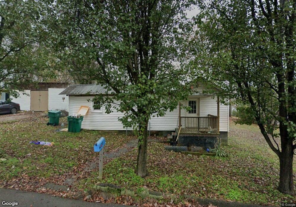
648 Lambert St Lewisburg, TN 37091
Estimated Value: $98,969 - $163,000
--
Bed
1
Bath
694
Sq Ft
$188/Sq Ft
Est. Value
About This Home
This home is located at 648 Lambert St, Lewisburg, TN 37091 and is currently estimated at $130,492, approximately $188 per square foot. 648 Lambert St is a home located in Marshall County with nearby schools including Oak Grove Elementary School, Marshall Elementary School, and Westhills Elementary School.
Ownership History
Date
Name
Owned For
Owner Type
Purchase Details
Closed on
Dec 26, 2007
Sold by
Kerry Griffin and Kerry Tammy
Bought by
Billy Griffin and Billy Linda
Current Estimated Value
Home Financials for this Owner
Home Financials are based on the most recent Mortgage that was taken out on this home.
Original Mortgage
$22,000
Outstanding Balance
$13,807
Interest Rate
6.05%
Estimated Equity
$116,685
Purchase Details
Closed on
Sep 21, 2007
Sold by
Walker Kerry W
Bought by
Billy Griffin and Billy Linda
Purchase Details
Closed on
Apr 4, 1994
Sold by
King James A
Bought by
Walker Kerry W
Purchase Details
Closed on
Jul 3, 1990
Bought by
King James A and Dallas Lyn
Create a Home Valuation Report for This Property
The Home Valuation Report is an in-depth analysis detailing your home's value as well as a comparison with similar homes in the area
Home Values in the Area
Average Home Value in this Area
Purchase History
| Date | Buyer | Sale Price | Title Company |
|---|---|---|---|
| Billy Griffin | $20,000 | -- | |
| Billy Griffin | -- | -- | |
| Walker Kerry W | $21,000 | -- | |
| King James A | $17,000 | -- |
Source: Public Records
Mortgage History
| Date | Status | Borrower | Loan Amount |
|---|---|---|---|
| Open | King James A | $22,000 |
Source: Public Records
Tax History Compared to Growth
Tax History
| Year | Tax Paid | Tax Assessment Tax Assessment Total Assessment is a certain percentage of the fair market value that is determined by local assessors to be the total taxable value of land and additions on the property. | Land | Improvement |
|---|---|---|---|---|
| 2024 | -- | $12,125 | $2,500 | $9,625 |
| 2023 | $377 | $12,125 | $2,500 | $9,625 |
| 2022 | $377 | $12,125 | $2,500 | $9,625 |
| 2021 | $303 | $6,525 | $1,250 | $5,275 |
| 2020 | $188 | $6,525 | $1,250 | $5,275 |
| 2019 | $293 | $6,525 | $1,250 | $5,275 |
| 2018 | $290 | $6,525 | $1,250 | $5,275 |
| 2017 | $290 | $6,525 | $1,250 | $5,275 |
| 2016 | $261 | $5,100 | $1,125 | $3,975 |
| 2015 | $238 | $5,100 | $1,125 | $3,975 |
| 2014 | $238 | $5,100 | $1,125 | $3,975 |
Source: Public Records
Map
Nearby Homes
- 630 6th Ave N
- 627 6th Ave N
- 594 5th Ave N
- 319 Greenwood St
- 231 Greenwood St
- 0 New Lake Rd Unit RTC3030964
- 726 Thomas Ave
- 638 2nd Ave N
- 1025 Glenn Ave
- 1144 Apple St
- 543 2nd Ave N
- 316 Haynes St
- 1204 Glenn Ave
- 215 5th Ave N
- 1111 W End Ave N
- 416 1st Ave N
- 1600 Larry Dospil Dr
- 655 Glenn Ave
- 518 Maple St
- 108 W End Ave N
- 725 N Church St
- 640 Lambert St
- 681 Franklin Ave
- 733 N Church St
- 675 Franklin Ave
- 641 Lambert St
- 706 Franklin Ave
- 728 N Church St
- 671 Franklin Ave
- 718 N Church St
- 643 Thomas St
- 739 N Church St
- 739 N Church St
- 635 Thomas St
- 631 Lambert St
- 714 Franklin Ave
- 624 Lambert St
- 740 N Church St
- 667 Franklin Ave
- 627 Thomas St