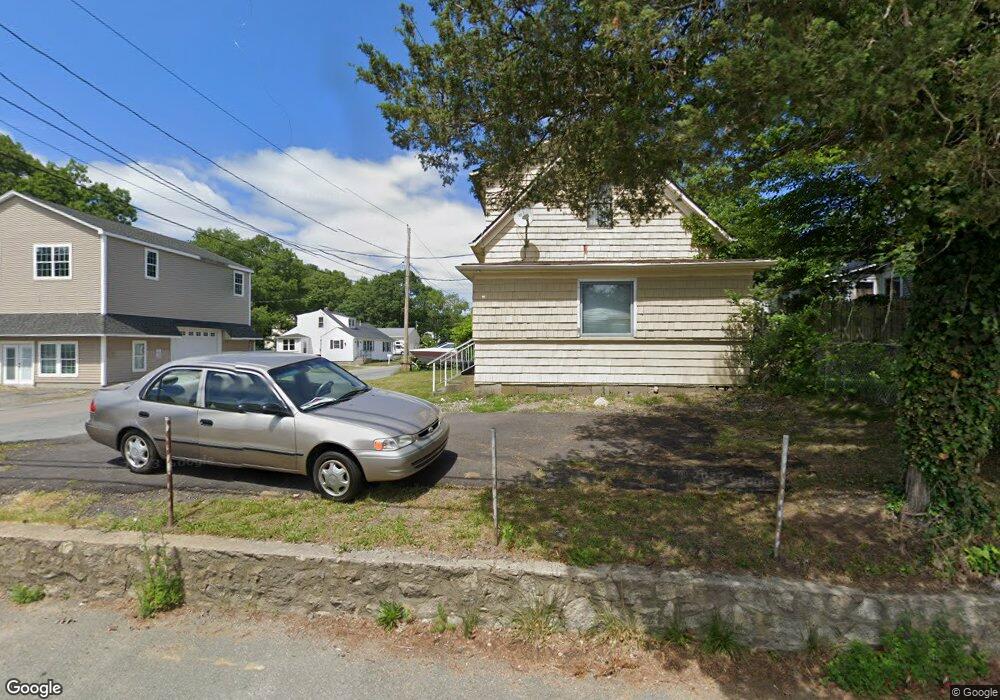
648 State Rd Westport, MA 02790
North Westport NeighborhoodEstimated Value: $347,072 - $444,000
2
Beds
--
Bath
978
Sq Ft
$406/Sq Ft
Est. Value
About This Home
This home is located at 648 State Rd, Westport, MA 02790 and is currently estimated at $397,268, approximately $406 per square foot. 648 State Rd is a home located in Bristol County with nearby schools including Alice A. Macomber Primary School, Westport Elementary School, and Westport Middle-High School.
Ownership History
Date
Name
Owned For
Owner Type
Purchase Details
Closed on
Dec 23, 2004
Sold by
Costa Pauline M
Bought by
Albergaria Paul
Current Estimated Value
Home Financials for this Owner
Home Financials are based on the most recent Mortgage that was taken out on this home.
Original Mortgage
$171,200
Interest Rate
5.74%
Mortgage Type
Purchase Money Mortgage
Purchase Details
Closed on
Feb 25, 1994
Sold by
Zitano Dean Pa and Zitano Leslie S
Bought by
Costa Pauline M
Create a Home Valuation Report for This Property
The Home Valuation Report is an in-depth analysis detailing your home's value as well as a comparison with similar homes in the area
Home Values in the Area
Average Home Value in this Area
Purchase History
| Date | Buyer | Sale Price | Title Company |
|---|---|---|---|
| Albergaria Paul | $214,000 | -- | |
| Costa Pauline M | $86,000 | -- |
Source: Public Records
Mortgage History
| Date | Status | Borrower | Loan Amount |
|---|---|---|---|
| Open | Costa Pauline M | $256,000 | |
| Closed | Costa Pauline M | $244,000 | |
| Closed | Costa Pauline M | $171,200 |
Source: Public Records
Tax History Compared to Growth
Tax History
| Year | Tax Paid | Tax Assessment Tax Assessment Total Assessment is a certain percentage of the fair market value that is determined by local assessors to be the total taxable value of land and additions on the property. | Land | Improvement |
|---|---|---|---|---|
| 2025 | $2,030 | $272,500 | $125,700 | $146,800 |
| 2024 | $2,018 | $261,100 | $116,400 | $144,700 |
| 2023 | $1,946 | $238,500 | $99,200 | $139,300 |
| 2022 | $1,501 | $183,100 | $99,200 | $83,900 |
| 2021 | $1,501 | $174,100 | $90,200 | $83,900 |
| 2020 | $1,437 | $170,500 | $86,600 | $83,900 |
| 2019 | $1,421 | $171,800 | $93,400 | $78,400 |
| 2018 | $1,431 | $175,100 | $103,100 | $72,000 |
| 2017 | $1,380 | $173,200 | $103,100 | $70,100 |
| 2016 | $1,370 | $173,200 | $103,100 | $70,100 |
| 2015 | $1,269 | $160,000 | $103,100 | $56,900 |
Source: Public Records
Map
Nearby Homes
- 20 Faulkner St
- 116 Gifford Rd
- 9 Kyle Jacob Rd
- 15 S Breault St
- 16 S Berryman St
- 3 Diane Way
- 100 D Dr
- 565 Highland Ave
- 1276 Old Fall River Rd
- 9 Register Ave
- 92 Benoit St
- 19 Charles Joseph Dr
- 2 Donna Marie Dr
- 33 William St
- 6 Beaulieu St
- 27 Dias Ave
- 25 Beaulieu St
- 771 Sanford Rd
- 96 Forge Rd
- 128 Old Bedford Rd
- 650 State Rd
- 636 State Rd
- 628 State Rd
- 5 Rock St
- 654 State Rd
- 8 Zulmira Dr
- 642 State Rd
- 8 Rock St
- 13 Rock St
- 10 Mount Pleasant St
- 9 Mount Pleasant St
- 641 State Rd
- 999 Po Box
- 645 State Rd Unit b
- 17 Rock St
- 18 Rock St
- 14 Lot 38 14 Hickory Ln
- 14 (lot 3) 14 Hickory Ln
- 15 Mount Pleasant St
- 16 Mount Pleasant St