64970 Gibas Rd Neffs, OH 43940
Neffs NeighborhoodEstimated Value: $82,224 - $143,000
2
Beds
1
Bath
1,188
Sq Ft
$87/Sq Ft
Est. Value
About This Home
This home is located at 64970 Gibas Rd, Neffs, OH 43940 and is currently estimated at $103,306, approximately $86 per square foot. 64970 Gibas Rd is a home with nearby schools including Bellaire Elementary School, Bellaire Middle School, and Bellaire High School.
Ownership History
Date
Name
Owned For
Owner Type
Purchase Details
Closed on
Nov 5, 2004
Sold by
Krivenko Patricia A
Bought by
Krivenko Patricia A
Current Estimated Value
Purchase Details
Closed on
Sep 1, 2004
Bought by
Bank One
Purchase Details
Closed on
Oct 17, 1994
Sold by
Robbins Charles J and Robbins Susan
Bought by
Robbins Charles J and Robbins Susan
Purchase Details
Closed on
Jan 1, 1986
Sold by
Olinski Charles E and Olinski Rose
Bought by
Olinski Charles E and Olinski Rose
Create a Home Valuation Report for This Property
The Home Valuation Report is an in-depth analysis detailing your home's value as well as a comparison with similar homes in the area
Home Values in the Area
Average Home Value in this Area
Purchase History
| Date | Buyer | Sale Price | Title Company |
|---|---|---|---|
| Krivenko Patricia A | $10,000 | -- | |
| Bank One | $22,000 | -- | |
| Robbins Charles J | $36,000 | -- | |
| Olinski Charles E | -- | -- |
Source: Public Records
Mortgage History
| Date | Status | Borrower | Loan Amount |
|---|---|---|---|
| Open | Krivenko Patricia A | $57,000 | |
| Closed | Krivenko Patricia A | $54,000 | |
| Closed | Krivenko Patricia A | $52,000 | |
| Closed | Krivenko Michael F | $8,507 | |
| Closed | Krivenko Michael F | $25,500 |
Source: Public Records
Tax History Compared to Growth
Tax History
| Year | Tax Paid | Tax Assessment Tax Assessment Total Assessment is a certain percentage of the fair market value that is determined by local assessors to be the total taxable value of land and additions on the property. | Land | Improvement |
|---|---|---|---|---|
| 2024 | $357 | $19,700 | $8,060 | $11,640 |
| 2023 | $348 | $18,050 | $7,210 | $10,840 |
| 2022 | $364 | $18,049 | $7,213 | $10,836 |
| 2021 | $404 | $19,103 | $7,213 | $11,890 |
| 2020 | $322 | $16,610 | $6,270 | $10,340 |
| 2019 | $324 | $16,610 | $6,270 | $10,340 |
| 2018 | $307 | $16,610 | $6,270 | $10,340 |
| 2017 | $292 | $15,960 | $4,680 | $11,280 |
| 2016 | $296 | $15,960 | $4,680 | $11,280 |
| 2015 | $299 | $15,960 | $4,680 | $11,280 |
| 2014 | $206 | $13,490 | $4,250 | $9,240 |
| 2013 | $175 | $13,490 | $4,250 | $9,240 |
Source: Public Records
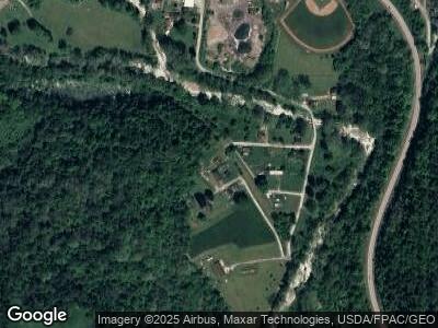
Map
Nearby Homes
- 65972 McGregor Hill Rd
- 54257 Fulton Hill Rd
- 54265 Fulton Hill Rd
- 64640 Patterson Hill Rd
- 67070 Willow Brook Ln
- 0 Chestnut Rd
- 0 Maple Dr Unit T9516724
- 0 Poplar Dr Unit 4491238
- 53206 Poplar Dr
- 56376 Jordan Run Rd
- 64301 Shady Lane Rd
- 0 Hilltop Ave
- 56260 Davis Rd
- 51345 Little McMahon Creek Rd
- 23311 W 23rd St
- 221 Taney Ave
- 67330 Ebbert Rd S Unit 5
- 1100 Central Ave
- 56929 Winding Hill Rd
- 65078 Indian Run Rd