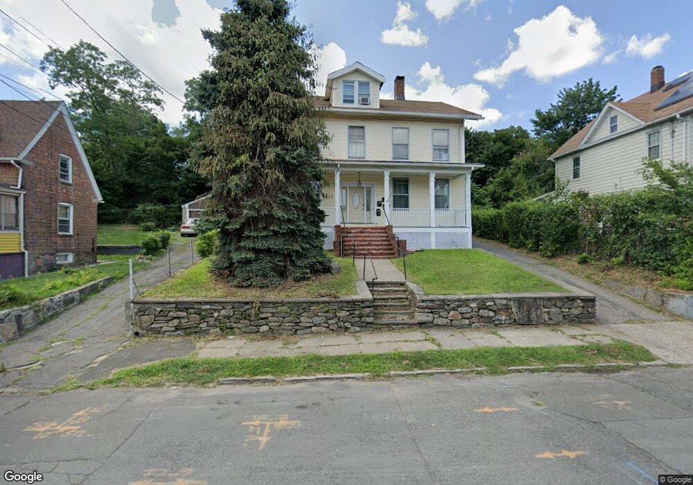
65 Asylum St Bridgeport, CT 06610
North Bridgeport NeighborhoodEstimated Value: $411,433 - $799,000
6
Beds
3
Baths
3,872
Sq Ft
$157/Sq Ft
Est. Value
About This Home
This home is located at 65 Asylum St, Bridgeport, CT 06610 and is currently estimated at $609,108, approximately $157 per square foot. 65 Asylum St is a home located in Fairfield County with nearby schools including Beardsley School, Harding High School, and Achievement First Bridgeport Academy Elementary School.
Ownership History
Date
Name
Owned For
Owner Type
Purchase Details
Closed on
May 5, 2011
Sold by
Cano Ramona
Bought by
Cano Walter
Current Estimated Value
Purchase Details
Closed on
Nov 9, 2009
Sold by
Cano Ramona
Bought by
Cano Walter
Purchase Details
Closed on
Nov 4, 1986
Bought by
Cano Walter H
Create a Home Valuation Report for This Property
The Home Valuation Report is an in-depth analysis detailing your home's value as well as a comparison with similar homes in the area
Home Values in the Area
Average Home Value in this Area
Purchase History
| Date | Buyer | Sale Price | Title Company |
|---|---|---|---|
| Cano Walter | -- | -- | |
| Cano Walter | -- | -- | |
| Cano Walter | -- | -- | |
| Cano Walter | -- | -- | |
| Cano Walter H | $173,000 | -- |
Source: Public Records
Mortgage History
| Date | Status | Borrower | Loan Amount |
|---|---|---|---|
| Open | Cano Walter H | $100,000 | |
| Closed | Cano Walter H | $70,000 |
Source: Public Records
Tax History Compared to Growth
Tax History
| Year | Tax Paid | Tax Assessment Tax Assessment Total Assessment is a certain percentage of the fair market value that is determined by local assessors to be the total taxable value of land and additions on the property. | Land | Improvement |
|---|---|---|---|---|
| 2025 | $9,110 | $209,676 | $39,016 | $170,660 |
| 2024 | $9,110 | $209,676 | $39,016 | $170,660 |
| 2023 | $9,110 | $209,676 | $39,016 | $170,660 |
| 2022 | $9,110 | $209,676 | $39,016 | $170,660 |
| 2021 | $9,110 | $209,676 | $39,016 | $170,660 |
| 2020 | $8,224 | $152,330 | $24,740 | $127,590 |
| 2019 | $8,224 | $152,330 | $24,740 | $127,590 |
| 2018 | $8,282 | $152,330 | $24,740 | $127,590 |
| 2017 | $8,282 | $152,330 | $24,740 | $127,590 |
| 2016 | $8,282 | $152,330 | $24,740 | $127,590 |
| 2015 | $8,378 | $198,540 | $37,980 | $160,560 |
| 2014 | $8,378 | $198,540 | $37,980 | $160,560 |
Source: Public Records
Map
Nearby Homes
- 50 Goddard Ave
- 105 Asylum St
- 110 Asylum St
- 202 Goddard Ave
- 199 Bradley St Unit 203
- 148 Orchard St
- 1218 Kossuth St
- 142 Palm St
- 2031 E Main St
- 1014 Noble Ave
- 502 Berkshire Ave
- 438 Park St
- 957 William St Unit A
- 83 Berkeley Place Unit 85
- 100 Putnam St
- 291 Stillman St
- 1248 Pembroke St
- 22 Roosevelt St
- 695 Shelton St
- 369 Park St
- 75 Asylum St
- 75 Asylum St Unit 2nd Floor
- 75 Asylum St Unit 1st Floor
- 51 Asylum St
- 95 Asylum St
- 43 Asylum St
- 66 Goddard Ave
- 80 Asylum St
- 74 Asylum St
- 80-82 Goddard Ave
- 54 Asylum St Unit 1
- 54 Asylum St Unit 2
- 725 Boston Ave
- 741 Boston Ave
- 84 Asylum St
- 103 Asylum St
- 52 Goddard Ave
- 86 Goddard Ave
- 82 Goddard Ave
- 90 Asylum St