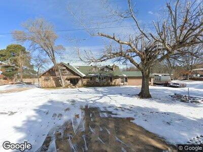
65 Buck Branch Rd Quitman, AR 72131
Estimated Value: $270,000 - $291,000
--
Bed
2
Baths
2,124
Sq Ft
$131/Sq Ft
Est. Value
About This Home
This home is located at 65 Buck Branch Rd, Quitman, AR 72131 and is currently estimated at $277,336, approximately $130 per square foot. 65 Buck Branch Rd is a home located in Faulkner County with nearby schools including Quitman Elementary School and Quitman High School.
Ownership History
Date
Name
Owned For
Owner Type
Purchase Details
Closed on
Sep 26, 2008
Bought by
Seeco, Inc
Current Estimated Value
Purchase Details
Closed on
Feb 12, 2007
Bought by
Burnette Jerry Daniel
Purchase Details
Closed on
Jan 11, 2007
Bought by
Desoto Gathering Co Llc
Purchase Details
Closed on
Feb 23, 2006
Sold by
Burnette Jerry Daniel
Bought by
Burnette Jerry Daniel
Purchase Details
Closed on
Oct 8, 2003
Bought by
Easement For Utilities
Create a Home Valuation Report for This Property
The Home Valuation Report is an in-depth analysis detailing your home's value as well as a comparison with similar homes in the area
Home Values in the Area
Average Home Value in this Area
Purchase History
| Date | Buyer | Sale Price | Title Company |
|---|---|---|---|
| Seeco, Inc | -- | -- | |
| Burnette Jerry Daniel | -- | -- | |
| Desoto Gathering Co Llc | -- | -- | |
| Burnette Jerry Daniel | -- | None Available | |
| Easement For Utilities | -- | -- |
Source: Public Records
Tax History Compared to Growth
Tax History
| Year | Tax Paid | Tax Assessment Tax Assessment Total Assessment is a certain percentage of the fair market value that is determined by local assessors to be the total taxable value of land and additions on the property. | Land | Improvement |
|---|---|---|---|---|
| 2024 | $1,402 | $39,160 | $3,860 | $35,300 |
| 2023 | $1,275 | $28,770 | $3,790 | $24,980 |
| 2022 | $1,275 | $28,770 | $3,790 | $24,980 |
| 2021 | $1,177 | $28,770 | $3,790 | $24,980 |
| 2020 | $1,071 | $24,620 | $4,160 | $20,460 |
| 2019 | $950 | $24,620 | $4,160 | $20,460 |
| 2018 | $890 | $24,620 | $4,160 | $20,460 |
| 2017 | $830 | $24,620 | $4,160 | $20,460 |
| 2016 | $770 | $18,380 | $4,160 | $14,220 |
| 2015 | $563 | $19,960 | $4,090 | $15,870 |
| 2014 | $564 | $18,200 | $2,330 | $15,870 |
Source: Public Records
Map
Nearby Homes
- 2 Buck Branch Rd
- 00 N Countryside Dr
- 50 Greg Sneed Dr
- 183 Old Springfield Rd
- 16 Sherrill King Dr
- 114 Greg Sneed Dr
- 44 Indian Meadows Dr
- 170 Enders Rd
- 149 Walnut St
- 49 2nd St
- 5109 Heber Springs Rd W
- 15 & 17 Walnut St
- 5049 Heber Springs Rd W
- 0 C A Holland Rd
- 007 Buckeye Ln
- 65 Turkey Roost
- 20 Jeffrey Scott Dr
- 150 Cadron Creek Rd
- 0 Cooper Ln Unit 25011711
- 00 Pryor Mt Road Roads