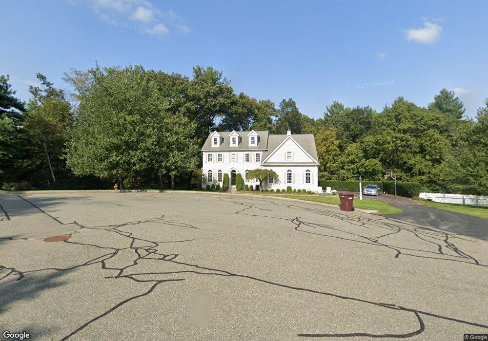
65 Deerpath Rd Dedham, MA 02026
Dexter NeighborhoodEstimated Value: $1,458,000 - $2,889,000
4
Beds
3
Baths
3,205
Sq Ft
$603/Sq Ft
Est. Value
About This Home
This home is located at 65 Deerpath Rd, Dedham, MA 02026 and is currently estimated at $1,931,108, approximately $602 per square foot. 65 Deerpath Rd is a home located in Norfolk County with nearby schools including Riverdale Elementary School, Dedham Middle School, and Dedham High School.
Ownership History
Date
Name
Owned For
Owner Type
Purchase Details
Closed on
Mar 23, 2021
Sold by
Jenkins Kellie A
Bought by
Kellie A Jenkins Lt and Jenkins
Current Estimated Value
Purchase Details
Closed on
May 28, 2020
Sold by
Kellie A Jenkins Lt and Jenkins
Bought by
Jenkins Kellie A
Home Financials for this Owner
Home Financials are based on the most recent Mortgage that was taken out on this home.
Original Mortgage
$485,000
Interest Rate
3.2%
Mortgage Type
New Conventional
Purchase Details
Closed on
Sep 7, 2017
Sold by
Jenkins Kellie A
Bought by
Kellie Ajenkins Lt and Jenkins
Create a Home Valuation Report for This Property
The Home Valuation Report is an in-depth analysis detailing your home's value as well as a comparison with similar homes in the area
Home Values in the Area
Average Home Value in this Area
Purchase History
| Date | Buyer | Sale Price | Title Company |
|---|---|---|---|
| Kellie A Jenkins Lt | -- | None Available | |
| Jenkins Kellie A | -- | None Available | |
| Kellie Ajenkins Lt | -- | -- |
Source: Public Records
Mortgage History
| Date | Status | Borrower | Loan Amount |
|---|---|---|---|
| Previous Owner | Jenkins Kellie A | $485,000 |
Source: Public Records
Tax History
| Year | Tax Paid | Tax Assessment Tax Assessment Total Assessment is a certain percentage of the fair market value that is determined by local assessors to be the total taxable value of land and additions on the property. | Land | Improvement |
|---|---|---|---|---|
| 2025 | $17,286 | $1,369,700 | $461,400 | $908,300 |
| 2024 | $16,720 | $1,337,600 | $402,600 | $935,000 |
| 2023 | $14,301 | $1,113,800 | $383,800 | $730,000 |
| 2022 | $13,067 | $978,800 | $344,200 | $634,600 |
| 2021 | $12,743 | $932,200 | $370,600 | $561,600 |
| 2020 | $13,199 | $962,000 | $379,400 | $582,600 |
| 2019 | $12,728 | $899,500 | $356,200 | $543,300 |
| 2018 | $13,904 | $955,600 | $359,200 | $596,400 |
| 2017 | $13,959 | $945,700 | $330,000 | $615,700 |
| 2016 | $13,171 | $850,300 | $277,500 | $572,800 |
| 2015 | $13,059 | $822,900 | $308,300 | $514,600 |
| 2014 | $12,763 | $793,700 | $308,300 | $485,400 |
Source: Public Records
Map
Nearby Homes
- 262 Meadowbrook Rd
- 1133 High
- 20 Shuttleworth Place
- 20-35 Shuttleworth Place
- 35 Shuttleworth Place
- 223 Robert Rd
- 87 Horrigan Dr Unit 8
- 80 Horrigan Dr Unit 24
- 86 Horrigan Dr Unit 23
- 66 Horrigan Dr Unit 25
- 57 Horrigan Dr Unit 3
- 37 Horrigan Dr Unit 1
- 47 Bemis Rd
- 213 Sandy Valley Rd
- 165 Highland St Unit 165
- 570 Bridge St
- 47 Village Ave Unit 203
- 85 Schoolmaster Ln
- 175 Schoolmaster Ln
- 429 Summer St
- 65 Deerpath Rd
- 55 Deerpath Rd
- 70 Deerpath Rd
- 50 Deerpath Rd
- 60 Deerpath Rd
- 161 Meadowbrook Rd
- 45 Deerpath Rd
- 40 Deerpath Rd
- 177 Meadowbrook Rd
- 35 Deerpath Rd
- 195 Meadowbrook Rd: Precinct 1
- 159 Meadowbrook Rd Unit 2
- 159 Meadowbrook Rd
- 30 Deerpath Rd
- 256 Meadowbrook Rd
- 152 Meadowbrook Rd
- 195 Meadowbrook Rd
- 1151 High St
- 183 Meadowbrook Rd
- 203 Meadowbrook Rd
Your Personal Tour Guide
Ask me questions while you tour the home.