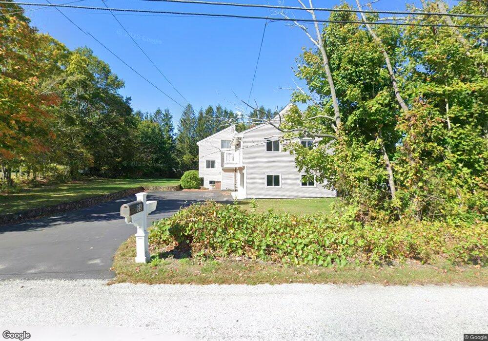
65 High St Plainville, MA 02762
Estimated Value: $713,043 - $845,000
4
Beds
3
Baths
2,394
Sq Ft
$325/Sq Ft
Est. Value
About This Home
This home is located at 65 High St, Plainville, MA 02762 and is currently estimated at $778,261, approximately $325 per square foot. 65 High St is a home located in Norfolk County with nearby schools including Anna Ware Jackson School, Beatrice H. Wood Elementary School, and Discovery Daycare Center.
Ownership History
Date
Name
Owned For
Owner Type
Purchase Details
Closed on
Apr 23, 2024
Sold by
Johnson Beverly A
Bought by
Beverly A Johnson Irt and Johnson
Current Estimated Value
Purchase Details
Closed on
Nov 9, 1981
Bought by
Johnson Aaron and Johnson Beverly
Create a Home Valuation Report for This Property
The Home Valuation Report is an in-depth analysis detailing your home's value as well as a comparison with similar homes in the area
Home Values in the Area
Average Home Value in this Area
Purchase History
| Date | Buyer | Sale Price | Title Company |
|---|---|---|---|
| Beverly A Johnson Irt | -- | None Available | |
| Beverly A Johnson Irt | -- | None Available | |
| Johnson Aaron | -- | -- |
Source: Public Records
Mortgage History
| Date | Status | Borrower | Loan Amount |
|---|---|---|---|
| Previous Owner | Johnson Aaron | $85,000 |
Source: Public Records
Tax History
| Year | Tax Paid | Tax Assessment Tax Assessment Total Assessment is a certain percentage of the fair market value that is determined by local assessors to be the total taxable value of land and additions on the property. | Land | Improvement |
|---|---|---|---|---|
| 2025 | $75 | $645,300 | $261,100 | $384,200 |
| 2024 | $7,016 | $584,700 | $237,900 | $346,800 |
| 2023 | $6,798 | $544,700 | $237,900 | $306,800 |
| 2022 | $7,197 | $513,000 | $229,200 | $283,800 |
| 2021 | $6,231 | $423,900 | $209,600 | $214,300 |
| 2020 | $5,946 | $404,500 | $209,600 | $194,900 |
| 2019 | $5,856 | $391,200 | $200,000 | $191,200 |
Source: Public Records
Map
Nearby Homes
- LOT 28 Broad St
- LOT 27 Broad St
- LOT 32 Legion Dr
- lot 65 Longview Rd
- 67 High St
- 2 Saddlebrook Rd Unit 3
- 2 Saddlebrook Rd
- 2 Saddlebrook Rd Unit LOT 14
- 2 Saddlebrook Rd
- 70 High St Unit 3
- 70 High St
- 1 Rhodes St
- 1 Rhodes St Parcel #1
- 4 Saddlebrook Rd
- 0 Rhodes St
- 63 High St
- 1 Saddlebrook Rd
- 69 High St
- 6 Saddlebrook Rd
- 3 Saddlebrook Rd
Your Personal Tour Guide
Ask me questions while you tour the home.