
Seller's Agent in 2025
Linda Cicchelli
REMAX Revolution
(401) 486-1486
1 in this area
44 Total Sales
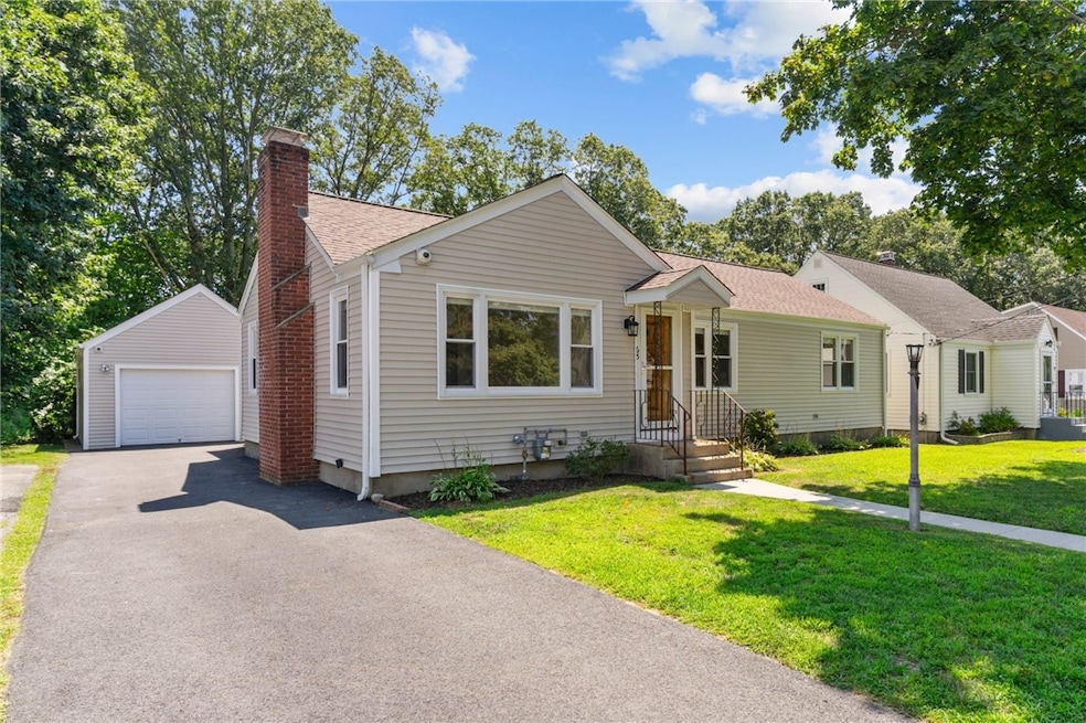
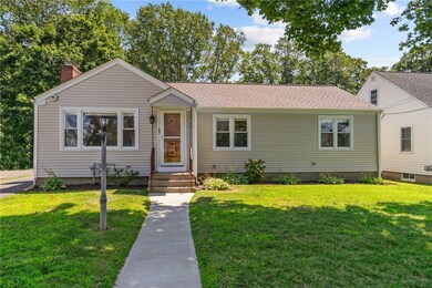
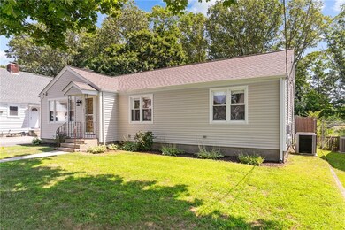
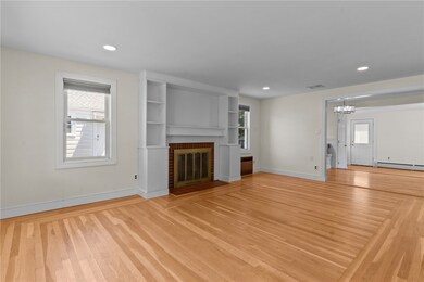
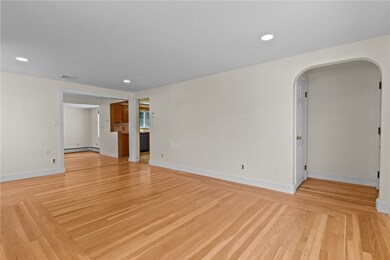
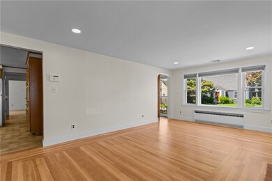
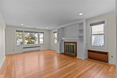
Welcome to this beautiful and spacious 3 bed, 2 full bath ranch in highly sought after Eden Park. This home is located across from Garden City Dr and is just a couple minutes to Garden City Shopping Center. As you enter you will be pleasantly surprised by the open floor plan and abundance of natural light. Some of the many noteworthy features include a BRAND NEW ROOF, remodeled bath, fresh paint, plenty of closet space, 3 zone gas furnace, central A/C, vinyl siding, replacement windows, oversized garage, beautifully finished lower level, and more! Unwind after a long day and enjoy the peace and serenity of the fenced in, private back yard. This home has it all! A must see!
Last Agent to Sell the Property
REMAX Revolution Brokerage Phone: 401-921-5011 License #RES.0041001 Listed on: 07/31/2025
| Date | Type | Sale Price | Title Company |
|---|---|---|---|
| Deed | $450,000 | -- | |
| Quit Claim Deed | -- | -- | |
| Warranty Deed | $120,000 | -- |
| Date | Status | Loan Amount | Loan Type |
|---|---|---|---|
| Open | $150,000 | Purchase Money Mortgage | |
| Previous Owner | $90,000 | Purchase Money Mortgage |
| Date | Event | Price | List to Sale | Price per Sq Ft |
|---|---|---|---|---|
| 09/22/2025 09/22/25 | Sold | $450,000 | +7.2% | $219 / Sq Ft |
| 08/28/2025 08/28/25 | Pending | -- | -- | -- |
| 07/31/2025 07/31/25 | For Sale | $419,900 | -- | $205 / Sq Ft |
| Year | Tax Paid | Tax Assessment Tax Assessment Total Assessment is a certain percentage of the fair market value that is determined by local assessors to be the total taxable value of land and additions on the property. | Land | Improvement |
|---|---|---|---|---|
| 2025 | $4,919 | $354,400 | $107,700 | $246,700 |
| 2024 | $4,823 | $354,400 | $107,700 | $246,700 |
| 2023 | $4,515 | $238,900 | $70,900 | $168,000 |
| 2022 | $4,422 | $238,900 | $70,900 | $168,000 |
| 2021 | $4,300 | $238,900 | $70,900 | $168,000 |
| 2020 | $4,092 | $197,000 | $67,500 | $129,500 |
| 2019 | $4,092 | $197,000 | $67,500 | $129,500 |
| 2018 | $3,997 | $197,000 | $67,500 | $129,500 |
| 2017 | $4,092 | $178,400 | $60,700 | $117,700 |
| 2016 | $4,005 | $178,400 | $60,700 | $117,700 |
| 2015 | $4,005 | $178,400 | $60,700 | $117,700 |
| 2014 | $3,933 | $172,200 | $60,700 | $111,500 |
Seller's Agent in 2025
Linda Cicchelli
REMAX Revolution
(401) 486-1486
1 in this area
44 Total Sales
Buyer's Agent in 2025
Jaclyn Arruda
JPAR Prime Real Estate
(401) 525-1631
2 in this area
43 Total Sales
Source: State-Wide MLS
MLS Number: 1391501
APN: CRAN-000005-000004-002277
Disclaimer: Certain information contained herein is derived from information provided by parties other than Homes.com. All information provided is deemed reliable, but is not guaranteed to be accurate and should be independently verified.
![]() IDX information is provided exclusively for personal, non-commercial use, and may not be used for any purpose other than to identify prospective properties consumers may be interested in purchasing. Information is deemed reliable but not guaranteed.
IDX information is provided exclusively for personal, non-commercial use, and may not be used for any purpose other than to identify prospective properties consumers may be interested in purchasing. Information is deemed reliable but not guaranteed.
Copyright © 2026 State-Wide MLS, Inc. All rights reserved.
Ask me questions while you tour the home.