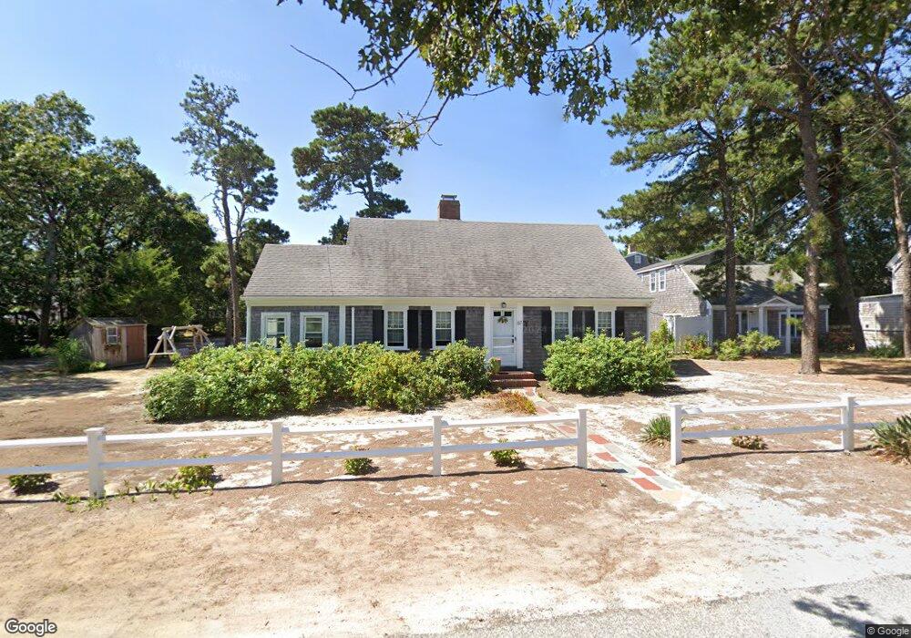
65 Inman Rd Unit D Dennis Port, MA 2639
Dennis Port NeighborhoodEstimated Value: $359,000 - $378,000
2
Beds
1
Bath
644
Sq Ft
$577/Sq Ft
Est. Value
About This Home
This home is located at 65 Inman Rd Unit D, Dennis Port, MA 2639 and is currently estimated at $371,650, approximately $577 per square foot. 65 Inman Rd Unit D is a home located in Barnstable County with nearby schools including Dennis-Yarmouth Regional High School and St. Pius X. School.
Ownership History
Date
Name
Owned For
Owner Type
Purchase Details
Closed on
Mar 17, 2005
Sold by
Demango Helen M and Demango Joseph A
Bought by
Filanowski Christopher J
Current Estimated Value
Home Financials for this Owner
Home Financials are based on the most recent Mortgage that was taken out on this home.
Original Mortgage
$215,600
Outstanding Balance
$108,060
Interest Rate
5.64%
Mortgage Type
Purchase Money Mortgage
Estimated Equity
$263,590
Create a Home Valuation Report for This Property
The Home Valuation Report is an in-depth analysis detailing your home's value as well as a comparison with similar homes in the area
Home Values in the Area
Average Home Value in this Area
Purchase History
| Date | Buyer | Sale Price | Title Company |
|---|---|---|---|
| Filanowski Christopher J | $239,900 | -- | |
| Filanowski Christopher J | $239,900 | -- |
Source: Public Records
Mortgage History
| Date | Status | Borrower | Loan Amount |
|---|---|---|---|
| Open | Filanowski Christopher J | $215,600 | |
| Closed | Filanowski Christopher J | $215,600 |
Source: Public Records
Tax History Compared to Growth
Tax History
| Year | Tax Paid | Tax Assessment Tax Assessment Total Assessment is a certain percentage of the fair market value that is determined by local assessors to be the total taxable value of land and additions on the property. | Land | Improvement |
|---|---|---|---|---|
| 2025 | $1,381 | $319,000 | $0 | $319,000 |
| 2024 | $1,309 | $298,200 | $0 | $298,200 |
| 2023 | $1,141 | $244,400 | $0 | $244,400 |
| 2022 | $0 | $199,400 | $0 | $199,400 |
| 2021 | $0 | $179,700 | $0 | $179,700 |
| 2020 | $0 | $174,400 | $0 | $174,400 |
| 2019 | $4,890 | $175,800 | $0 | $175,800 |
| 2018 | $0 | $167,600 | $0 | $167,600 |
| 2017 | $4,227 | $167,600 | $0 | $167,600 |
| 2016 | $1,049 | $160,700 | $0 | $160,700 |
| 2015 | $1,028 | $160,700 | $0 | $160,700 |
| 2014 | -- | $159,900 | $0 | $159,900 |
Source: Public Records
Map
Nearby Homes
- 11 Ocean Park W
- 26 Manning Rd
- 1 E Belmont Unit 630
- 9 Chase Ave Unit 6
- 1 Belmont Rd Unit 630
- 1 Belmont Rd Unit 513
- 402 Old Wharf Rd
- 402 Old Wharf Rd
- 405 Old Wharf Rd Unit B204
- 405 Old Wharf Rd Unit B204
- 159 Center St Unit 22
- 12 Cross St
- 102 Sea St
- 3 Fairbanks Dr
- 73 Division St
- 148 Belmont Rd
- 22 Ferncliff Rd
- 19 Riverway
- 19 Riverway
- 40 Willow St
- 65 Inman Rd Unit F
- 65 Inman Rd Unit C
- 65 Inman Rd Unit Y
- 65 Inman Rd Unit E
- 65 Inman Rd
- 65 Inman Rd Unit X
- 65 Inman Rd Unit A
- 65 Inman Rd Unit B
- 65 Inman Rd Unit D
- 67 Inman Rd Unit Y
- 67 Inman Rd Unit F
- 67 Inman Rd Unit E
- 67 Inman Rd Unit D
- 67 Inman Rd Unit C
- 67 Inman Rd Unit B
- 67 Inman Rd Unit A
- 67 Inman Rd
- 67 Inman Rd Unit A-Y
- 67 Inman Rd Unit U-C
- 67 Inman Rd Unit U-E